#248 Postby MEANINGLESS_NUMBERS » Wed Aug 13, 2025 9:00 am
wxman57 wrote:MEANINGLESS_NUMBERS wrote:cycloneye wrote:11 PM advisorie has two M's at the end of forecast period at graphic. Still southern side of cone is over some of the northern leeward islands, BVI and U.SVI.
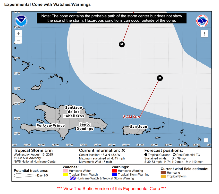
https://i.imgur.com/GUbaXkc.png
Although some of the islands are in the cone, the model consensus at that point is fairly tight and spares them. So perhaps lower risk than you might typically feel at the edge of the cone.
As a reminder the cone is meaningless as far as potential impacts. It has nothing to do with forecast confidence for this storm, and it does not have anything to do with Erin's projected wind field or squalls. All the cone represents is a 5-year average track error. It says that 66.7% of the time over the past five seasons, the center of the storm tracked somewhere within that cone. Do NOT use the cone for planning purposes or to assess potential storm impacts.
That's my point - it is based on historical average error which may be more or less applicable to any given storm. This storm, there appears to be higher-than-average consensus through 5 days, so the center is more likely to stay within the cone. And as you say, wind field may extend well beyond the center, etc. The northern leeward islands will likely feel
some impacts but hopefully will be spared the worst of it.
0 likes
Emily '87, Felix '95, Gert '99, Fabian '03, Humberto '19, Paulette '20, Teddy '20, Fiona '22, Lee '23, Ernesto '24, Humberto/Imelda '25


