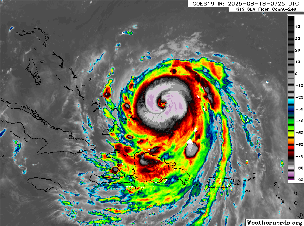
HurricaneIrma wrote:Is it just me or does it look like as of 1:00 a.m. this morning that the eye of hurricane Erin is starting to move or wobble and a due Westerly direction again
I think so, but I doubt it will last for long.
Moderator: S2k Moderators
HurricaneIrma wrote:Is it just me or does it look like as of 1:00 a.m. this morning that the eye of hurricane Erin is starting to move or wobble and a due Westerly direction again
HurricaneIrma wrote:Is it just me or does it look like as of 1:00 a.m. this morning that the eye of hurricane Erin is starting to move or wobble and a due Westerly direction again
869MB wrote:HurricaneIrma wrote:Is it just me or does it look like as of 1:00 a.m. this morning that the eye of hurricane Erin is starting to move or wobble and a due Westerly direction again
No it’s not you, Erin has not gained the latitude I was expecting it to gain by this point in time tonight. It appears to be taking the ICON route through the Atlantic Basin so far. Plus it’s getting uncomfortably close to some of the Bahama islands in my humble opinion. If it’s going to make that much anticipated turn to the north, right now would be a great time to do so.


Users browsing this forum: No registered users and 15 guests


