ATL: ERIN - Post-Tropical - Discussion
Moderator: S2k Moderators
Re: ATL: ERIN - Hurricane - Discussion
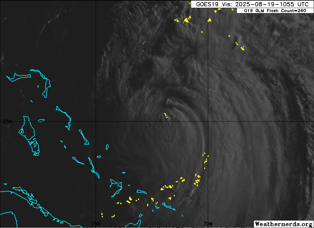
NW part of the center is exposed, easier to tell motion on vis now.
0 likes
Re: ATL: ERIN - Hurricane - Discussion
Further to the above regarding restrengthening potential:
I just noticed this on the 0Z UKMET: it initialized it at 943 as of 8PM EDT last evening, then weakened it all the way down to 963 as of 12Z/8AM EDT this morning, and then restrengthens her starting today all the way down to 928 mb Thursday at 8PM EDT:
HURRICANE ERIN ANALYSED POSITION : 23.9N 71.5W
ATCF IDENTIFIER : AL052025
LEAD CENTRAL MAXIMUM WIND
VERIFYING TIME TIME POSITION PRESSURE (MB) SPEED (KNOTS)
-------------- ---- -------- ------------- -------------
0000UTC 19.08.2025 0 23.9N 71.5W 943 84
1200UTC 19.08.2025 12 25.2N 72.6W 963 75
0000UTC 20.08.2025 24 26.9N 73.1W 953 79
1200UTC 20.08.2025 36 28.9N 74.3W 942 89
0000UTC 21.08.2025 48 31.6N 74.3W 936 100
1200UTC 21.08.2025 60 34.0N 73.3W 935 96
0000UTC 22.08.2025 72 36.2N 70.8W 928 94
2 likes
Personal Forecast Disclaimer:
The posts in this forum are NOT official forecasts and should not be used as such. They are just the opinion of the poster and may or may not be backed by sound meteorological data. They are NOT endorsed by any professional institution or storm2k.org. For official information, please refer to the NHC and NWS products.
The posts in this forum are NOT official forecasts and should not be used as such. They are just the opinion of the poster and may or may not be backed by sound meteorological data. They are NOT endorsed by any professional institution or storm2k.org. For official information, please refer to the NHC and NWS products.
Re: ATL: ERIN - Hurricane - Discussion
Low levels are still really solid here, a lot of the models showed it getting a lot stronger again tonight/tomorrow. We already had one go to sleep and wake up to a monster night (and the opposite this morning waking up to the shear). Starting to wonder if it'll happen again, I know the NHC is hesitant either way from that 11am discussion.
5 likes

Re: ATL: ERIN - Hurricane - Discussion
GCANE wrote:Pow - Wow!!!
Huge Hot Tower just exploded.
Just in time for AF308 to take a gander
1 likes
-
MGC

- S2K Supporter

- Posts: 5940
- Joined: Sun Mar 23, 2003 9:05 pm
- Location: Pass Christian MS, or what is left.
Re: ATL: ERIN - Hurricane - Discussion
Dry air and some shear beat up Erin last night and this morning. Should recover and perhaps reintensify back up a bit......MGC
2 likes
Re: ATL: ERIN - Hurricane - Discussion
12Z UKMET: like the 0Z this run restrengthens Erin to a peak Thu evening off NC, but by not as much as it gets down to 947 vs 928 on the 0Z:
HURRICANE ERIN ANALYSED POSITION : 25.3N 72.1W
ATCF IDENTIFIER : AL052025
LEAD CENTRAL MAXIMUM WIND
VERIFYING TIME TIME POSITION PRESSURE (MB) SPEED (KNOTS)
-------------- ---- -------- ------------- -------------
1200UTC 19.08.2025 0 25.3N 72.1W 961 79
0000UTC 20.08.2025 12 27.0N 73.1W 960 71
1200UTC 20.08.2025 24 29.0N 73.8W 954 83
0000UTC 21.08.2025 36 31.7N 74.0W 950 84
1200UTC 21.08.2025 48 34.1N 73.1W 949 81
0000UTC 22.08.2025 60 36.1N 70.7W 947 76
0 likes
Personal Forecast Disclaimer:
The posts in this forum are NOT official forecasts and should not be used as such. They are just the opinion of the poster and may or may not be backed by sound meteorological data. They are NOT endorsed by any professional institution or storm2k.org. For official information, please refer to the NHC and NWS products.
The posts in this forum are NOT official forecasts and should not be used as such. They are just the opinion of the poster and may or may not be backed by sound meteorological data. They are NOT endorsed by any professional institution or storm2k.org. For official information, please refer to the NHC and NWS products.
Re: ATL: ERIN - Hurricane - Discussion
invest man wrote:xironman wrote:The dry air seems to be doing the job as well. One thing, looking at the steering layers weaker is definitely more west
I was about to ask about that. So how much further west? West enough for a landfall in the TS watch area of ENC. I remember Irene “2011” deteriorating almost in this same area and causing chaos in ENC. Any ideas?
Not sure how much but there is a westward tilt to the steering layers.

1 likes

Re: ATL: ERIN - Hurricane - Discussion
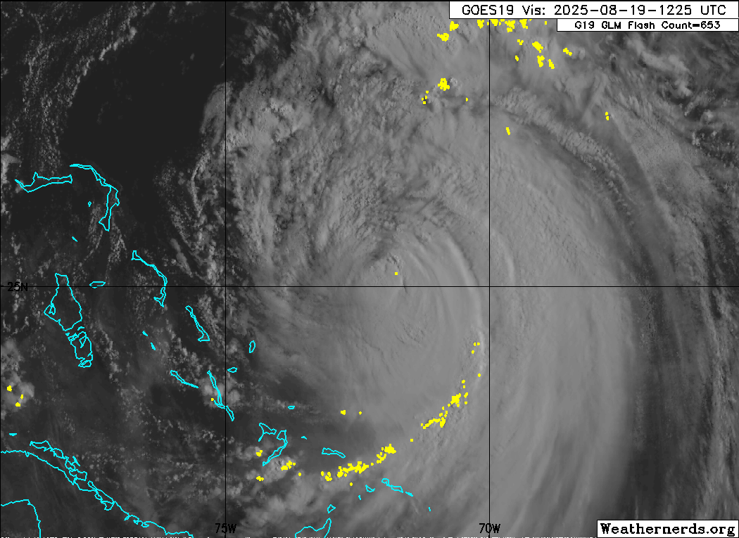
Convection is returning and no change in the models location at 72 hours ~72.5 W as a 925 to 945 major hurricane.
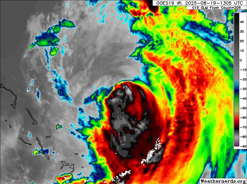
That shear really made the morning IR image look weak but its apparently temporary.
That shear really made the morning IR image look weak but its apparently temporary.
1 likes


Re: ATL: ERIN - Hurricane - Discussion
xironman wrote:invest man wrote:xironman wrote:The dry air seems to be doing the job as well. One thing, looking at the steering layers weaker is definitely more west...
Not sure how much but there is a westward tilt to the steering layers.
So, there is something I'm not understanding here. The CIMSS chart shows westward 200-700mb steering currents all the way up to Wilmington, NC. If Erin re-intensifies, would it not "feel" this westward influence more rather than less? Weak storms that have no upper-air structures can be carried along by the low-level trade winds, without much influence from upper-air steering...but in this situation, I wonder if the solidly westward winds from 200-700mb would influence the strengthening storm track strongly, driving it further west.
1 likes
-
TampaWxLurker
- Tropical Storm

- Posts: 196
- Joined: Thu Aug 01, 2024 8:20 am
Re: ATL: ERIN - Hurricane - Discussion
If I'm understanding how the synoptic set-up for Erin will work (mainly based on years of watching Levi Cowan videos), I THINK it is supposed to feel the westward steering pattern (which is why it's still headed WNW to NNW) BUT once it gets to about North Carolina's latitutude it'll be coming over the northeast side of the Atlantic high pressure ridge and into the influence of a big low pressure system/jet stream that's been moving east over maritime Canada, both systems being much more powerful/influential than the westward steering currents, and those 2 features should direct it sharply east.
3 likes
-
USTropics
- Professional-Met

- Posts: 2738
- Joined: Sun Aug 12, 2007 3:45 am
- Location: Florida State University
Re: ATL: ERIN - Hurricane - Discussion
Stellar wrote:xironman wrote:invest man wrote:
So, there is something I'm not understanding here. The CIMSS chart shows westward 200-700mb steering currents all the way up to Wilmington, NC. If Erin re-intensifies, would it not "feel" this westward influence more rather than less? Weak storms that have no upper-air structures can be carried along by the low-level trade winds, without much influence from upper-air steering...but in this situation, I wonder if the solidly westward winds from 200-700mb would influence the strengthening storm track strongly, driving it further west.
A few things to consider here, when analyzing steering currents from CIMSS, this was a snapshot of the current steering currents at that timestamp. If that timestamp was 3 hours old, those currents could have changed (or 3 hours from now, etc.). In this instance, a stronger Erin would actually turn more northward quickly (think Erin magnet and trough a magnet, they are wanting to connect), but it's not really what's dictating the steering currents here. This is a current snapshot of the 12z GFS run for 2PM ET:

The position of the trough is what the GFS has had a hard time resolving in past runs (which is why it had a quicker Erin initially). It has been shifting southwestward really over the past 12 runs, and that's been just ever so slightly allowing the western edge of the ridge to remain in place just a bit longer (and a more westward position for Erin on approach to OBX):

10 likes

-
Sciencerocks
- Category 5

- Posts: 10186
- Age: 40
- Joined: Thu Jul 06, 2017 1:51 am

-
emeraldislenc
- Category 2

- Posts: 601
- Joined: Fri Aug 24, 2012 4:49 pm
- Location: Emerald Isle NC
Re: ATL: ERIN - Hurricane - Discussion
Satellite presentation is looking better this afternoon looks like it may be bending slightly to the west or maybe just how it looks. The aircraft will tell us a lot this evening
1 likes
-
wxman57

- Moderator-Pro Met

- Posts: 23174
- Age: 68
- Joined: Sat Jun 21, 2003 8:06 pm
- Location: Houston, TX (southwest)
Re: ATL: ERIN - Hurricane - Discussion
So far, no hurricane force wind SE of the center and maybe 65 kts NW side. Heading NE through the SW quadrant now. Maybe the plane will find 70-75 kts in the NE quadrant. This is not a Cat 2 any longer.
0 likes
-
cycloneye

- Admin

- Posts: 149463
- Age: 69
- Joined: Thu Oct 10, 2002 10:54 am
- Location: San Juan, Puerto Rico
Re: ATL: ERIN - Hurricane - Discussion
1 likes
Visit the Caribbean-Central America Weather Thread where you can find at first post web cams,radars
and observations from Caribbean basin members Click Here
and observations from Caribbean basin members Click Here
-
Hurricane2022

- Category 5
- Posts: 2037
- Joined: Tue Aug 23, 2022 11:38 pm
- Location: Araçatuba, Brazil
Re: ATL: ERIN - Hurricane - Discussion
The highest FL winds are well removed from the center now. Quite interesting to see.
https://x.com/BradyBGWX/status/1957989154073244027
GCANE, CrazyC83, USTropics... Do you guys have any idea why this is happening?
https://x.com/BradyBGWX/status/1957989154073244027
GCANE, CrazyC83, USTropics... Do you guys have any idea why this is happening?
1 likes
Sorry for the bad English sometimes...!
For reliable and detailed information for any meteorological phenomenon, please consult the National Hurricane Center, Joint Typhoon Warning Center , or your local Meteo Center.
--------
ECCE OMNIA NOVA FACIAM (Ap 21,5).
For reliable and detailed information for any meteorological phenomenon, please consult the National Hurricane Center, Joint Typhoon Warning Center , or your local Meteo Center.
--------
ECCE OMNIA NOVA FACIAM (Ap 21,5).
-
Kingarabian

- S2K Supporter
- Posts: 16364
- Joined: Sat Aug 08, 2009 3:06 am
- Location: Honolulu, Hawaii
Re: ATL: ERIN - Hurricane - Discussion
Looking good on IR satellite imagery once again
0 likes
RIP Kobe Bryant
Who is online
Users browsing this forum: No registered users and 7 guests