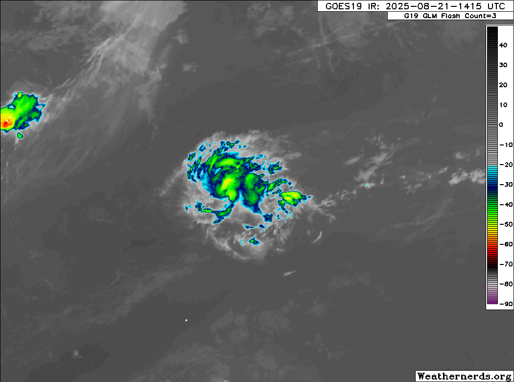
I've been watching this low currently near 30N 50W since last evening. It's small, but pretty tightly wound, and has become more convectively active over the past 6 hours. It looks like a midget TD wannabe that has found a small sweet spot in the subtropics. It appears as if westerly upper level shear is displacing the convection to the east side of the center, and since this is a small feature, this could cause it to dissipate pretty rapidly if it persists. I can't imagine the global models are resolving this very well at all.
Here's a recent IR Channel 2 large scale pass. It has the area highlighted, so you can see where it is relative to Erin, the central Atlantic MDR wave and Invest 99L. It would be great if someone could make a zoomed in high res animation of this tiny feature, because it looks more impressive in motion.

Here's a OSCAT mosaic from 21/03 UTC that I stitched together. It's small so it won't be too well-resolved, however OSCAT has higher resolution wind data than ASCAT.