LarryWx wrote:StormWeather wrote:
Well that’s ominous. Thanks Hurricane Erin.
I’m not saying I agree or disagree with him, but I’ll put this tweet out here from Derek Ortt as he clearly has the opposite take from Bastardi:
Erin has made things far less favorable over the Atlantic
https://x.com/DerekOrtt/status/1959963275161956575
My take is that the cooling will likely reverse to a significant extent fairly quickly as the cooled subtropical anomalies where Erin traversed warm back up. This is typically what happens and the rewarmings have actually averaged to be quicker in recent years than in the past. So, if so, this cooling will probably be forgotten in a couple of weeks.
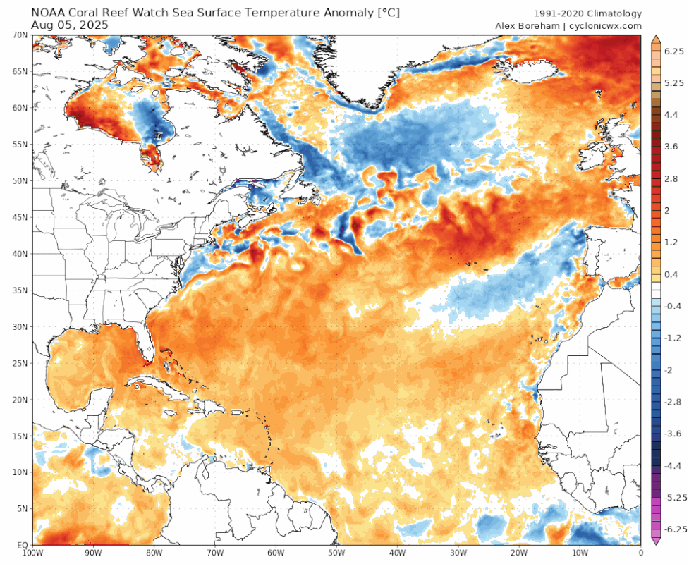
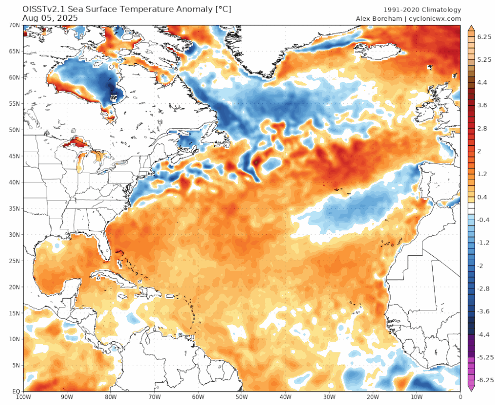
I honestly disagree with Derek, I'd argue Erin may've made things more favorable for Atlantic activity. Erin cooled the western subtropics (in a textbook +amo configuration you want a cooler western subtropics) while its large circulation helped warm the Caribbean below by slacking the trades there.
The configuration is pretty optimal now for later season Atlantic activity, with warmth focused in the eastern/tropical Atlantic:


Example of a +amo: