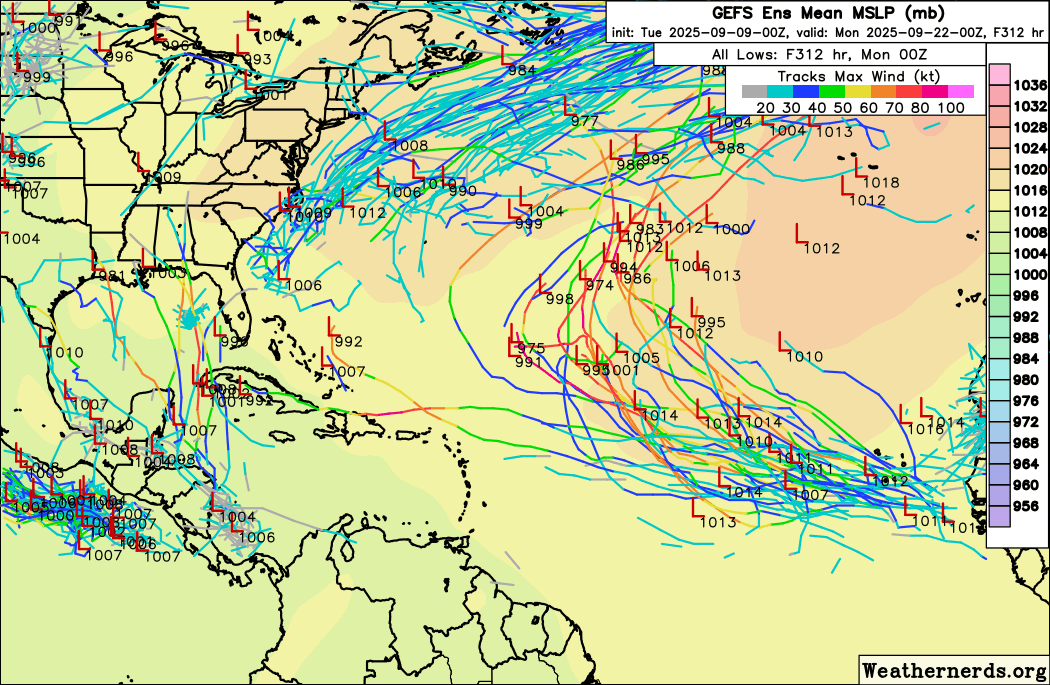
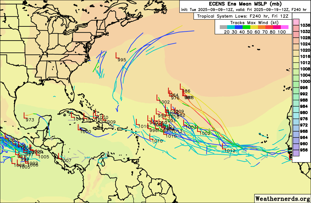
Stratton23 wrote:Still think its too early to say this seasons a dud for sure, even in some of the really quiet seasons we have seen some infamous or memorable storms form especially from CAG setups ( which the GGS continues to be persistent about) which will likely be the basins best shot at developing, new CPC tropical hazardous outlook is out and it seems they are taking the GEFS solutions and MJO over the EPS/ GEPS because they got 2 new zones to watch in the gulf/ caribbean
The CFS weeklies don't want to load for me on TT but I'm pretty sure (not certain) the CFS is a lower res GFS ensemble smoothed by averaging the results from several days. Might be 4 runs by 4 days. I'm not sure. The CFS used to have the added benefit of ocean-atmosphere coupling, weather affects the ocean and the ocean affects the weather and the model 'knew' that. That was 10 plus years ago, that may have been added to the GFS ensembles. I welcome red taggers with up to date knowledge.
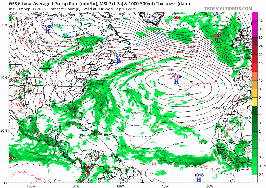
If it is the same general physics between the CFS and GFS then a GFS bias to CAG development would probably show up in the CFS and I doubt CPC would ever completely discount the US climate model. GFS ensembles through 16 days show 200 mb flow with a pronounced W component (early on, from NW for the west half of the N Gulf, SW for the E half. Usually over 20 knots. Later a more general W flow. This will obviously impact storms heading for Florida less because relative show is lower, but the ensembles showing the NW quarter of the Gulf having hostile shear for any TC trying to approach. The 12Z op GFS storm stays S of the highest shear but still has the dry air being pushed S by mid to upper flow to deal with and never becomes strong.
Beyond the 16 day purview of the thread the Euro weeklies suggest the BoC and Caribbean start having activity as September turns to October. I'm aware of the 1949 and 1989 October Texas hurricanes but I'm getting a positive feeling about homeowners insurance rates not climbing here in SETX.
Don't know if it was here or Twitter, but someone commented if there isn't TC activity to take heat out of the Gulf, all else equal, higher dewpoints means more robust thunderstorms during the secondary peak of tornado season. It does seem Florida gets a major hurricane on the Gulf side almost every year now, that storm will at least take some heat out if it happens as I expect.
+