
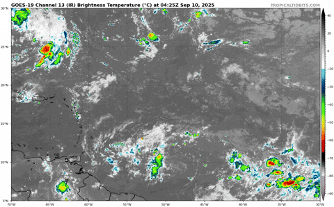
Shown here is 850 mb, but 925 and 750 mb are similar.

Notice how there's still a visible low-level rotation near 48W, but not moving in tandem with the convection racing west.

Moderator: S2k Moderators

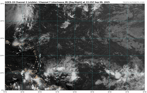
AJC3 wrote:Stitched MON evening METOP-B and METOP-C ASCAT passes. Looks like the broad, ill-defined center was near 9.5N 46W about 6 hours ago. Roughly 24 hours,ASCAT showed a broad center near 7.9N 40W, so it is gaining latitude, and likely enough to avoid running into SOAM. But we'll see what happens when it enters the accelerating easterlies of the eastern Caribbean "graveyard".
https://i.imgur.com/I2brB5n.png
Teban54 wrote:Despite the sustained convection, the issue is that low-level vorticity remains concentrated near 48W, while the hot towers have moved to near 54W.
Shown here is 850 mb, but 925 and 750 mb are similar.
https://i.imgur.com/2f8Y3iA.png
Notice how there's still a visible low-level rotation near 48W, but not moving in tandem with the convection racing west.
https://i.imgur.com/92yiktJ.gif


BobHarlem wrote:Very elongated axis and attached to the flow, this is a case where NHC is accurate with the current outlooks.


GCANE wrote:Looks like it may be slowly coming together.
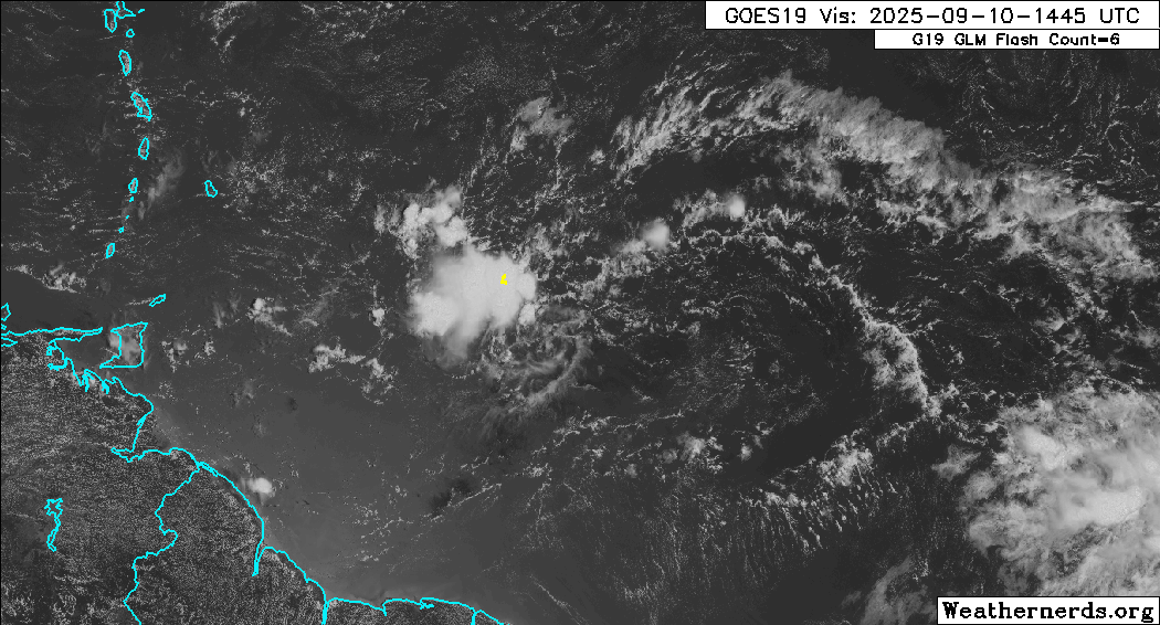
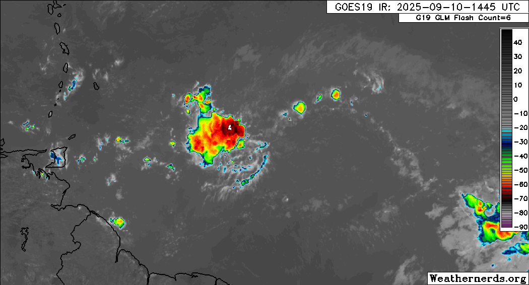
Strong convection and low-level vort are very close to each other.'
TUTT to the north is helping to ventilate it.
Nimbus wrote:GCANE wrote:Looks like it may be slowly coming together.
Strong convection and low-level vort are very close to each other.'
TUTT to the north is helping to ventilate it.
Won't the TUTT pull it north and OTS eventually or will it miss because its too weak?


GCANE wrote:Nimbus wrote:GCANE wrote:Looks like it may be slowly coming together.
Strong convection and low-level vort are very close to each other.'
TUTT to the north is helping to ventilate it.
Won't the TUTT pull it north and OTS eventually or will it miss because its too weak?
Likely the TUTT will cause it to make a more NW trajectory.
Once it gets on the SW side of the TUTT, development becomes much more likely.
Already seeing a hot tower zip across east to west.

Users browsing this forum: Iceresistance, pepecool20 and 212 guests


