2025 Global Model Runs Discussion (Out thru day 16)
Moderator: S2k Moderators
Forum rules

The posts in this forum are NOT official forecasts and should not be used as such. They are just the opinion of the poster and may or may not be backed by sound meteorological data. They are NOT endorsed by any professional institution or STORM2K. For official information, please refer to products from the National Hurricane Center and National Weather Service.
-
TomballEd
- Category 5

- Posts: 1317
- Age: 62
- Joined: Wed Aug 16, 2023 4:52 pm
- Location: Spring/Klein area, not Tomball
Re: 2025 Global Model Runs Discussion (Out thru day 16)
If we were having the predicted hurricane season, 2 week off hour GFS forecasts would not be getting much oxygen.
1 likes
-
TomballEd
- Category 5
- Posts: 1317
- Age: 62
- Joined: Wed Aug 16, 2023 4:52 pm
- Location: Spring/Klein area, not Tomball
Re: 2025 Global Model Runs Discussion (Out thru day 16)
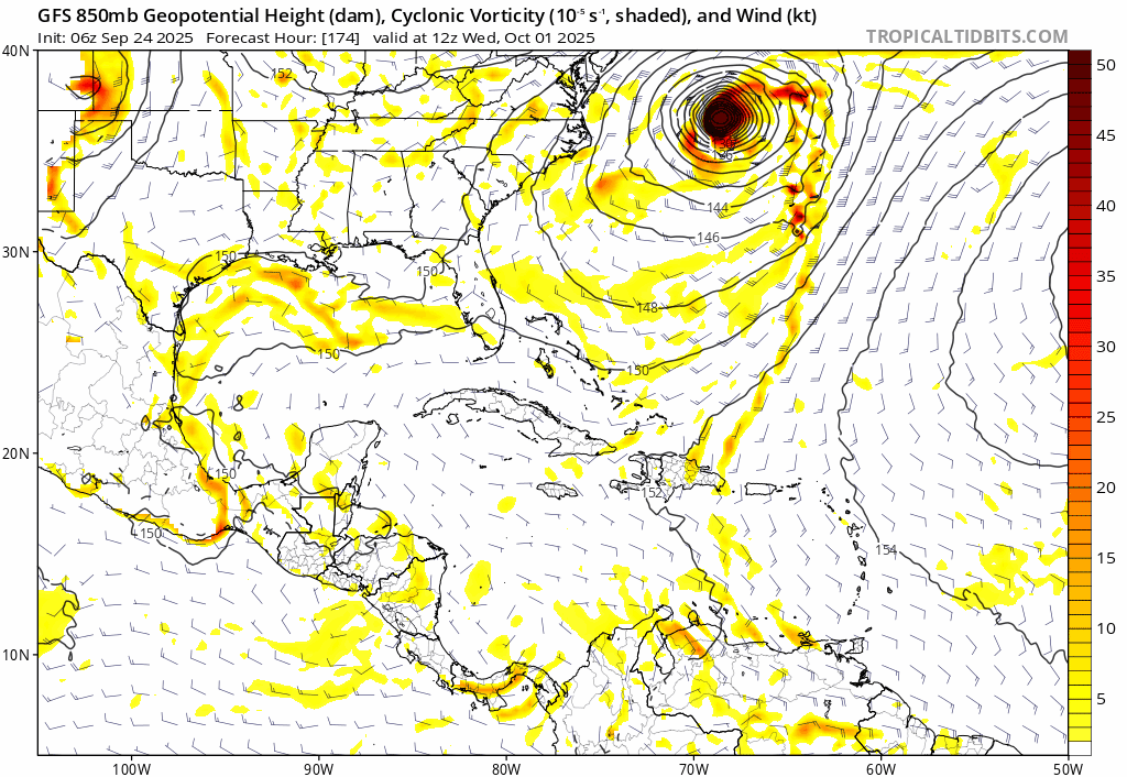
If the GFS is correct, out toward silly season and all (I consider 240 hours and beyond silly season), but maybe we get the traditional Florida October hurricane. I'm not all the way out to 16 days, but there is a break in the ridge that should allow the recurve into the E. Gulf. Still S of W Cuba but I'm going to lunch w/ my daughter.

0 likes

Re: 2025 Global Model Runs Discussion (Out thru day 16)
Full run of 12z GFS, including the continued insistence of the 10/40 AOI being an East Coast threat, and a fantasy-range October WCar monster:

0 likes
TC naming lists: retirements and intensity
Most aggressive Advisory #1's in North Atlantic (cr. kevin for starting the list)
Most aggressive Advisory #1's in North Atlantic (cr. kevin for starting the list)
Re: 2025 Global Model Runs Discussion (Out thru day 16)
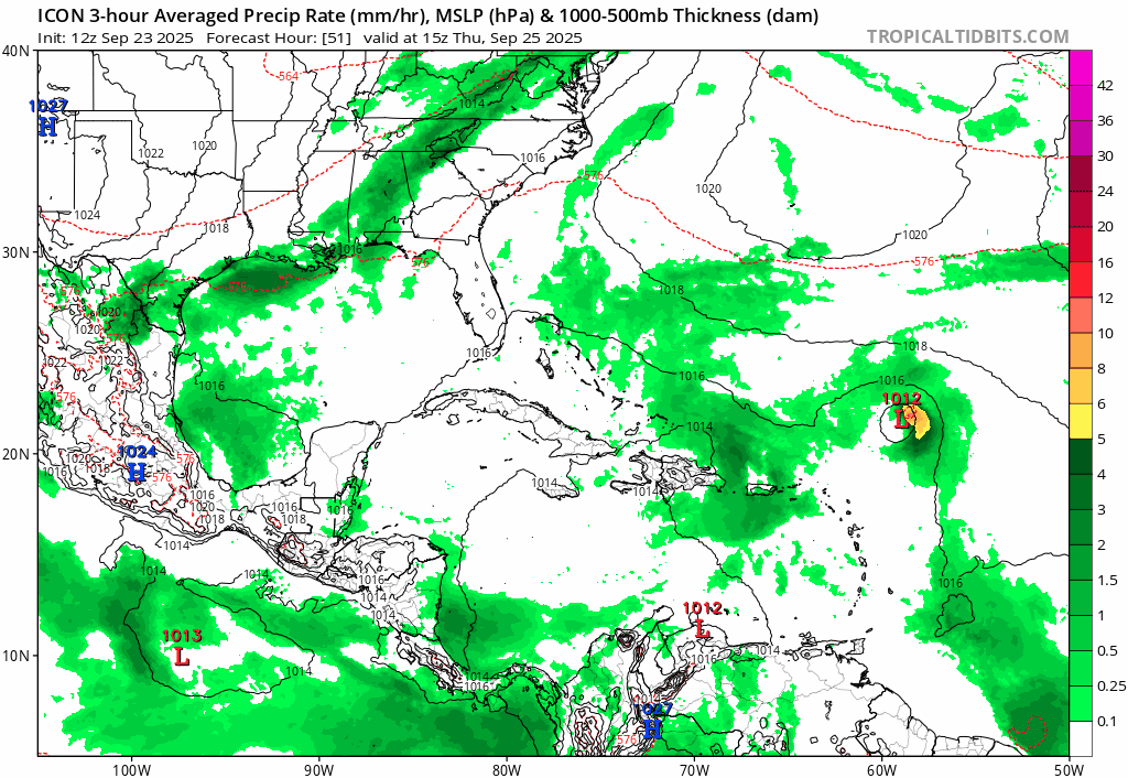
Teban54 wrote:I think 12z ICON now fits this thread.
https://i.postimg.cc/3JVpL69W/icon-mslp-pcpn-watl-fh51-180.gif
I put the 12z ICON runs in Crazy Model Runs earlier... But now 12z CMC also bombs out both 93L and 94L while they're very close to each other.
(Technically it only gets them down to 980s and 970s, but that's very strong by CMC standards.)
2 likes
TC naming lists: retirements and intensity
Most aggressive Advisory #1's in North Atlantic (cr. kevin for starting the list)
Most aggressive Advisory #1's in North Atlantic (cr. kevin for starting the list)
Re: 2025 Global Model Runs Discussion (Out thru day 16)
Here is Google Weather Lab ML model runs on the 2 systems with intensity forecasts.


2 likes

Re: 2025 Global Model Runs Discussion (Out thru day 16)
00z Euro ensemble says it's go time, probably the most active Euro ensemble so far this season. It shows at least one TC (93L or 94L) becoming a MH, perhaps both. And has two more waves with some support in the MDR as well as some disturbances in the Gulf. Note that the first of the upcoming MDR waves as well as the Gulf members already develop at +5 days. Still awfully quiet in the WCar, where the big players usually are in October. But there's still plenty of time for some scary stuff there later next month.

3 likes
-
skillz305
- Category 1

- Posts: 312
- Joined: Sat Sep 08, 2018 11:10 am
- Location: Miami, Florida --> Vero Beach, Florida
Re: 2025 Global Model Runs Discussion (Out thru day 16)
I know it’s 300+ hours out… but 06Z GFS has a major hitting south Florida from a storm that develops south of Cuba
2 likes
 Hurricanes: Andrew 1992 - Irene 1999 - Frances 2004 - Jeanne 2004 - Katrina 2005 - Wilma 2005 - Matthew 2016 - Irma 2017 - Ian 2022 - Nicole 2022 - Milton 2024
-
CFLHurricane

- Category 1
- Posts: 350
- Joined: Thu Mar 27, 2014 5:56 pm
- Location: Floriduh
Re: 2025 Global Model Runs Discussion (Out thru day 16)
skillz305 wrote:I know it’s 300+ hours out… but 06Z GFS has a major hitting south Florida from a storm that develops south of Cuba
The first of many, no doubt
Is there even an extant wave to seed such a monstrosity?
0 likes
I'm not a meteorologist, but I did stay at a motel 8.
-
SFLcane

- S2K Supporter

- Posts: 10281
- Age: 48
- Joined: Sat Jun 05, 2010 1:44 pm
- Location: Lake Worth Florida
Re: 2025 Global Model Runs Discussion (Out thru day 16)
skillz305 wrote:I know it’s 300+ hours out… but 06Z GFS has a major hitting south Florida from a storm that develops south of Cuba
Nice one gfs very silly but its 100% fake typical bias in this area i am sure it will not be the last one. You can see the vort shoot out from the venezuelan coast.
2 likes

Re: 2025 Global Model Runs Discussion (Out thru day 16)
SFLcane wrote:skillz305 wrote:I know it’s 300+ hours out… but 06Z GFS has a major hitting south Florida from a storm that develops south of Cuba
Nice one gfs very silly but its 100% fake typical bias in this area i am sure it will not be the last one. You can see the vort shoot out from the venezuelan coast.
https://i.postimg.cc/hPKC17Ch/IMG-1217.gif
I'm sure it'll disappear from this mornings 12Z GFS run. I plan on finishing my day early today, just so I can be home and make myself a Bloody Mary, kick back and enjoy the GFS Happy Hour "pin the Cat 5 on your favorite city" game
18Z Predicted landfall: Key West!
0 likes
Andy D
(For official information, please refer to the NHC and NWS products.)
(For official information, please refer to the NHC and NWS products.)

Re: 2025 Global Model Runs Discussion (Out thru day 16)
SFLcane wrote:skillz305 wrote:I know it’s 300+ hours out… but 06Z GFS has a major hitting south Florida from a storm that develops south of Cuba
Nice one gfs very silly but its 100% fake typical bias in this area i am sure it will not be the last one. You can see the vort shoot out from the venezuelan coast.
https://i.postimg.cc/hPKC17Ch/IMG-1217.gif
Right on schedule on October 1st for the GFS
1 likes
-
ConvergenceZone
.gif)
- Category 5
- Posts: 5241
- Joined: Fri Jul 29, 2005 1:40 am
- Location: Northern California
Re: 2025 Global Model Runs Discussion (Out thru day 16)
skillz305 wrote:I know it’s 300+ hours out… but 06Z GFS has a major hitting south Florida from a storm that develops south of Cuba
I've given up on the GFS to be honest with you. I mean just a couple of days ago it had a monster cane in the Gulf of Mexico and that suddenly vanished. It just seems very flakey this year, so I stopped paying attention to it.
3 likes
-
TomballEd
- Category 5
- Posts: 1317
- Age: 62
- Joined: Wed Aug 16, 2023 4:52 pm
- Location: Spring/Klein area, not Tomball
Re: 2025 Global Model Runs Discussion (Out thru day 16)
ConvergenceZone wrote:skillz305 wrote:I know it’s 300+ hours out… but 06Z GFS has a major hitting south Florida from a storm that develops south of Cuba
I've given up on the GFS to be honest with you. I mean just a couple of days ago it had a monster cane in the Gulf of Mexico and that suddenly vanished. It just seems very flakey this year, so I stopped paying attention to it.
Ensembles, especially after 240 hours.
0 likes
-
StPeteMike

- Category 2

- Posts: 657
- Joined: Thu Jun 07, 2018 11:26 pm
Re: 2025 Global Model Runs Discussion (Out thru day 16)
If 94L fails to develop, it would be fitting the dreaded I storm would develop and slam into West Florida as a major.
But as others have said, it has been pretty unreliable to trust the models this year.
But as others have said, it has been pretty unreliable to trust the models this year.
0 likes
The above post is not official and should not be used as such. It is the opinion of the poster and may or may not be backed by sound meteorological data. It is not endorsed by any professional institution or storm2k.org. For official information, please refer to the NHC and NWS products.
Re: 2025 Global Model Runs Discussion (Out thru day 16)
AI models seem to favor the EPAC side for development in the next 2 weeks, if it verifies then the Caribbean will be quiet.
0 likes


Re: 2025 Global Model Runs Discussion (Out thru day 16)
chaser1 wrote:SFLcane wrote:skillz305 wrote:I know it’s 300+ hours out… but 06Z GFS has a major hitting south Florida from a storm that develops south of Cuba
Nice one gfs very silly but its 100% fake typical bias in this area i am sure it will not be the last one. You can see the vort shoot out from the venezuelan coast.
https://i.postimg.cc/hPKC17Ch/IMG-1217.gif
I'm sure it'll disappear from this mornings 12Z GFS run. I plan on finishing my day early today, just so I can be home and make myself a Bloody Mary, kick back and enjoy the GFS Happy Hour "pin the Cat 5 on your favorite city" game
18Z Predicted landfall: Key West!
Well you pinned the location but not as strong as you predicted.
Not bad
2 likes
Re: 2025 Global Model Runs Discussion (Out thru day 16)
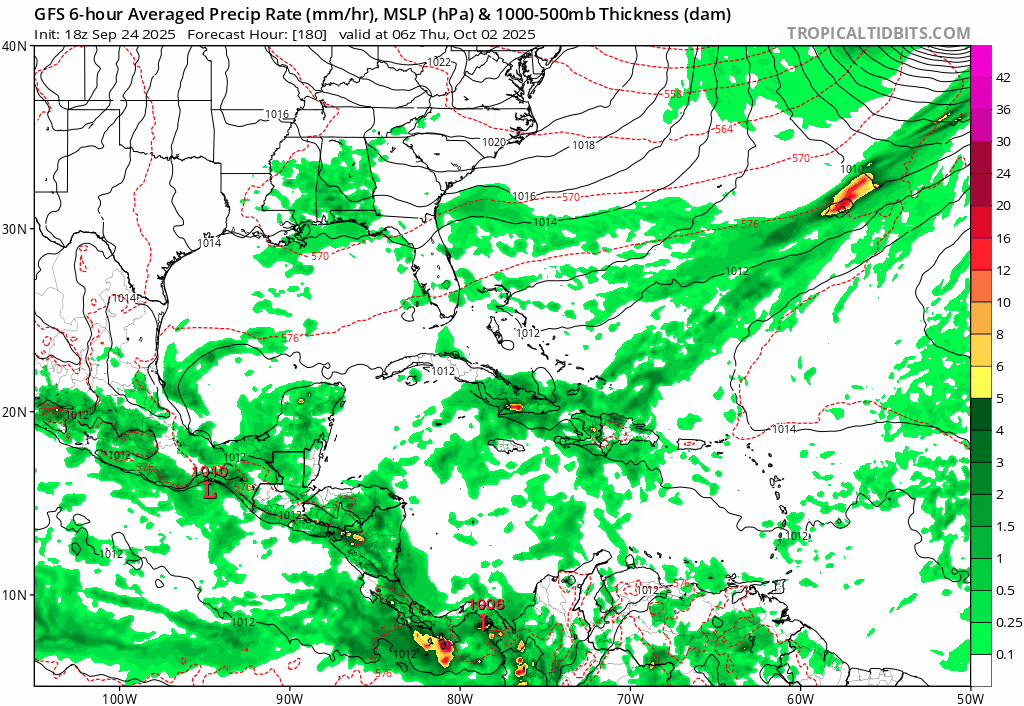
For funsies only:
1 likes
TC naming lists: retirements and intensity
Most aggressive Advisory #1's in North Atlantic (cr. kevin for starting the list)
Most aggressive Advisory #1's in North Atlantic (cr. kevin for starting the list)
Re: 2025 Global Model Runs Discussion (Out thru day 16)
MetroMike wrote:chaser1 wrote:SFLcane wrote:
Nice one gfs very silly but its 100% fake typical bias in this area i am sure it will not be the last one. You can see the vort shoot out from the venezuelan coast.
https://i.postimg.cc/hPKC17Ch/IMG-1217.gif
I'm sure it'll disappear from this mornings 12Z GFS run. I plan on finishing my day early today, just so I can be home and make myself a Bloody Mary, kick back and enjoy the GFS Happy Hour "pin the Cat 5 on your favorite city" game
18Z Predicted landfall: Key West!
Well you pinned the location but not as strong as you predicted.
Not bad
Thanks lol! What can I say....i have GFS in my veins
1 likes
Andy D
(For official information, please refer to the NHC and NWS products.)
(For official information, please refer to the NHC and NWS products.)
Re: 2025 Global Model Runs Discussion (Out thru day 16)
Can't put too much stock into the long range GFS, let alone a Happy Hour forecast but one thing should be considered. The updated 18Z moved the Florida landfall clock forward in time. Just have to sit back and see whether GFS can maintain any model consistency. More importantly, whether ICON or EURO eventually come on board. Until then, pass the popcorn
1 likes
Andy D
(For official information, please refer to the NHC and NWS products.)
(For official information, please refer to the NHC and NWS products.)
-
DorkyMcDorkface

- Category 5
- Posts: 1039
- Age: 28
- Joined: Mon Sep 30, 2019 1:32 pm
- Location: Mid-Atlantic
Re: 2025 Global Model Runs Discussion (Out thru day 16)
CMC thinks we might have a shot at MDR development in a few days. This also has modest EPS support. Would continue the theme of October MDR development we've been seeing in recent seasons.


2 likes
Please note the thoughts expressed by this account are solely those of the user and are from a hobbyist perspective. For more comprehensive analysis, consult an actual professional meteorologist or meteorological agency.
Floyd 1999 | Isabel 2003 | Hanna 2008 | Irene 2011 | Sandy 2012 | Isaias 2020
Who is online
Users browsing this forum: No registered users and 243 guests