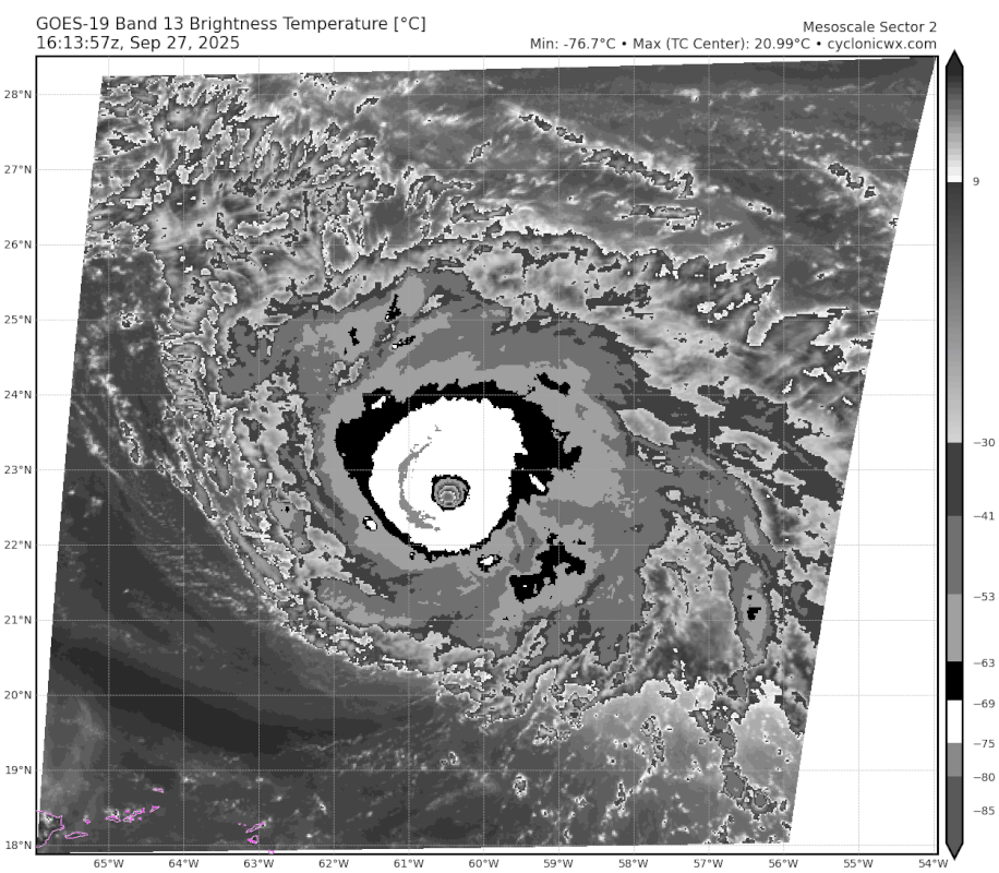
cheezyWXguy wrote:Is Humberto being underestimated because of its small size, or is it that the ring of deepest convection isn’t thick enough yet for a higher estimate?
Or because they don’t have the budget to run recon like they used to?
Moderator: S2k Moderators

cheezyWXguy wrote:Is Humberto being underestimated because of its small size, or is it that the ring of deepest convection isn’t thick enough yet for a higher estimate?


aspen wrote:
Yeah no way that’s just 125 kt lol.
It has a complete thick W ring too. Should be a T7.0.


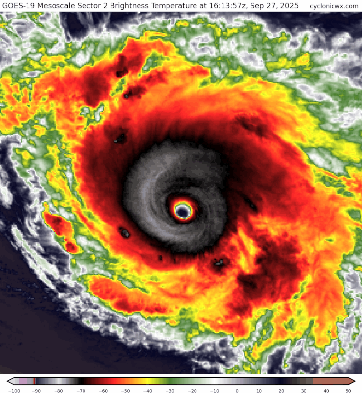
zzzh wrote:https://i.imgur.com/6K0beT8.png
There are many Sams, Kirks but there is only 1 Lorenzo.
aspen wrote:zzzh wrote:https://i.imgur.com/6K0beT8.png
There are many Sams, Kirks but there is only 1 Lorenzo.
How on Earth did Lorenzo get a T7.0 on ADT but not this lol

aspen wrote:
There’s a very real chance this could be rivaling Erin’s peak right now.


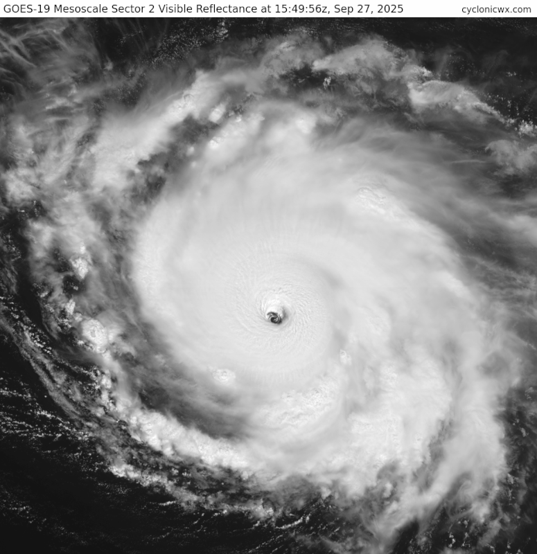
zzzh wrote:https://i.imgur.com/2ataUWk.png
SAR from 10z.


Users browsing this forum: No registered users and 73 guests