These are all in-shore or north shore. I don't know if you can find one on the south shore but that's where the action is at the moment.
I'm going to save these for later though, when the wind direction swings around.
Moderator: S2k Moderators


MEANINGLESS_NUMBERS wrote:
These are all in-shore or north shore. I don't know if you can find one on the south shore but that's where the action is at the moment.
I'm going to save these for later though, when the wind direction swings around.


Buck wrote:Any more recon scheduled today?


cycloneye wrote:
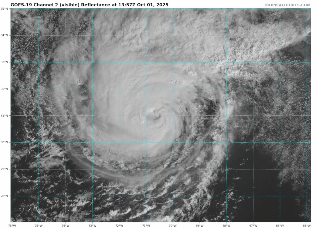
Looking at the cams, the sea is very rough and it will be worse in the comming hours. All those boats that are seen in the cam stay where they are?
Users browsing this forum: No registered users and 116 guests


