
NATL: JERRY - Models
Moderator: S2k Moderators
-
MEANINGLESS_NUMBERS
- Category 2

- Posts: 503
- Joined: Mon Nov 02, 2020 1:43 pm
NATL: JERRY - Models
GFS ensembles suggest the season may not be over for the Leeward islands.
0 likes
Emily '87, Felix '95, Gert '99, Fabian '03, Humberto '19, Paulette '20, Teddy '20, Fiona '22, Lee '23, Ernesto '24, Humberto/Imelda '25

Re: NATL: INVEST 95L - Models
12z ICON continues to show landfall over the Leeward Islands.
0 likes
TC naming lists: retirements and intensity
Most aggressive Advisory #1's in North Atlantic (cr. kevin for starting the list)
Most aggressive Advisory #1's in North Atlantic (cr. kevin for starting the list)
-
cycloneye

- Admin

- Posts: 149276
- Age: 69
- Joined: Thu Oct 10, 2002 10:54 am
- Location: San Juan, Puerto Rico
Re: NATL: INVEST 95L - Models
12z GFS very close to landfall in northern Leewards.

0 likes
Visit the Caribbean-Central America Weather Thread where you can find at first post web cams,radars
and observations from Caribbean basin members Click Here
and observations from Caribbean basin members Click Here

Re: NATL: INVEST 95L - Models
Still waiting for the Euro to jump onboard.
0 likes
Igor 2010, Sandy 2012, Fay 2014, Gonzalo 2014, Joaquin 2015, Nicole 2016, Humberto 2019, Imelda 2025
I am only a tropical weather enthusiast. My predictions are not official and may or may not be backed by sound meteorological data. For official information, please refer to the NHC and NWS products.
I am only a tropical weather enthusiast. My predictions are not official and may or may not be backed by sound meteorological data. For official information, please refer to the NHC and NWS products.

Re: NATL: INVEST 95L - Models
12Z UKMET: further SW than 0Z as it goes WNW to Leewards and PR followed by NW and then NNW turn to near Erin’s position NE of Turks/Caicos (pretty weak and actually a little weaker than 0Z) with a safe recurve from the Conus as it is taken out by an upper trough:
NEW TROPICAL CYCLONE FORECAST TO DEVELOP AFTER 78 HOURS
FORECAST POSITION AT T+ 78 : 13.6N 53.2W
LEAD CENTRAL MAXIMUM WIND
VERIFYING TIME TIME POSITION PRESSURE (MB) SPEED (KNOTS)
-------------- ---- -------- ------------- -------------
0000UTC 09.10.2025 84 14.2N 55.1W 1009 36
1200UTC 09.10.2025 96 15.4N 58.6W 1009 37
0000UTC 10.10.2025 108 16.5N 61.9W 1008 33
1200UTC 10.10.2025 120 17.1N 64.7W 1009 34
0000UTC 11.10.2025 132 18.9N 67.3W 1008 33
1200UTC 11.10.2025 144 20.5N 69.1W 1008 38
0000UTC 12.10.2025 156 22.3N 70.6W 1007 34
1200UTC 12.10.2025 168 24.2N 71.4W 1006 33
1 likes
Personal Forecast Disclaimer:
The posts in this forum are NOT official forecasts and should not be used as such. They are just the opinion of the poster and may or may not be backed by sound meteorological data. They are NOT endorsed by any professional institution or storm2k.org. For official information, please refer to the NHC and NWS products.
The posts in this forum are NOT official forecasts and should not be used as such. They are just the opinion of the poster and may or may not be backed by sound meteorological data. They are NOT endorsed by any professional institution or storm2k.org. For official information, please refer to the NHC and NWS products.
-
USTropics
- Professional-Met

- Posts: 2737
- Joined: Sun Aug 12, 2007 3:45 am
- Location: Florida State University
Re: NATL: INVEST 95L - Models
Interested to see what the ECMWF ensembles show later, they haven't really budged. Here is the 12z ECMWF position though (slightly more south, still on the weak side compared to the other global models):

The last 3 runs of the GFS ensemble suite:

The last 3 runs of the GFS ensemble suite:
1 likes
Re: NATL: INVEST 95L - Models
USTropics wrote:Interested to see what the ECMWF ensembles show later, they haven't really budged. Here is the 12z ECMWF position though (slightly more south, still on the weak side compared to the other global models):
https://i.imgur.com/qheGH0m.png
The last 3 runs of the GFS ensemble suite:
https://i.imgur.com/T5ZqSq1.gif
The 12Z Euro ensembles have a higher % that go right over the Leewards (with two as far W as PR) than recent runs. However, (practically) all of them still recurve safely with regard to the CONUS and even the Bahamas with the help of an increasing signal for a strong hybrid/nor’easter type of system off the US E coast.
A good number, however, do go just SE of Bermuda with some near or just N.
Do you much about that cutoff hybrid off of the US E coast showing on all of the models in one form or another around next weekend?
Last edited by LarryWx on Sun Oct 05, 2025 2:30 pm, edited 4 times in total.
1 likes
Personal Forecast Disclaimer:
The posts in this forum are NOT official forecasts and should not be used as such. They are just the opinion of the poster and may or may not be backed by sound meteorological data. They are NOT endorsed by any professional institution or storm2k.org. For official information, please refer to the NHC and NWS products.
The posts in this forum are NOT official forecasts and should not be used as such. They are just the opinion of the poster and may or may not be backed by sound meteorological data. They are NOT endorsed by any professional institution or storm2k.org. For official information, please refer to the NHC and NWS products.
-
cycloneye
- Admin
- Posts: 149276
- Age: 69
- Joined: Thu Oct 10, 2002 10:54 am
- Location: San Juan, Puerto Rico
Re: NATL: INVEST 95L - Models
The Spaghetti.


7 likes
Visit the Caribbean-Central America Weather Thread where you can find at first post web cams,radars
and observations from Caribbean basin members Click Here
and observations from Caribbean basin members Click Here


Re: NATL: INVEST 95L - Models
That intensity guidance is super bullish, especially relative to what the Euro and GDM ensembles are currently showing. 95L becoming an MH would bring the season to the extremely odd tally of 10/5/4, well below-normal for named storms and hurricanes but above-normal for majors with ~7 weeks remaining. (But early guidance is often like this; it's quite possible that the hurricane models will be a bit less aggressive once this becomes a proper TD.)
3 likes
-
USTropics
- Professional-Met
- Posts: 2737
- Joined: Sun Aug 12, 2007 3:45 am
- Location: Florida State University
Re: NATL: INVEST 95L - Models
LarryWx wrote:USTropics wrote:Interested to see what the ECMWF ensembles show later, they haven't really budged. Here is the 12z ECMWF position though (slightly more south, still on the weak side compared to the other global models):
https://i.imgur.com/qheGH0m.png
The last 3 runs of the GFS ensemble suite:
https://i.imgur.com/T5ZqSq1.gif
The 12Z Euro ensembles have a higher % that go right over the Leewards (with two as far W as PR) than recent runs. However, (practically) all of them still recurve safely with regard to the CONUS and even the Bahamas with the help of an increasing signal for a strong hybrid/nor’easter type of system off the US E coast.
A good number, however, do go just SE of Bermuda with some near or just N.
Do you much about that cutoff hybrid off of the US E coast showing on all of the models in one form or another around next weekend?
Yea I don't see any chance of this getting to the United States unless it stays really weak and just plows westward into the Caribbean (unlikely imo given its current structure and model support). The eastern Caribbean islands are definitely in play here though.
As for the cutoff hybrid, this is a classic QG vorticity advection scenario. I've highlighted the upper-level pattern with the jet stream buckling all the way down into the GOM:

Throwback to my synoptics 2 class, I made this diagram to explain this exact process:

I'd reference this GFS product on Alicia's website again (her stuff is really good):

https://www.atmos.albany.edu/student/abentley/realtime/standard.php?domain=northamer&variable=rel_vort
10 likes
-
cycloneye
- Admin
- Posts: 149276
- Age: 69
- Joined: Thu Oct 10, 2002 10:54 am
- Location: San Juan, Puerto Rico
Re: NATL: INVEST 95L - Models
18z GFS evades the northern Leewards and hopefully that continues in the next runs.

2 likes
Visit the Caribbean-Central America Weather Thread where you can find at first post web cams,radars
and observations from Caribbean basin members Click Here
and observations from Caribbean basin members Click Here
-
cycloneye
- Admin
- Posts: 149276
- Age: 69
- Joined: Thu Oct 10, 2002 10:54 am
- Location: San Juan, Puerto Rico
Re: NATL: INVEST 95L - Models


2 likes
Visit the Caribbean-Central America Weather Thread where you can find at first post web cams,radars
and observations from Caribbean basin members Click Here
and observations from Caribbean basin members Click Here

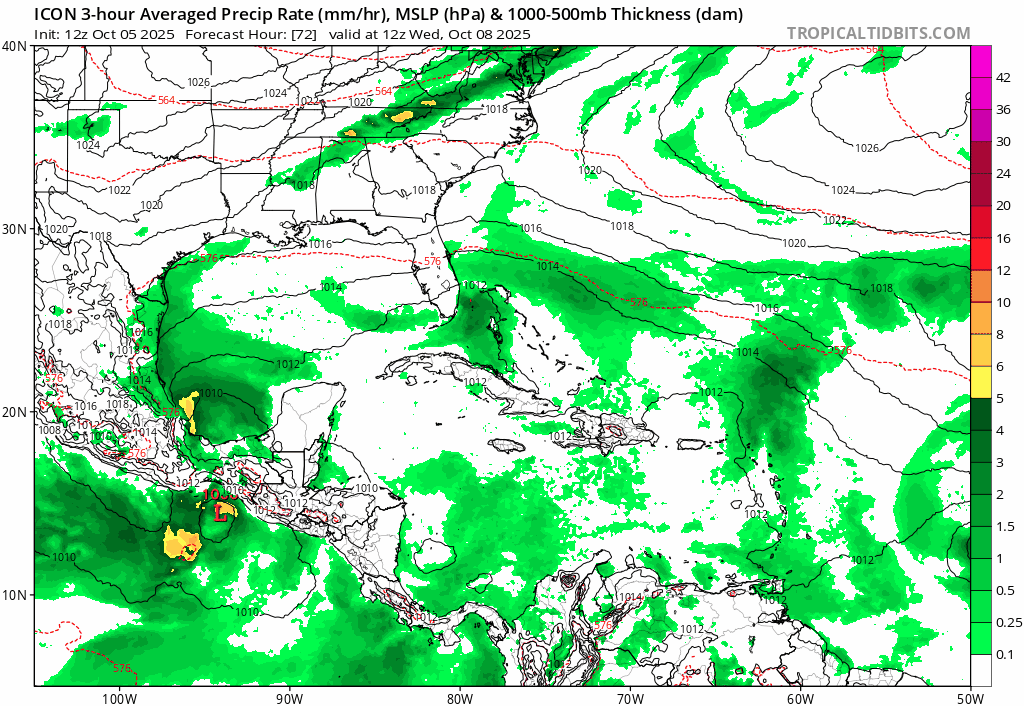
Re: NATL: INVEST 95L - Models
0z ICON seems to cave towards the Euro - has a weak tropical storm vs. major hurricanes on the past few runs.
0 likes
Kendall -> SLO -> PBC
Memorable Storms: Katrina (for its Florida landfall...) Wilma Matthew Irma
Memorable Storms: Katrina (for its Florida landfall...) Wilma Matthew Irma
Re: NATL: INVEST 95L - Models
Ubuntwo wrote:0z ICON seems to cave towards the Euro - has a weak tropical storm vs. major hurricanes on the past few runs.
Wow, 0Z Icon never gets below 1007 mb! 12Z UKMET was similarly weak. We’ll see what the 0Z has.
Other 0Z:
Gfs is starting off weaker than 12Z/6Z but near 18Z with it down to 1002 mb so far.
CMC and JMA also weaker on maps to 72.
UKMET: a little stronger than 12Z but doesn’t become a TC til 150 as it’s moving N in the subtropics NE of Turks/Caicos:
NEW TROPICAL CYCLONE FORECAST TO DEVELOP AFTER 150 HOURS
FORECAST POSITION AT T+150 : 23.4N 69.8W
LEAD CENTRAL MAXIMUM WIND
VERIFYING TIME TIME POSITION PRESSURE (MB) SPEED (KNOTS)
-------------- ---- -------- ------------- -------------
1200UTC 12.10.2025 156 24.3N 69.9W 1005 37
0000UTC 13.10.2025 168 26.8N 69.3W 1004 40
FORECAST POSITION AT T+150 : 23.4N 69.8W
LEAD CENTRAL MAXIMUM WIND
VERIFYING TIME TIME POSITION PRESSURE (MB) SPEED (KNOTS)
-------------- ---- -------- ------------- -------------
1200UTC 12.10.2025 156 24.3N 69.9W 1005 37
0000UTC 13.10.2025 168 26.8N 69.3W 1004 40
0 likes
Personal Forecast Disclaimer:
The posts in this forum are NOT official forecasts and should not be used as such. They are just the opinion of the poster and may or may not be backed by sound meteorological data. They are NOT endorsed by any professional institution or storm2k.org. For official information, please refer to the NHC and NWS products.
The posts in this forum are NOT official forecasts and should not be used as such. They are just the opinion of the poster and may or may not be backed by sound meteorological data. They are NOT endorsed by any professional institution or storm2k.org. For official information, please refer to the NHC and NWS products.


Re: NATL: INVEST 95L - Models
Woofde wrote:Large downtrend in the 0z GFS ensembles.https://uploads.tapatalk-cdn.com/20251006/dcefbb45af2d5c3266e98b7b61a8a633.jpg https://uploads.tapatalk-cdn.com/20251006/052d79ad249a772e66e865811d4fc177.jpg
I wonder if there’s an actual inverse relationship with the hybrid just off the US, which is more active further south (just off SE US) on this run vs further NE on prior runs.
0Z Euro again has ~nothing and it again has the US E coast hybrid.
0 likes
Personal Forecast Disclaimer:
The posts in this forum are NOT official forecasts and should not be used as such. They are just the opinion of the poster and may or may not be backed by sound meteorological data. They are NOT endorsed by any professional institution or storm2k.org. For official information, please refer to the NHC and NWS products.
The posts in this forum are NOT official forecasts and should not be used as such. They are just the opinion of the poster and may or may not be backed by sound meteorological data. They are NOT endorsed by any professional institution or storm2k.org. For official information, please refer to the NHC and NWS products.
Re: NATL: INVEST 95L - Models
HAFS-A and HAFS-B both went from 0z runs showing major hurricanes near Lesser Antilles, to 6z runs barely slowing a weak TS or nothing at all.
We'll see what happens with 12z models.
We'll see what happens with 12z models.
0 likes
TC naming lists: retirements and intensity
Most aggressive Advisory #1's in North Atlantic (cr. kevin for starting the list)
Most aggressive Advisory #1's in North Atlantic (cr. kevin for starting the list)
-
ScottNAtlanta

- Category 5

- Posts: 2535
- Joined: Sat May 25, 2013 3:11 pm
- Location: Atlanta, GA
Re: NATL: INVEST 95L - Models
0 likes
The posts in this forum are NOT official forecast and should not be used as such. They are just the opinion of the poster and may or may not be backed by sound meteorological data. They are NOT endorsed by any professional institution or storm2k.org. For official information, please refer to the NHC and NWS products.

Re: NATL: INVEST 95L - Models
This large envelope disturbance appears to be consolidating nicely. Once a clearly defined COC has formed, an accurate initialization and forward motion can be better analyzed. I think models will more accurately latch on to less varying & better forecast predictability.
1 likes
Andy D
(For official information, please refer to the NHC and NWS products.)
(For official information, please refer to the NHC and NWS products.)
Re: NATL: INVEST 95L - Models
12z GFS still shows a hurricane out of this. I’m hoping for this outcome- a hurricane to boost season stats and provide some surfable waves.
0 likes
Igor 2010, Sandy 2012, Fay 2014, Gonzalo 2014, Joaquin 2015, Nicole 2016, Humberto 2019, Imelda 2025
I am only a tropical weather enthusiast. My predictions are not official and may or may not be backed by sound meteorological data. For official information, please refer to the NHC and NWS products.
I am only a tropical weather enthusiast. My predictions are not official and may or may not be backed by sound meteorological data. For official information, please refer to the NHC and NWS products.
Who is online
Users browsing this forum: No registered users and 172 guests