2025 Global Model Runs Discussion (Out thru day 16)
Moderator: S2k Moderators
Forum rules

The posts in this forum are NOT official forecasts and should not be used as such. They are just the opinion of the poster and may or may not be backed by sound meteorological data. They are NOT endorsed by any professional institution or STORM2K. For official information, please refer to products from the National Hurricane Center and National Weather Service.

Re: 2025 Global Model Runs Discussion (Out thru day 16)
People are going to lose their **** over this GFS run.
0 likes
Igor 2010, Sandy 2012, Fay 2014, Gonzalo 2014, Joaquin 2015, Nicole 2016, Humberto 2019, Imelda 2025
I am only a tropical weather enthusiast. My predictions are not official and may or may not be backed by sound meteorological data. For official information, please refer to the NHC and NWS products.
I am only a tropical weather enthusiast. My predictions are not official and may or may not be backed by sound meteorological data. For official information, please refer to the NHC and NWS products.
Re: 2025 Global Model Runs Discussion (Out thru day 16)
Close enough, welcome back Hurricane Wilma.

9 likes
Igor 2010, Sandy 2012, Fay 2014, Gonzalo 2014, Joaquin 2015, Nicole 2016, Humberto 2019, Imelda 2025
I am only a tropical weather enthusiast. My predictions are not official and may or may not be backed by sound meteorological data. For official information, please refer to the NHC and NWS products.
I am only a tropical weather enthusiast. My predictions are not official and may or may not be backed by sound meteorological data. For official information, please refer to the NHC and NWS products.
-
HURRICANELONNY
- Category 5

- Posts: 1390
- Joined: Wed May 07, 2003 6:48 am
- Location: HOLLYWOOD.FL
Re: 2025 Global Model Runs Discussion (Out thru day 16)
You know one of these times the GFS will be remotely right this far out. Get Florida Soon=GFS
1 likes
hurricanelonny


Re: 2025 Global Model Runs Discussion (Out thru day 16)
18z run has a weaker trough which traps the system until another trough picks it up towards the end of the month. End result is stronger (921 v 923) and farther west. Definitely a crazy hour run and a run like that, that's 16 days out is as useful as scrap paper but Miami and the Key Islands end up getting the nasty side of a major hurricane. No thanks.
0 likes


Re: 2025 Global Model Runs Discussion (Out thru day 16)
The part i'm having a hard time swallowing is a briskly west (or WNW) motion MDR storm in middle to late October, that makes it as far westward as Jamaica, and then threatens Central America, Cuba, or Florida with a major h'cane. A potential threat to the Eastern Caribbean? Perhaps. Otherwise, it would darn near have to sneak into the Caribbean and then explode (rapidly deepen) west of 65W for me to buy into a W. Caribbean major threat.
0 likes
Andy D
(For official information, please refer to the NHC and NWS products.)
(For official information, please refer to the NHC and NWS products.)
-
SouthFLTropics

- Category 5
- Posts: 4258
- Age: 50
- Joined: Thu Aug 14, 2003 8:04 am
- Location: Port St. Lucie, Florida
Re: 2025 Global Model Runs Discussion (Out thru day 16)
While certainly not a likely outcome given the time of year, it is most certainly not without precedent… we only need to look back to 2005 and see when Wilma hit South Florida.
Sent from my iPhone using Tapatalk
Sent from my iPhone using Tapatalk
2 likes
Fourth Generation Florida Native
Personal Storm History: David 79, Andrew 92, Erin 95, Floyd 99, Irene 99, Frances 04, Jeanne 04, Wilma 05, Matthew 16, Irma 17, Ian 22, Nicole 22, Milton 24
Personal Storm History: David 79, Andrew 92, Erin 95, Floyd 99, Irene 99, Frances 04, Jeanne 04, Wilma 05, Matthew 16, Irma 17, Ian 22, Nicole 22, Milton 24
-
otowntiger
- Category 5
- Posts: 1932
- Joined: Tue Aug 31, 2004 7:06 pm
Re: 2025 Global Model Runs Discussion (Out thru day 16)
actually the nasty side would be the NE side, into the Bahamas. It would have to pass to the west of Miami to get the ‘nasty’ or ‘dirty’ side in this case.Owasso wrote:18z run has a weaker trough which traps the system until another trough picks it up towards the end of the month. End result is stronger (921 v 923) and farther west. Definitely a crazy hour run and a run like that, that's 16 days out is as useful as scrap paper but Miami and the Key Islands end up getting the nasty side of a major hurricane. No thanks.
0 likes

Re: 2025 Global Model Runs Discussion (Out thru day 16)
HURRICANELONNY wrote:You know one of these times the GFS will be remotely right this far out. Get Florida Soon=GFS
Lol Get Florida Soon..i go with Give Florida a Storm.
This is probably the 100th time this season the GFS has a phantom storm going to Florida.
I will admit this time the long range Euro ensembles have a bit of a signal, but we will see if that hold in the days ahead.
I am seriously going to try to keep track of the GFS phantom doom storms it spits out next season. I really dont think my above estimation is an exaggeration.
As Joe Bastardi one said, "sometimes a blind squirrel finds a nut".
1 likes
Re: 2025 Global Model Runs Discussion (Out thru day 16)
SouthFLTropics wrote:While certainly not a likely outcome given the time of year, it is most certainly not without precedent… we only need to look back to 2005 and see when Wilma hit South Florida.
Sent from my iPhone using Tapatalk
Hurricane Michelle in 2001 is another.
It is also when I heard Bastardi's blind nut comment as one of the models showed Michelle taking a track through Florida similar to how Wilma played out, in my opinion he was hyping that track a bit with the doom scenerio but it did eventually play out 4 years later.
Michelle was extremely devastating to Cuba so not something we want to see.
As I posted above, my confidence in the long range GFS doom storms is close to nil, at least this time the Canadian and Euro ensembles also have a signal.
2 likes
Re: 2025 Global Model Runs Discussion (Out thru day 16)
0Z: huge disagreement
-Icon has very little
-UK dropped it after having it 3 runs
-CMC hits NE Caribbean and then recurves into Turks/Caicos
-GFS again has TCG in far S Caribbean then N through Haiti/Turks/Caicos
-Icon has very little
-UK dropped it after having it 3 runs
-CMC hits NE Caribbean and then recurves into Turks/Caicos
-GFS again has TCG in far S Caribbean then N through Haiti/Turks/Caicos
2 likes
Personal Forecast Disclaimer:
The posts in this forum are NOT official forecasts and should not be used as such. They are just the opinion of the poster and may or may not be backed by sound meteorological data. They are NOT endorsed by any professional institution or storm2k.org. For official information, please refer to the NHC and NWS products.
The posts in this forum are NOT official forecasts and should not be used as such. They are just the opinion of the poster and may or may not be backed by sound meteorological data. They are NOT endorsed by any professional institution or storm2k.org. For official information, please refer to the NHC and NWS products.

Re: 2025 Global Model Runs Discussion (Out thru day 16)
Figure out where a storm is going in October or November; challenge level [impossible]
3 likes
-
cycloneye

- Admin

- Posts: 149259
- Age: 69
- Joined: Thu Oct 10, 2002 10:54 am
- Location: San Juan, Puerto Rico
Re: 2025 Global Model Runs Discussion (Out thru day 16)
This is very interesting. The AI Deepmind is overperforming NHC and HCCA consensus on track and a little less on intensity. The bottomline is Airtificial Intelligence when it comes to models is here to stay and dominante.
https://x.com/WxTca/status/1977938918826803265
https://x.com/WxTca/status/1977938918826803265
4 likes
Visit the Caribbean-Central America Weather Thread where you can find at first post web cams,radars
and observations from Caribbean basin members Click Here
and observations from Caribbean basin members Click Here
Re: 2025 Global Model Runs Discussion (Out thru day 16)
cycloneye wrote:This is very interesting. The AI Deepmind is overperforming NHC and HCCA consensus on track and a little less on intensity. The bottomline is Airtificial Intelligence when it comes to models is here to stay and dominante.
https://x.com/WxTca/status/1977938918826803265
We've had a pretty conventional season (the twin storm situation aside) - basically lots of fairly easy to forecast recurves with no land interaction that would seem like they would be the best case scenario for pattern matching.
2 likes

Re: 2025 Global Model Runs Discussion (Out thru day 16)
LarryWx wrote:Fancy1002 wrote:LarryWx wrote:
1. It’s the same based on following the various upper vortices.
2. Based also on upper vortex, the 0Z Euro is close to a TD at the Lesser Antilles. But the sfc low itself is still weak then. However, soon after at 198 in E Caribbean pretty far S, a TD forms and moves WNW. This kind of resembles the UKMET though a little slower.
Edit: Then turns back almost due W and goes well S of Jamaica as a strengthening TS.
Edit: It then moves slowly W underneath a strengthening ridge in the direction of Honduras/Nicaragua at end of run at 947 mb. That general kind of track has occurred several times mid Oct and later in stark contrast to the CMC track. Details that far out are unimportant, regardless.
Would you mind posting a picture of the ending of the run if you can, or send a link. Tropical tidbits is really slow at getting the euro in.
If the environment is how I think it is, it will likely be heading north to north west from that ending point then north east
I can’t link it as it is paywalled. But I can tell you that H5 winds are clearly E to W underneath a strong (593 dm) H5 high covering entire Gulf and moving only slowly E. This is extremely speculative so far out but that setup tells me it, would hit Honduras/Nic border area within 48 hours similar to Mitch of 1998 on about the same date. Eventually though it could turn NW, N, and then NE if it survives land.
The Heat content in the Caribbean is still high in October as Mitch taught us years ago, back and forth that major tracked without the models having much of a clue even just 72 hours out.
4 likes

Re: 2025 Global Model Runs Discussion (Out thru day 16)
Fantasy-range 300+ hr GFS alert...
This is NOT Melissa.
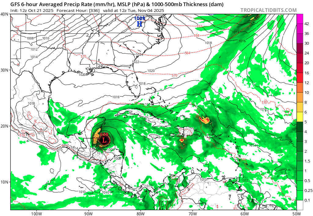
This is NOT Melissa.
1 likes
TC naming lists: retirements and intensity
Most aggressive Advisory #1's in North Atlantic (cr. kevin for starting the list)
Most aggressive Advisory #1's in North Atlantic (cr. kevin for starting the list)
Re: 2025 Global Model Runs Discussion (Out thru day 16)
CourierPR wrote:mrbagyo wrote:mrbagyo wrote:Could this be the one?
https://s14.gifyu.com/images/bwOvR.png
https://s14.gifyu.com/images/bwOv6.png
https://s14.gifyu.com/images/bwOvg.png
https://s14.gifyu.com/images/bwOvi.gif
Turns out, it's indeed THE ONE.
What are we seeing here?
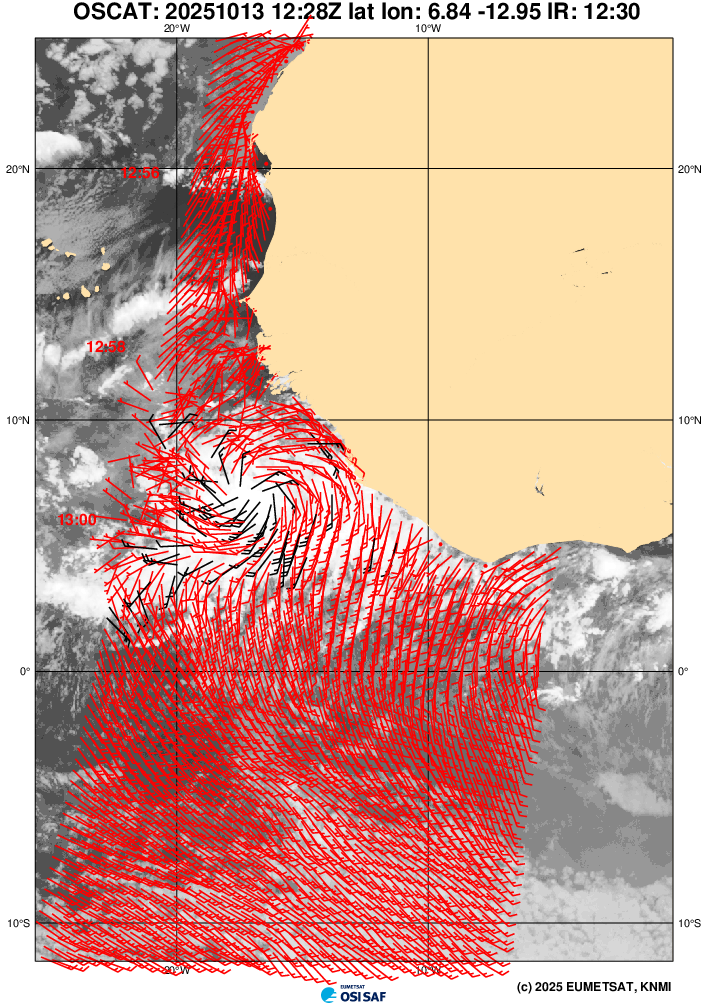
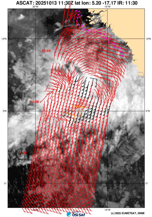
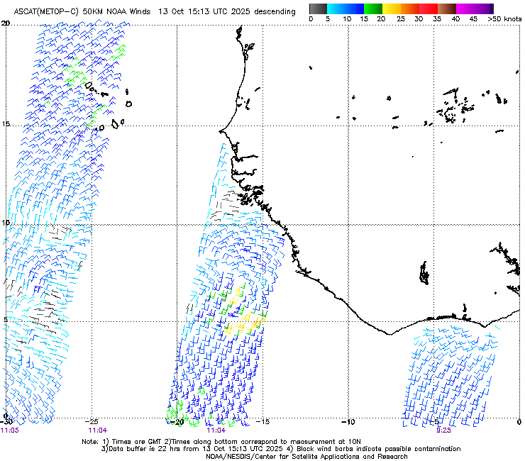
The wave that eventually became Melissa, when it first left Africa (and spent a long time traversing through the open Atlantic before actually developing into a TC in the Caribbean).
2 likes
TC naming lists: retirements and intensity
Most aggressive Advisory #1's in North Atlantic (cr. kevin for starting the list)
Most aggressive Advisory #1's in North Atlantic (cr. kevin for starting the list)
Re: 2025 Global Model Runs Discussion (Out thru day 16)
GEFS may be back to its old tricks of showing lows in Western Caribbean (likely from CAGs). Whether they will verify is obviously unclear, but here are the last three runs at 240 hrs. (The 18z run isn't out yet.)

This is for entertainment only, but here's the end of the 6z run:

FWIW, 12z EPS does show some intermittent lows in the region:

This is for entertainment only, but here's the end of the 6z run:
FWIW, 12z EPS does show some intermittent lows in the region:
4 likes
TC naming lists: retirements and intensity
Most aggressive Advisory #1's in North Atlantic (cr. kevin for starting the list)
Most aggressive Advisory #1's in North Atlantic (cr. kevin for starting the list)
-
Category5Kaiju

- Category 5
- Posts: 4330
- Joined: Thu Dec 24, 2020 12:45 pm
- Location: Seattle and Phoenix
Re: 2025 Global Model Runs Discussion (Out thru day 16)
A ways out of course (mid-November), but the GFS long range has a system that seems to develop out of a CAG and gets pulled northward toward the Yucatán.
Season may not be quite over yet….
Season may not be quite over yet….
1 likes
Unless explicitly stated, all info in my posts is based on my own opinions and observations. Tropical storms and hurricanes can be extremely dangerous. Refer to an accredited weather research agency or meteorologist if you need to make serious decisions regarding an approaching storm.
-
Stormlover70
- Tropical Storm

- Posts: 194
- Age: 56
- Joined: Fri Jun 21, 2024 5:31 am
- Location: New port richey
Re: 2025 Global Model Runs Discussion (Out thru day 16)
it's the gfs.....long range...Category5Kaiju wrote:A ways out of course (mid-November), but the GFS long range has a system that seems to develop out of a CAG and gets pulled northward toward the Yucatán.
Season may not be quite over yet….

2 likes
Re: 2025 Global Model Runs Discussion (Out thru day 16)
Category5Kaiju wrote:A ways out of course (mid-November), but the GFS long range has a system that seems to develop out of a CAG and gets pulled northward toward the Yucatán.
Season may not be quite over yet….
In addition to 18z as mentioned above, 0z and 6z GFS runs also show a CAG storm forming around the 10-day mark (November 13). It's weak on all three runs, likely due to proximity to land.
While it's not in the 16-day fantasy range, this is also a common bias of GFS.
0 likes
TC naming lists: retirements and intensity
Most aggressive Advisory #1's in North Atlantic (cr. kevin for starting the list)
Most aggressive Advisory #1's in North Atlantic (cr. kevin for starting the list)
Who is online
Users browsing this forum: No registered users and 119 guests