 The posts in this forum are NOT official forecast and should not be used as such. They are just the opinion of the poster and may or may not be backed by sound meteorological data. They are NOT endorsed by any professional institution or


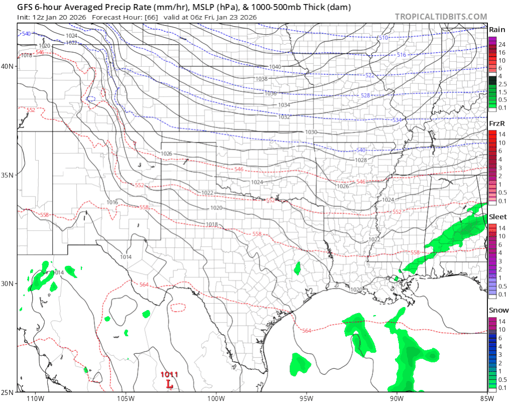
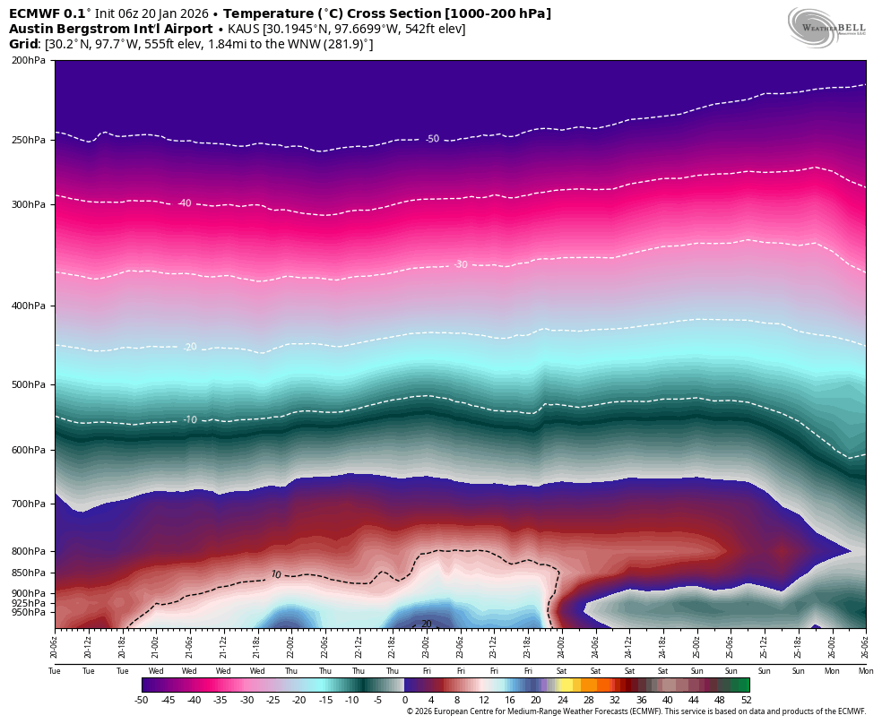
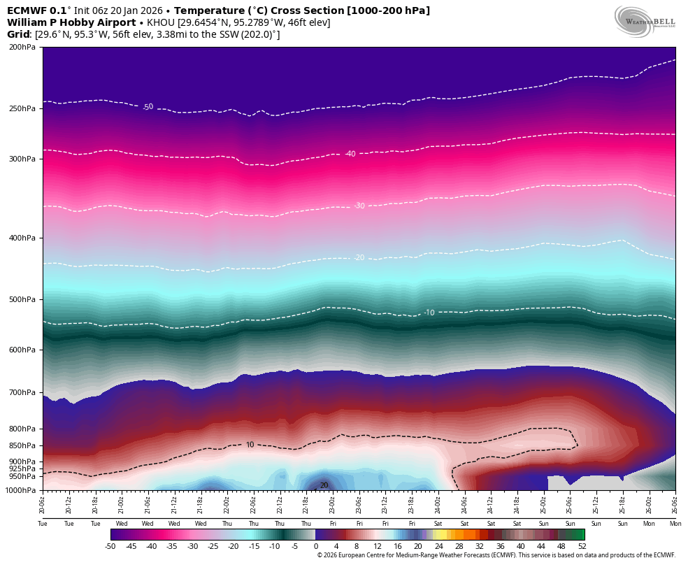
orangeblood wrote:Here's a good tool I like to use for these events...representation from the Euro temp cross section forecasts over time for DFW Austin Houston. DFW's look like it can overcome a fairly weak warm nose quickly but Austin and Houston will be difficult to shake unless the deeper cold can get much further south
https://images.weatherbell.com/meteogram/ecmwf-deterministic/KDFW/cross_section_full/1768888800/1768888800-AUdLgv0BRdY.png
https://images.weatherbell.com/meteogram/ecmwf-deterministic/KAUS/cross_section_full/1768888800/1768888800-H4EQvtbovPE.png
https://images.weatherbell.com/meteogram/ecmwf-deterministic/KHOU/cross_section_full/1768888800/1768888800-PEkFD3pX2h4.png
Yeah soundings help. That isn't a pretty look for Austin in terms of icing, hoping more of it comes in deeper for sleet.


