New DEC QBO value out ---- RAPIDLY increasing west:

Winter Weather Discussion

Moderator: S2k Moderators

Forum rules

The posts in this forum are NOT official forecast and should not be used as such. They are just the opinion of the poster and may or may not be backed by sound meteorological data. They are NOT endorsed by any professional institution or STORM2K.

Help Support Storm2K
Message
Author
User avatar
FLguy
Professional-Met
Professional-Met
Posts: 799
Joined: Mon Dec 29, 2003 5:36 pm
Location: Daytona Beach FL
Contact:

New DEC QBO value out ---- RAPIDLY increasing west:

#1 Postby FLguy » Tue Jan 06, 2004 10:28 pm

the new monthly-averaged QBO value for DEC 03 has averaged out around -11.38 ---- which is an increase of +6.48 from the NOV monthly average of -17.86. the net change in the QBO index between OCT and NOV of 03 was only +2.48 (note a positive increase in the QBO index would imply a trending toward the QBO west or positive phase)

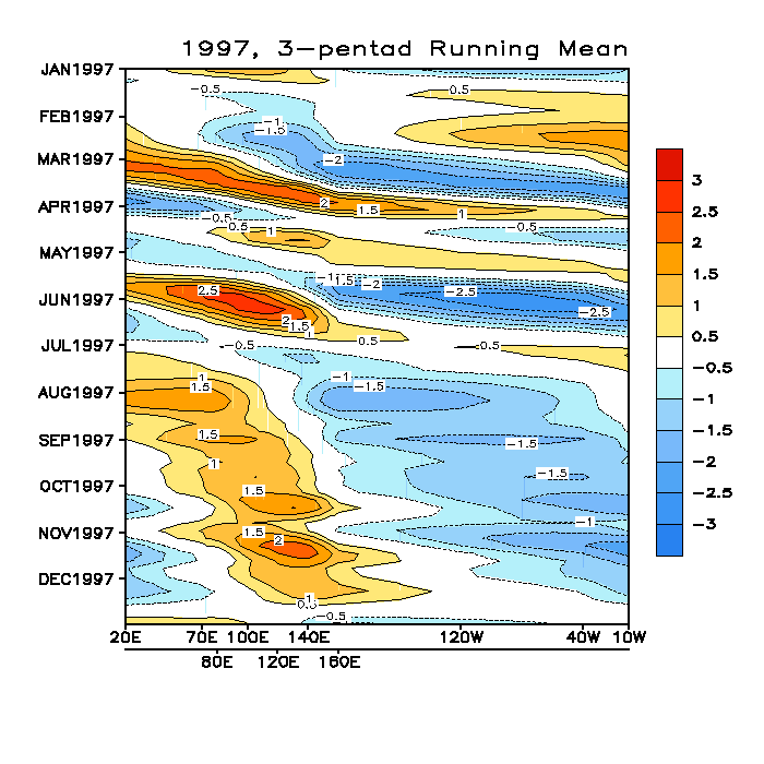
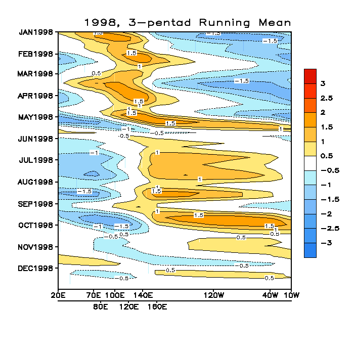
a comprehensive data-set of QBO indices back to 1948 can be obtained through the CDC (Climate Diagnostics Center) by using the link below:

http://www.cdc.noaa.gov/Correlation/qbo.data

so what impact will this have on us here in the CONUS:

As most of you are aware...the large scale pattern has in many respects reflected that of what is normal for La nina (cold phase ENSO conditions) of late. this in spite of the fact that equatorial PAC SSTA anomalies have been near to slightly WARMER than avg (coinciding with warm phase ENSO conditions) over the past three months:

from left to right:
WEEK/MO/YR...NINO 1+2...NINO 3.0...NINO 3.4...NINO 4.0

01OCT2003 20.1 -.7 25.3 .4 27.3 .6 29.1 .7
08OCT2003 20.9 .1 25.5 .6 27.4 .8 29.1 .7
15OCT2003 20.9 .0 25.2 .3 27.1 .5 29.1 .7
22OCT2003 21.5 .5 25.3 .3 27.1 .5 29.3 .9
29OCT2003 21.4 .2 25.4 .5 27.2 .6 29.3 1.0
05NOV2003 21.6 .2 25.3 .4 27.0 .5 29.4 1.0
12NOV2003 21.8 .3 25.3 .4 26.9 .4 29.3 1.0
19NOV2003 22.0 .2 25.4 .5 27.1 .5 29.3 1.0
26NOV2003 22.3 .3 25.5 .5 27.2 .7 29.2 .9
03DEC2003 22.5 .1 25.6 .6 27.1 .6 29.2 .9
10DEC2003 22.9 .3 25.5 .4 27.0 .5 29.1 .9
17DEC2003 23.0 .1 25.4 .3 26.8 .4 29.0 .7
24DEC2003 23.0 -.2 25.6 .4 26.8 .3 28.9 .6

the data-set above of weekely averaged SSTA anomalies over the Equatorial PAC nino regions throughout the three month period (OCT-DEC) shows that ONLY the ENSO 1+2 region has seen SSTA anomalies below average during that period. the other three ENSO regions have been consistently ABOVE normal (between +0.3C to +0.6C in the ENSO 3.0 region...+0.3C to +0.8C in the NINO 3.4 region and between +0.6C and +1.0C in the ENSO 4.0 region closest to the dateline).

link to the complete dataset back to 1992...

ftp://ftpprd.ncep.noaa.gov/pub/cpc/wd52 ... /wksst.for

Here is a graphical representation of seasonally averaged SSTA anomalies: (10/5/03 to 1/3/04)

Image

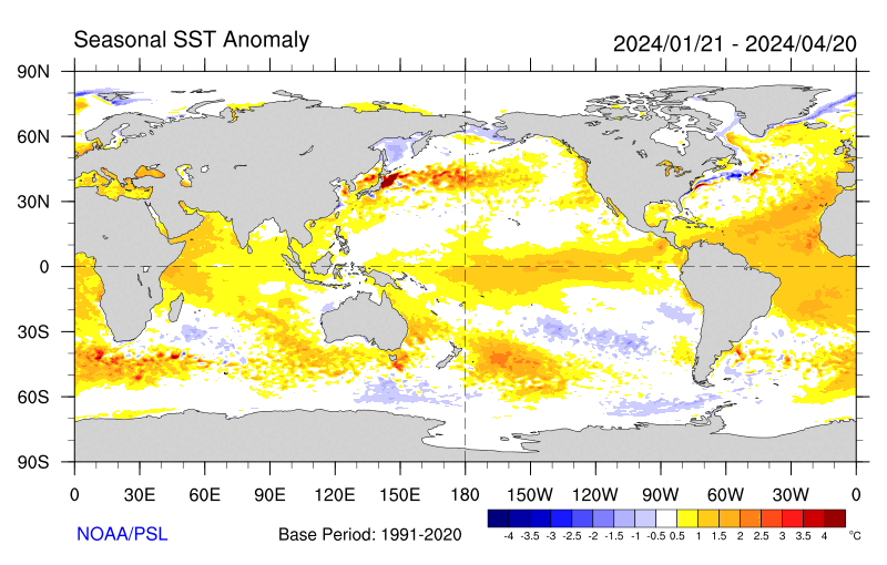
Notice how SSTA over the equatorial PAC have been near to slightly warmer than normal. the greatest area of above normal SSTA to be found was located to the west of the dateline in the NINO 4.0 region.

Also we noticed a strong positive (monthly avg) SOI develop in DEC which bucked the trend of the previous 22 months (remember that the SOI is related to the difference in pressure between tahiti and darwin Australia --- POS SOI would imply that pressues are above normal at tahiti and below normal in darwin australia). the POS SOI and its effect on the downstream pattern is most consistent with that of La Nina whereas the negative phase of the SOI is correlated more strongly to El nino.

the figure below illustrates the connection between the SOI...and pressureas at those two locations:

Image

the negative (east) QBO tends to correlate to an enhanced (and more dominating) PJ as we have been experiencing (while a (west) +QBO implies the opposite).

As the QBO continues to decline...we may be able to expect the PJ to relax as we head into FEB and MAR.

These however are not the only factors responsible for the pattern we are currently dealing with.

the cold pool IF further northeast (like in 2001-02) would imply a presistent RNA Pattern (trough in the west...ridge off the southeast coast of the US)...although since the cold pool is centered further back to the west...its more of a neutral or variable signal . If one was to expect a +PNA to dominate like it did last winter you would want to see a similar SSTA configuration across the north pacific to 1993-94.

Lastly...the more active MJO would be quite consistent with La Nina and ENSO neutral conditions as we have seen (while is less active to in some cases absent in El Nino years).

the correlation between the QBO and the increased POTENTIAL for major east coast snow events is maximized when the upper level zonal winds over the equatorial PAC are near neutral (within +/- 10.00 of neutral).

NINO 3.4 SSTA anomalies over the past three months (between +0.3C to +0.8C) also appear to be quite favorable for major east coast snow events and indeed we have already had two in dec (although DEC 14-15 was a miss for many closer to the coast).
0 likes   

User avatar
HuffWx
Tropical Storm
Tropical Storm
Posts: 126
Joined: Wed Mar 05, 2003 11:16 pm
Location: Forest, VA
Contact:

#2 Postby HuffWx » Tue Jan 06, 2004 10:41 pm

Nice post FL!

I hope we can calm this ragin PJ down...I hope we dont waste all this cross polar flow. The new EC has promise, but many possible pitfalls.

Huff
0 likes   

User avatar
FLguy
Professional-Met
Professional-Met
Posts: 799
Joined: Mon Dec 29, 2003 5:36 pm
Location: Daytona Beach FL
Contact:

#3 Postby FLguy » Tue Jan 06, 2004 10:48 pm

as the QBO declines we should see the PJ respond. many other winters with similar strong -QBo values had the same issue in relation to the raging PJ.
0 likes   

User avatar
Stormsfury
Category 5
Category 5
Posts: 10549
Age: 53
Joined: Wed Feb 05, 2003 6:27 pm
Location: Summerville, SC

#4 Postby Stormsfury » Wed Jan 07, 2004 9:09 am

Excellent post, FLguy ... (as usual)

Keep in mind the recent Kelvin Wave observed and also TC Heta (07P). Continues westerly bursting has been occurring (observed by QuikScat). Extrapolation of Estimated/Progged QBO value declines would led me to believe that the AVG for January will be likely very close to -5, and a POTENTIAL for a WEST phase of the QBO by mid-February.

TIME SENSITIVE!
Image

Image
0 likes   

User avatar
boca
Category 5
Category 5
Posts: 6367
Age: 60
Joined: Mon Dec 15, 2003 8:49 am
Location: Boca Raton,FL

what about the east coast including FL

#5 Postby boca » Wed Jan 07, 2004 9:17 am

What does that mean in english for the east coast and FL? Thanks
0 likes   

User avatar
FLguy
Professional-Met
Professional-Met
Posts: 799
Joined: Mon Dec 29, 2003 5:36 pm
Location: Daytona Beach FL
Contact:

#6 Postby FLguy » Wed Jan 07, 2004 1:27 pm

Stormsfury wrote:Excellent post, FLguy ... (as usual)

Keep in mind the recent Kelvin Wave observed and also TC Heta (07P). Continues westerly bursting has been occurring (observed by QuikScat). Extrapolation of Estimated/Progged QBO value declines would led me to believe that the AVG for January will be likely very close to -5, and a POTENTIAL for a WEST phase of the QBO by mid-February.

TIME SENSITIVE!
http://manati.wwb.noaa.gov/dataimages21 ... MBds69.png

http://manati.wwb.noaa.gov/dataimages21 ... MBas69.png


agreed. and if we extrapolate the trend in the 30 hPa zonal wind anomalies based on the rate of change frommonth tomonth in the index we sould see the QBO reverse in FEB. however it will still be below +10 through april (from there it will depend on how quickly it increases positive)...so the correlation between the QBO observed montly indices and the threat for SECS/MECS events would support and INC likelihood for those occurances into march and an perhaps early APR...and a relaxing of the PJ.

BTW...heres the MJO indicies from the 1997/98 winter. notice several strong kelvin waves preceeded the development of the El Nino...shortly thereafter...the oscillation became virtuallynon-existant. this is another example of the strong intra seasonal variability in the MJO:

Image

notice the strong activity observed pror to JUN 1997...then the feature was virtually non-existant. this waslikely the function of the coupledeffect ofthe changes in SST and SLP anomalies across the western equatorial PAC in that winter.

Also notice in DEC 1997 the position of the greatest convection corresponding to decreased OLR anomalies was centered further east which translates to more significant rainfallfurther south along the west coast. while supressed convection was obseved near 120E which of course would imply less precipitation across the PAC northwest.

heres the 1998 anomalies:

Image
0 likes   

donsutherland1
S2K Analyst
S2K Analyst
Posts: 2718
Joined: Mon Sep 15, 2003 8:49 pm
Location: New York

Re: New DEC QBO value out ---- RAPIDLY increasing west:

#7 Postby donsutherland1 » Wed Jan 07, 2004 2:11 pm

Excellent discussion, FLguy.

This bodes well for a snowy February especially when one also ties in historical seasonal snowfall (January-April) following a snowy December (12" or more in NYC/BOS; 6" or more in DCA) and an early-season significant snowfall (December 7 or before).
0 likes   

User avatar
FLguy
Professional-Met
Professional-Met
Posts: 799
Joined: Mon Dec 29, 2003 5:36 pm
Location: Daytona Beach FL
Contact:

Re: New DEC QBO value out ---- RAPIDLY increasing west:

#8 Postby FLguy » Wed Jan 07, 2004 2:19 pm

donsutherland1 wrote:Excellent discussion, FLguy.

This bodes well for a snowy February especially when one also ties in historical seasonal snowfall (January-April) following a snowy December (12" or more in NYC/BOS; 6" or more in DCA) and an early-season significant snowfall (December 7 or before).


thanks...

and thats exactly right...the december trends...decreasing QBO...and ENSO 3.4 SSTA are becoming aligned perfectly with one another to favor a MAJOR east coast snowstorm...however the monthly avg SOI values were strongly POS in DEC (above +1.0) which normally i would want to see near neutralor negative SOI values to favor a major east coast snow event. although that didint stop the early and mid DEC events from occuring. but in the short term im MOST impressed with the potential for late next week.
0 likes   

User avatar
WEATHERGURU
Tropical Storm
Tropical Storm
Posts: 109
Joined: Fri Nov 21, 2003 10:09 pm
Location: Wyandotte, Mi (15 miles south of Detroit)

#9 Postby WEATHERGURU » Wed Jan 07, 2004 2:28 pm

How does this bode for the lower lakes for an snowier january on?
0 likes   


Return to “Winter Weather”

Who is online

Users browsing this forum: No registered users and 15 guests