The posts in this forum are NOT official forecast and should not be used as such. They are just the opinion of the poster and may or may not be backed by sound meteorological data. They are NOT endorsed by any professional institution or


The majority of last Night's 0z GGEM ensembles still show the mid week system moving northeast toward Newfoundland and becoming the new 50/50 low.
120 hours

144 hours

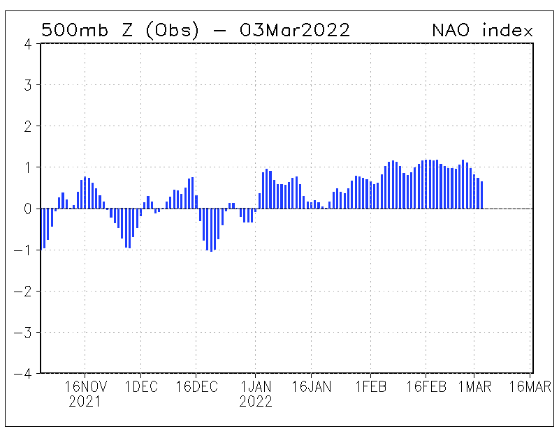
Most of the members are implying the development of a decent 50/50 low, as the product of the mid week system, although, since the positive height anomaly is back toward England, The NAO for the most part is positive, and therfore, the 50/50 low is not held in place, and progresses northweard toward greenland at 144 hours.
Here's the GGEM ensemble surface depiction at 120 and 144 hours.


Most of the members develop a significant midwest/plains low pretty far to the north which pushes eastward into the Lakes. But because the 50/50 low is there, the s/w is probably going to have to take a more suppressed track than what the model is indicating, which would also take the track of the surface low much further south.
The GFSX (paralell run) from 0z 2/15 develops a near textbook 50/50 low at 132 hours, and the Polar vortex is near Baffin Island in a climatological position, and also not strong enough where it would develop a strong jet in the confluence zone underneath it, preventing energy from digging like we saw in January.

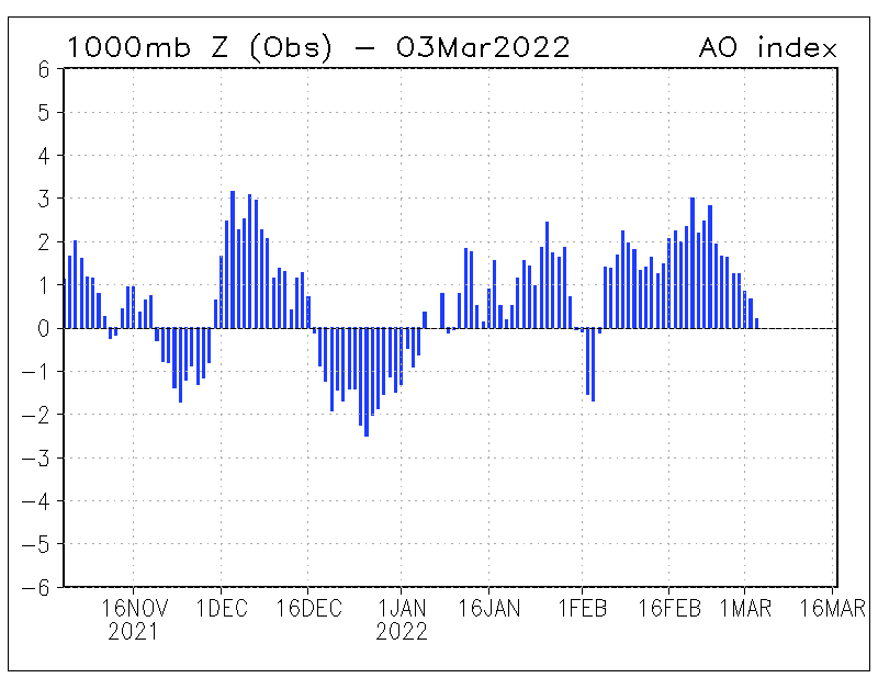
The problem still is that the blocking is located pretty far to the east, and the NAO is for the most part positive.
If the 50/50 low weakens and and progresses out, then the low would probably be able to move into the lakes, with no transfer of energy to the coast.
Remember, the right set-up has to be in place for a major east coast snowstorm to develop. That is the relationship between the NAO (blocking height center), 50/50 low, and polar vortex. if one is absent, or unfavorable, the likelihood of getting a major east coast snowstorm is less likely.
Another thing we appear to not have is the big cold high over southeast Quebec. This is importnat because the resulant ageostropic flow helps keep the cold air in place along the coast and I-95 corridor for snow, and the right set-up for cold air damming east of the Appalachains down into the Carolinas.
In many situations, this winter, and especially with the December 13-14 Nor'easter, the high moved out to sea, the reason why, becuase the NAO was positive and there was no 50/50 low to hold it in.
As far as the Mid week system it's self goes
The 12z GGEM operational run this afternoon still has the Surface low with the mid week system pretty far southeast of the benchmark, and the trough at 500mb remains an open wave, failing to close off. The problem is the trough is too far to the east, right along the coast, that the surface low remians far enough off shore to effect only coastal areas of the Northeast and Mid Atlantic, South and east of the I-95 corridior.
Immediate coastal sections may not get away free though. As much as 6-12 Inches could be possible across eastern long Island, The Cape, and Nantucket.