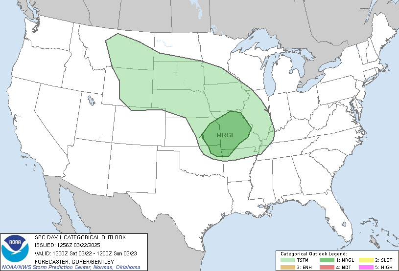
Good morning everyone. A definitely active severe weather weekend is likely to occur and it could be a potentially dangerous severe weather weekend for some areas too.
Taking a look at the situation today is rather complicating, especially further north where a warm front is expected to plow northward into the upper Mississippi Valley area including southeastern Iowa, northeastern Missouri and into west central Illinois. Along and to the north of the warm front, east to southeast surface winds and cooler air will be present with southwest wind aloft. South of the warm front, much warmer southwesterly winds at the surface with southwest wind aloft will be present. This shearing profile along and north of the warm front favors supercell development with a heightened risk of tornadoes and damaging winds in this region, especially if we're talking about low level shear, which is very possible. The area of surface low pressure is expected to lift northeast from Oklahoma into eastern Iowa throughout the day today. Areas east and northeast of this surface low are favored for tornadoes and damaging winds, some possibly significant should supercells and bow echos form. Some places from the Quad Cities to Kirksville and extending eastward into west central Missouri may need to be upgraded to a moderate risk in later outlooks to reflect this potential trend. Something we should keep a watchful eye on today.
Further south, it will be the trailing cold front, which provides severe weather potential from St Louis southward through Little Rock and Houston. Main threat with these storms will be damaging wind, hail, and very heavy flooding rains. Areas from Fort Smith westward do not need anymore rain and thus a flood threat remains quite high with swollen creeks and streams expected. A severe thunderstorm watch is also in effect for Arkansas this morning. Also keep an eye out from Houston northward to Huntsville, TX this morning as severe weather threat appears quite high with damaging wind the primary threat.
For Sunday, all of this severe weather shifts northeastward into the Ohio Valley where damaging wind and tornadoes may occur in this region. Both supercells and bow echo type storms could form in this region. The area of main concern Sunday will be from Dayton and Columbus northward into Toledo, Cleveland, Erie, and Buffalo. In this region, an enhanced risk of damaging wind and tornadoes may result in an upgrade from slight to moderate risk in later forecasts. Otherwise storms along the trailing cold front down into the Tennessee Valley should have damaging wind and hail with them as primary severe threats, but less widespread severe south of the Ohio River.
The situation will continue to evolve throughout the day and changes to this forecast may still occur. Continue to monitor the situation throughout the weekend.
Jim
Some widespread severe weather possible this weekend!!!
Moderator: S2k Moderators
Forum rules
The posts in this forum are NOT official forecast and should not be used as such. They are just the opinion of the poster and may or may not be backed by sound meteorological data. They are NOT endorsed by any professional institution or STORM2K.
-
Guest
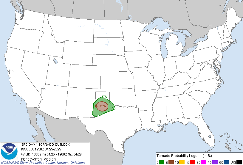
Looks like SPC's mid-morning update nudged the slight risk a little further west into Nebraska and Kansas. However, I still have concerns with the extensive cloudiness hampering instability. But should we see a few breaks in the clouds, they are talking supercell tornadoes, large hail and damaging winds for my area.

Tornado Risk


Tornado Risk

0 likes
It will be interesting to see how much recovery we see with the boundary layer across southeast Texas and extending northward into the ARKLATEX region and the central plains given the rains of this morning.
As for the situation further north into the Quad Cities area, northeast winds are definitely doing the damage for severe weather that far north. Areas south and west of the Quad Cities are more favored today. However later this evening, a few strong to severe storms could impact the Quad Cities area and into central Illinois as well. The big question is the track of the low. If this system tracks towards the Quad Cities, areas south and east of there would be favored for severe weather including possible tornadoes. If this surface low tracks further south, then the Quad Cities is out of the woods. A track even further west into east central Iowa will put most of the east central part of Iowa and into most of Illinois into the severe weather/tornado threat. But the timing is also an issue as well as the level of instability. If we see breaks in the overcast this afternoon in the upper Mississippi Valley area and also the central plains, then we're in trouble with huge storms, possibly low topped supercells again. So a few things to consider here.
A. The actual storm track
B. Timing of day
C. Will the boundary layer recover any
Lots of questions to answer through the day and definitely a tough forecast, especially from the Quad Cities area points south and west into the central plains.
Jim
0 likes
Return to “USA & Caribbean Weather”
Who is online
Users browsing this forum: No registered users and 107 guests

