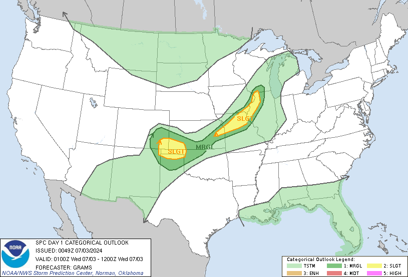
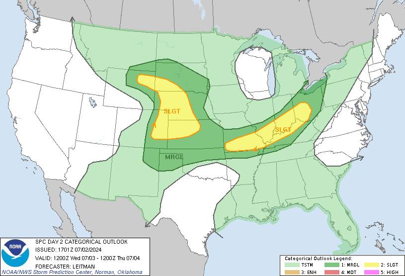
TX, LA Event. Radar/SPC. Rain Rain Rain

U.S. & Caribbean Weather Discussions and Severe Weather Events

Moderator: S2k Moderators

Forum rules

The posts in this forum are NOT official forecast and should not be used as such. They are just the opinion of the poster and may or may not be backed by sound meteorological data. They are NOT endorsed by any professional institution or STORM2K.

Help Support Storm2K
Message
Author
chadtm80

TX, LA Event. Radar/SPC. Rain Rain Rain

#1 Postby chadtm80 » Sat May 01, 2004 7:19 am

Image

Image

Image

Image

Image
0 likes   

User avatar
vbhoutex
Storm2k Executive
Storm2k Executive
Posts: 29113
Age: 73
Joined: Wed Oct 09, 2002 11:31 pm
Location: Cypress, TX
Contact:

#2 Postby vbhoutex » Sat May 01, 2004 8:09 am

MOst definitely not going t be a nice day unless you're a duck!!! It just started moving in in W Houston with a nice little gust front coming through and now the thunderstorms themselves are arriving. No indications at this time of any severe, but just issued got a tornado warning for right over my head!!!!! I'll let you know what happens!!!!
0 likes   
Skywarn, C.E.R.T.
Please click below to donate to STORM2K to help with the expenses of keeping the site going:
Image

User avatar
Lindaloo
Category 5
Category 5
Posts: 22658
Joined: Sat Mar 29, 2003 10:06 am
Location: Pascagoula, MS

#3 Postby Lindaloo » Sat May 01, 2004 8:14 am

Kelly had a severe thunderstorm in her area last night.
0 likes   

chadtm80

#4 Postby chadtm80 » Sat May 01, 2004 8:21 am

That line is getting plain NASTY
0 likes   

User avatar
vbhoutex
Storm2k Executive
Storm2k Executive
Posts: 29113
Age: 73
Joined: Wed Oct 09, 2002 11:31 pm
Location: Cypress, TX
Contact:

#5 Postby vbhoutex » Sat May 01, 2004 8:22 am

They had storms in their area and especially PTtrackers area all day yesterday. We are currently seeing a rain rate of about 2"-3"/ hour at my house(my calc) with winds in the 20-30 range in gusts with plenty of rumbling. Nothing severe at this pioint though. We've had a inch of rain already since 1 am with half of than coming in the last 10 minutes.
0 likes   
Skywarn, C.E.R.T.
Please click below to donate to STORM2K to help with the expenses of keeping the site going:
Image

chadtm80

#6 Postby chadtm80 » Sat May 01, 2004 8:26 am

I believe Florida will get in on some nasty storms as well again today.. Set up very similar to yesturday.
0 likes   

User avatar
Brett Adair
Category 1
Category 1
Posts: 322
Joined: Sun Apr 11, 2004 8:49 pm
Location: Sylacauga, Alabama
Contact:

#7 Postby Brett Adair » Sat May 01, 2004 8:32 am

More than likely Florida will. This stuff in SE Texas is really getting nasty. That line is feeding on every little bit of energy to tap there in the atmosphere. Main concern with this thing would be large hail and heavy rain. Upper level impulse pushing in S TX could increase the intensity over the next several hours. Looks like my area (Central AL) will get into some action later on as well. Models prog 3000+ SBCAPE in my area by 18z with very little CINH. Weak deep layer shear and slightly lopped hodographs are going to support some severe multicells that could form bows around here.
0 likes   

User avatar
Stormsfury
Category 5
Category 5
Posts: 10549
Age: 53
Joined: Wed Feb 05, 2003 6:27 pm
Location: Summerville, SC

#8 Postby Stormsfury » Sat May 01, 2004 8:38 am

And furthermore, dynamics from the SE TX storms are offsetting the diurnal minimum (where storms tend to be at their weakest) ... but don't tell that to that current complex ...
0 likes   

GalvestonDuck
Category 5
Category 5
Posts: 15941
Age: 57
Joined: Fri Oct 11, 2002 8:11 am
Location: Galveston, oh Galveston (And yeah, it's a barrier island. Wanna make something of it?)

#9 Postby GalvestonDuck » Sat May 01, 2004 8:42 am

vbhoutex wrote:Most definitely not going to be a nice day unless you're a duck!!!


:)

Nothing here yet. Watching and waiting. Probably gonna be logged off when it hits, for obvious reasons.

Stay safe everyone!
0 likes   

User avatar
Brett Adair
Category 1
Category 1
Posts: 322
Joined: Sun Apr 11, 2004 8:49 pm
Location: Sylacauga, Alabama
Contact:

#10 Postby Brett Adair » Sat May 01, 2004 8:45 am

Stormsfury wrote:And furthermore, dynamics from the SE TX storms are offsetting the diurnal minimum (where storms tend to be at their weakest) ... but don't tell that to that current complex ...


That is correct....wait until the heating kicks up a bit. She may just get stronger unless she becomes outflow dominant.
0 likes   

User avatar
Stormsfury
Category 5
Category 5
Posts: 10549
Age: 53
Joined: Wed Feb 05, 2003 6:27 pm
Location: Summerville, SC

#11 Postby Stormsfury » Sat May 01, 2004 8:49 am

I believe these storms will release an outflow boundary later, but that should easily set the stage for later this afternoon as new storms begin to fire out ahead of the main complex currently going now. The new storms that get going should have no problems intensifying this afternoon ...

SF
0 likes   

User avatar
Brett Adair
Category 1
Category 1
Posts: 322
Joined: Sun Apr 11, 2004 8:49 pm
Location: Sylacauga, Alabama
Contact:

#12 Postby Brett Adair » Sat May 01, 2004 9:08 am

Not at all.....they will have the increased cool air aloft and convergence. A little diurnal heating....and BOOM....more convection.
0 likes   

Suzi Q

#13 Postby Suzi Q » Sat May 01, 2004 9:10 am

I just noticed they have extended our tornado watch until 3:00 PM, with the flash flood thing in place until 6:00. So much for my barbecuing tonight.
0 likes   

User avatar
Brett Adair
Category 1
Category 1
Posts: 322
Joined: Sun Apr 11, 2004 8:49 pm
Location: Sylacauga, Alabama
Contact:

#14 Postby Brett Adair » Sat May 01, 2004 9:24 am

WOW.....they are thinking the same thing with the outflow boundaries as we are I assume. Line isn't progressing very fast either....
0 likes   

User avatar
vbhoutex
Storm2k Executive
Storm2k Executive
Posts: 29113
Age: 73
Joined: Wed Oct 09, 2002 11:31 pm
Location: Cypress, TX
Contact:

#15 Postby vbhoutex » Sat May 01, 2004 9:45 am

Over 2" of rain here so far. Nothing severe though so far. Still raining, blowing and rumbling, but that is is on the West side of Houston.
0 likes   
Skywarn, C.E.R.T.
Please click below to donate to STORM2K to help with the expenses of keeping the site going:
Image

chadtm80

#16 Postby chadtm80 » Sat May 01, 2004 9:52 am

Image
0 likes   

Suzi Q

#17 Postby Suzi Q » Sat May 01, 2004 9:57 am

:eek: I be getting hammered here!
0 likes   

User avatar
vbhoutex
Storm2k Executive
Storm2k Executive
Posts: 29113
Age: 73
Joined: Wed Oct 09, 2002 11:31 pm
Location: Cypress, TX
Contact:

#18 Postby vbhoutex » Sat May 01, 2004 9:58 am

Damage and injuries on the N side of the city in the Tomball area. (about 10 miles n of me) Trees down, windows blown out, cars damaged, apartment carports damaged, etc. Taking this live off the TV as they report it. 40,000 w/o power. I guess I was right when I told the wife the worst was to our North(thank goodness). Apparently happened when the gust front came through earlier.
0 likes   
Skywarn, C.E.R.T.
Please click below to donate to STORM2K to help with the expenses of keeping the site going:
Image

User avatar
Wnghs2007
Category 5
Category 5
Posts: 6836
Age: 36
Joined: Wed Mar 24, 2004 11:14 pm
Location: Gwinnett-Barrow Line; Georgia
Contact:

#19 Postby Wnghs2007 » Sat May 01, 2004 10:00 am

:eek: my god...that is one heck of a line...must be soem tremendous rainfall in those babies
0 likes   

User avatar
vbhoutex
Storm2k Executive
Storm2k Executive
Posts: 29113
Age: 73
Joined: Wed Oct 09, 2002 11:31 pm
Location: Cypress, TX
Contact:

#20 Postby vbhoutex » Sat May 01, 2004 10:02 am

Reports of up to 10" in some areas so far. I am over 2" here at the house with confirmed reports of 5.5" in the damage areas. EOM guages are showing from 1"-2.5" in most areas. Unfortunately more rain moving in from the West.
0 likes   
Skywarn, C.E.R.T.
Please click below to donate to STORM2K to help with the expenses of keeping the site going:
Image


Return to “USA & Caribbean Weather”

Who is online

Users browsing this forum: No registered users and 21 guests