


http://www.cdc.noaa.gov/cgi-bin/Climdiv ... reate+Plot
With a persistent +PNA pattern, and active STJ driven by the moderate El Nino, the east experienced a return to “real” winter during the DJF period in 2002-03. The Moderate El Nino which dominated the 2002-03 winter, then declined during the spring of 2003, giving way to ENSO neutral conditions, which still continue to this time.
http://www.osdpd.noaa.gov/PSB/EPS/SST/d ... 1.2003.gif
The summer of 2003 proved to be a warm one across the west, and rather cool and wet in the eastern part of the country.
http://www.cdc.noaa.gov/cgi-bin/Climdiv ... reate+Plot
http://www.cdc.noaa.gov/cgi-bin/Climdiv ... reate+Plot
The keys to what the 2004 summer hold depend on several factors, including the ENSO, QBO, EPO, Solar Activity, soil moisture, and the events of the previous winter among others.
-- THE ENSO --
The summer of 2004 will likely feature slightly cold ENSO neutral conditions (shy of La Nina), with the greatest below normal SSTA confined to the eastern pacific NINO regions 1+2 and 3.0, while the NINO 3.4 and 4.0 regions remain fairly close to average. This is consistent with the downturn in EQPAC SSTA which has been observed over the last 4-5 months (began in DEC)
2003 12 22.99 0.15 25.56 0.47 29.02 0.75 26.89 0.42
2004 1 24.60 0.09 25.92 0.30 28.83 0.68 26.74 0.23
2004 2 25.81 -0.22 26.46 0.10 28.59 0.58 26.86 0.17
2004 3 25.94 -0.54 27.16 0.08 28.43 0.34 27.10 -0.05
ftp://ftpprd.ncep.noaa.gov/pub/cpc/wd52 ... oi.indices
However, as I spoke about in our tropical outlook, there are SOME factors which would suggest a slow evolution toward cold ENSO conditions.
In FEB, anomalous upper level easterly zonal winds were observed off the northeast coast of South America, which would suggest that the upward portion of the walker circulation is located in the western PAC, implying the onset of La Nina conditions, however, other critical factors such as OLR indices, 200 MB zonal winds, the SOI, and MJO have shown too much variability to suggest the onset of La Nina conditions.
That being said, there have been some indications aside from those which were previously discussed that DO support the development of weak La Nina conditions.
1. Suppressed convection and correspondingly drier than average conditions over the central EQPAC.
2. Enhanced easterly zonal winds between 160E and 150W.
Furthermore, the idea for the continuation of ENSO neutral conditions is supported strongly by MUCH of the data w/ the exception of the OUTRAGEOUSLY WARM NSIPP model. Disregard it. It is likely COMPLETE BS.
http://www.cdc.noaa.gov/seasonalfcsts/sst/lag1.html
http://www.cdc.noaa.gov/seasonalfcsts/sst/lag4.html
Some SLOW/SLIGHT warming is forecasted toward the end of the AUG-SEP-OCT period.
Summers with a weak or decaying La Nina have been shown to feature cooler than normal conditions nationally. For example, the summers of 1950, 1962, 1967, 1968, were among the coldest summers on record and all either had the aforementioned weak or decaying La Nina. IF weak La Nina conditions do come on for a period thus summer, one may expect cooler than average conditions nationally. Stronger La Nina episodes favor warmer than normal conditions.
-- EPO/QBO --
THE EPO (Eastern Pacific Oscillation) will play a leading role as well this summer. There appears to be a VERY distinct correlation between the EPO phase and US mean summer (JUN-JUL-AUG) temperatures, where a +EPO would suggest above normal temperatures over much of the central and eastern 2/3 of the nation, and a –EPO would imply the opposite.
In times where the EPO is mainly positive, cold SSTA are found in the Gulf of Alaska, with warmer than AVG SSTA to the NW of Hawaii. A GREAT example of this would December 2001. Lower than average pressures are found in the Gulf Of AK, with above average pressures to the south, thereby resulting in an intensification of the westerly flow, deluging western North America with mild Pacific air.

On the flip side, years with a –EPO have seen the reverse SSTA pattern in the Pacific, w/ anomalous warm SSTA in the Gulf Of AK, and cold water NW of Hawaii. Example; OCT 2002.

Note the ENORMOUS warm pool in the Gulf of AK, with normal to slightly cooler than average SSTA NW of Hawaii. This results in the opposite pressure pattern across the pacific, and a mostly +PNA pattern. The ENSO and EPO also appear to tie in well with one another, where La Nina conditions normally favor a +EPO and El Nino, a –EPO. A –EPO in summer suggests below normal temperatures over much of the north central and northeastern US.
This past winter saw a variable EPO index, w/ dead neutral conditions in FEB 04, positive values in DEC and MAR. JAN saw a strongly –EPO (EPO > -0.5)
2003 0.0 -1.6 -0.8 -0.2 0.0 -1.6 0.8 -9.9 -9.9 -0.5 -0.4 0.3
2004 -0.6 0.0 2.2 -9.9 -9.9 -9.9 -9.9 -9.9 -9.9 -9.9 -9.9 -9.9
ftp://ftpprd.ncep.noaa.gov/pub/cpc/wd52 ... e_index.nh
Though the SSTA configuration across the North PAC at the present time is somewhat ill-defined, if the EPO is to get into a mostly positive phase this summer, one might expect a greater tendency towards warmer than normal conditions over the north central and northeastern us. However, until a more defined pattern develops in the SSTA over the N PAC, considerable variations in the EPO are possible the first half of the summer at least and potentially longer.
http://www.cdc.noaa.gov/cgi-bin/Correla ... r.test1.pl
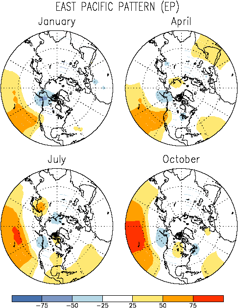
http://www.cpc.ncep.noaa.gov/data/teledoc/epmap.gif
A +QBO (west QBO) in concert with a +EPO (both of which independently favor above normal temperatures over the northern 2/3 of the US) suggest the potential for MUCH warmer than normal summertime temperatures over the northern half of the nation.
The QBO transitioned to west in FEB of this year, and will remain west through the entire summer.
2003 -1.39 -1.44 -3.30 -8.57 -13.94 -18.01 -22.99 -24.64 -22.51 -20.34 -17.86 -11.38
2004 -4.84 2.61 5.45
http://www.cdc.noaa.gov/cgi-bin/Climdiv ... reate+Plot
-- PREVIOUS WINTER TEMPS --
The winter of 2003-04 averaged slightly warmer than normal nationally, even in spite of the horrifically cold January over the northeastern half of the nation. The DEC-FEB nationally averaged temperature (based on prelim data) was 33.7F or about 0.7F above normal for the three month period according to new 1971-2000 averages.
http://climvis.ncdc.noaa.gov/cgi-bin/ca ... display.pl
Summers following a warmer than average winter (examples, 1952-53, 1953-54, 1956-57, 1957-58, 1982-83, 1986-87, 1991-92, 1994-95, 1997-98, 1998-99, 1999-00)have also shown some tendency to be warmer than normal, especially over the southeast US. Below are US averaged summer (JUN-AUG) temps in the summers following the winters listed above.
http://www.cdc.noaa.gov/cgi-bin/Climdiv ... reate+Plot
so although portions of the US (with PRIMARY emphasis on the Northeast) were colder than average this past winter, the nationally averaged temperature for the 3-month period still ended up ABOVE NORMAL. Therefore, assuming that the connection between the previous winter’s temperature and those the following summer is once again effective, one may expect warmer than average conditions over the EUS, and especially areas which last summer were cooler than normal.
-- SOLAR ACTIVITY --
High solar flux, ESPECIALLY late in the summer (AUG-Early SEP) can have a profound effect on contributing to warmer than average temperatures over the eastern/southeastern half of the nation.
http://www.cdc.noaa.gov/cgi-bin/Climdiv ... reate+Plot
Research has shown that high 10.7 CM solar flux (wave associated w/ greater brightness, solar irradiance and UV) contributes to higher than average heights over the mid latitudes and sub-tropics, due at least in part to warming as a result of various chemical reactions on ozone. Similarly, high geomagnetic activity is linked to a weakening of the Aleutian low, and the intensification of the Icelandic low, wherefore, one can assimilate that the greatest effect of high geomagnetic activity is felt in the Polar Regions because the wave its self and corresponding charged particles are directed toward the earth’s magnetic poles.
Furthermore, high solar flux can also produce a marked decrease in cloudiness, leading to the formation, intensification or spreading of drought conditions much like we saw during the late summer, fall and winter of 2001-02.
For those of you which do have access to the meteorological journals, I HIGHLY encourage you to check out some of the published research on this topic.
Since the unexpected (short term) upturn in solar activity this past OCT and NOV, solar activity has been and should continue to decrease as we trend toward the solar minimum of 2007.
http://www.cdc.noaa.gov/correlation/solar.data
http://www.sec.noaa.gov/SolarCycle/
http://www.sec.noaa.gov/ftpdir/weekly/Predict.txt
Barring any unexpected upsurges in activity between now and SEPT, Solar activity should NOT play a significant role this summer as it did in the late summer of 2001.
2003 1440 1245 1322 1263 1162 1293 1277 1221 1122 1513 1408 1150
2004 1141 1070 1120
-- VOLCANIC ASH AND AEROSOL --
Volcanic ash and aerosol loading in the atmosphere can act as a mechanism which blocks solar radiation from reaching the earth’s surface, thereby reducing temperatures globally.
There were many periods since 1950 which have seen the temperature-reducing effects of major volcanic eruptions, such as Agung in the 1960s, El Chichon and Mt. St. Helens in the 1980s, and Cerro Hudson and Mt. Pinatubo in the 1990s.
Cooler than normal lower-trophospheric temperatures were noted during ALL of the periods where the major eruptions took place.
http://www.ghcc.msfc.nasa.gov/MSU/msusci.html
Since Volcanic ash and aerosol levels remain relatively low, and will until another significant eruption occurs, solar radiation would have an easier time reaching the surface, and therefore MAY translate to warmer than average temperatures.
-- SOIL MOISTURE --
Below average soil moisture implies a drier ground, which then in turn leads to less moisture in the air, decreased cloudiness, and the expansion, development or intensification of drought conditions, warmer than normal temperatures and increased wild fire danger (association w/ lower RH and crop moisture).
http://www.cpc.noaa.gov/products/soilms ... .daily.gif
http://www.cpc.noaa.gov/products/soilms ... 0.anom.gif
Below normal; precipitation of late over the southeastern part of the country has lead to a decrease in soil moisture over much of the region recently.
Should this trend continue, we might anticipate warmer than average conditions in these areas, this summer. On the flip side however, while precipitation has been running below average over the southeast in the short term, we are not anywhere near where we were during the late 90s and into 2002 with respect to the drought.
Land falling Tropical systems will make a HUGE difference this year in the eastern and southeastern part of the country if the dry pattern persists, or in the event that la Nina conditions were to come on quickly, (however this does NOT appear likely RIGHT NOW).
SO WHAT CAN WE EXPECT? ---->
-- SOUTHEAST --
Warmer than Normal temperatures, and below normal precipitation, although land falling tropical systems which move slowly over a given area may produce significant rainfall over the course of several days, in spite of what otherwise would be a relatively dry pattern. Some minor drought development is possible if tropical moisture does not get involved.
-- NORTHEAST/MID ATLANTIC --
Normal to above normal temperatures, and near normal precipitation. This will be the battle ground this summer between what may be a very warm southeast and cooler than average plains and PAC northwest. Best potential for a significant BUST in the temp department is here. This summer will be warmer than last.
-- UPPER MIDWEST/INTERMOUNTAIN WEST --
Near normal temperatures, above normal precipitation. Some drought improvement will be possible as well.
-- SOUTHERN PLAINS/TX --
Above Normal temperatures, near normal precipitation, however along the TX gulf coast, tropical influences will be ESPECIALLY important.
-- GREAT LAKES RGN --
Normal to above normal temperatures, near normal precipitation. Area may fit into much the same category as the northeast WRT the potential for significant temperature busts. Overall however, this summer should be WARMER than last.
-- PAC NORTHWEST --
Below normal temperatures, near to somewhat above normal precipitation. This summer will be MUCH cooler than last, with some drought improvement possible.
-- SOUTHWEST --
Near Normal temperatures, near normal precipitation. SOME drought improvement is possible as well. This summer will be cooler than last.

