let's hope okc doesn't get this
Moderator: S2k Moderators
Forum rules

The posts in this forum are NOT official forecast and should not be used as such. They are just the opinion of the poster and may or may not be backed by sound meteorological data. They are NOT endorsed by any professional institution or STORM2K.
-
Guest


-
simplykristi
- S2K Supporter

- Posts: 1220
- Joined: Sat May 10, 2003 1:59 pm
- Location: Near KCMO
- Contact:
-
Guest

-
vbhoutex

- Storm2k Executive

- Posts: 29149
- Age: 74
- Joined: Wed Oct 09, 2002 11:31 pm
- Location: Cypress, TX
- Contact:
Spotters have reported tornado on the ground in N OKC heading into Edmund!!
North cam we've been watching has gone black. Metro cam still up.
both cams back up.
North cam we've been watching has gone black. Metro cam still up.
both cams back up.
Last edited by vbhoutex on Sat May 29, 2004 9:23 pm, edited 1 time in total.
0 likes
Skywarn, C.E.R.T.
Please click below to donate to STORM2K to help with the expenses of keeping the site going:

Please click below to donate to STORM2K to help with the expenses of keeping the site going:


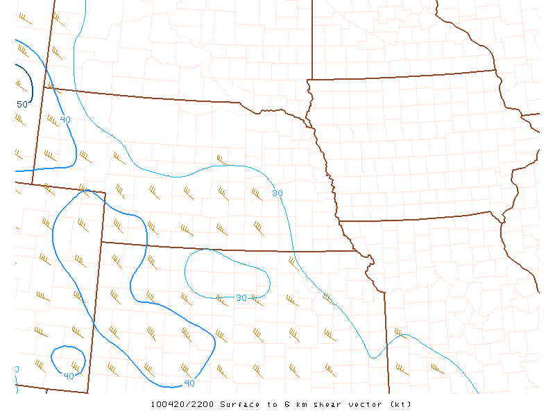
If you take a second to look at the composite radar image out of KS/OK, notice the overall lack of convection with the exception being the cell in S central KS and the other being our tornado producer threatening the OKC area.
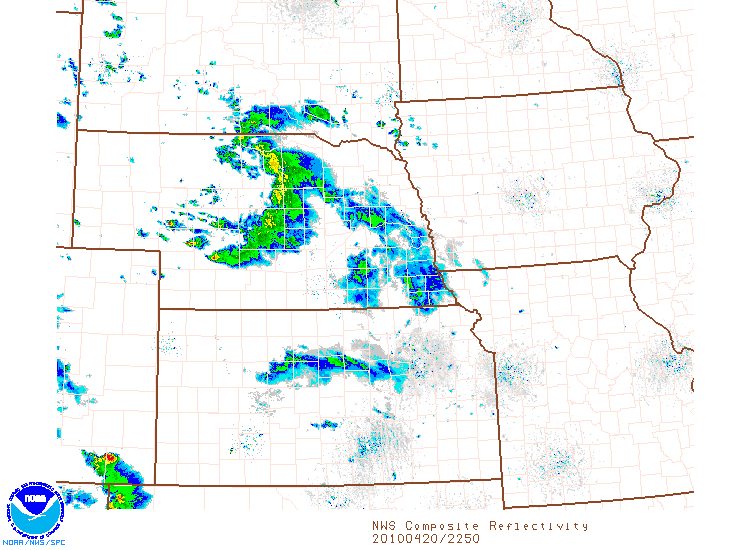
these cells are stronger and more discrete for two reasons:
1) More pronounced CAP over the region is preventing widespread convective initiation, as compared to further north where coverage is MUCH more widespread, and CAP is considerably weaker.
2) these cells are tapping the full magnitude of the available instability (NCAPEs of almost .4 over central KS, which would suggest strong parcel accelerations, and VIGOROUS convective updrafts), vertical shear and SRI (Storm-relative Inflow), thus being stronger, w/ very large Hail, and tornadoes.
Further north all of the aforementioned parameters have to be shared by the rest of the convection since there is little cap in place.
0 likes


-
simplykristi
- S2K Supporter
- Posts: 1220
- Joined: Sat May 10, 2003 1:59 pm
- Location: Near KCMO
- Contact:
-
Stormsfury

- Category 5

- Posts: 10549
- Age: 53
- Joined: Wed Feb 05, 2003 6:27 pm
- Location: Summerville, SC


Return to “USA & Caribbean Weather”
Who is online
Users browsing this forum: AnnularCane, Cpv17, cstrunk, txtwister78 and 111 guests