I just don't see that this will become a tropical cyclone...time is not on its side, and it really has a ways to go...
(unofficial) IWIC Atlantic Basin Tropical Weather Discussion - 13 June 2004 - 10:45 AM EDT
The situation in the Gulf of Mexico has become rather chaotic over the past 12 hours or so. The broad low level circulation that developed yesterday has continued to scoot off to the west-northwest closer to the northern Mexican coastline, while all of the convection has remained further east in the central Gulf of Mexico. Early visible imagery hints that this low level circulation is also becoming elognated. In order for this circulation to develop, convection will have to shift or rebuild over it. Given the recent convection trends, and the upper level low-driven dry air in the vicinity of the exposed circulation, redevelopment of convection appears highly unlikely. This low level circulation expected continue to move uneventfully to the west-northwest and dissipate with time.
This leaves us with the poorly organized mass of convection in the central Gulf of Mexico. In essence, the shape of the convection is an arc, with slow cyclonic motion noted. Convection is being inhibited to the south of the flow due to dry air being undercutted from the upper level low in the Bay of Campeche. There is no evidence whatsoever of another low level circulation within this large mass. Satellite imagery animation over the past 12 hours shows that the "arc" may be trying to bend inward on the left flank, which could lead to more of a distorted comma shape later today. The global models, including the GFS, CMC, NOGAPS, and UKMET, all develop a new, though still broad, low level circulation within this convection over the next day or so as they lose the current one off to the west. This does not seem all that unreasonable given the recent convection configuration trends already mentioned. The process will not occur right away, as the convection still has to organize into a more concentrated shape, and the low level circulation to the west has to dissipate or weaken significantly so that a new one can take over.
As a result, time is thus clearly something this disturbance needs, but does not have. A shortwave trough is still going to dig down into the northern Gulf of Mexico within the next day or so. As this occurs, upper level southerly shear will rapidly increase in the vicinity of the disturbance. Based on the average of progged times of when the shear will come into play by the global models, this system has only about 24 hours to organize, develop a new low level circulation, and become a classified tropical cyclone. Afterwards, southerly shear will blow most of the convection north and east of any low level circulation that might be present. If the system is a classified tropical cyclone when that occurs, no doubt it will not strengthen any further, and if anything will just weaken back into a disorganized disturbance.
Trackwise, the main area of convection will continue to move slowly to the northwest along the southeastern prehiphery of the subtropical ridge. After 24 hours or so, the convection, possibly with a new low level circulation, will then be steered more quickly to the north as the shortwave trough moves through. The system is expected to come ashore somewhere from Louisiana to to the western Florida Panhandle late Monday night, though the area of showers and thunderstorms will cover a large area and be displaced more to the east. So Mississippi, Alabama, Georgia, and the Florida Panhandle may end up getting the most weather from this disturbance. The main threat will be heavy rainfall. There does not appear to be time for this to organize into a tropical cyclone before it feels the impact from shear, and we expect a weak hybrid at the very most. All in all, tropical development still appears very unlikely.
Elsewhere, all is quiet.
Still not very impressed
Moderator: S2k Moderators
Forum rules

The posts in this forum are NOT official forecasts and should not be used as such. They are just the opinion of the poster and may or may not be backed by sound meteorological data. They are NOT endorsed by any professional institution or STORM2K. For official information, please refer to products from the National Hurricane Center and National Weather Service.
-
lilbump3000

- Category 4

- Posts: 966
- Age: 38
- Joined: Sat Sep 20, 2003 10:09 am
- Location: New Orleans, Louisiana
- Contact:
-
Stormcenter
- S2K Supporter

- Posts: 6687
- Joined: Wed Sep 03, 2003 11:27 am
- Location: Houston, TX
Re: Still not very impressed
Supercane wrote:I just don't see that this will become a tropical cyclone...time is not on its side, and it really has a ways to go...
(unofficial) IWIC Atlantic Basin Tropical Weather Discussion - 13 June 2004 - 10:45 AM EDT
The situation in the Gulf of Mexico has become rather chaotic over the past 12 hours or so. The broad low level circulation that developed yesterday has continued to scoot off to the west-northwest closer to the northern Mexican coastline, while all of the convection has remained further east in the central Gulf of Mexico. Early visible imagery hints that this low level circulation is also becoming elognated. In order for this circulation to develop, convection will have to shift or rebuild over it. Given the recent convection trends, and the upper level low-driven dry air in the vicinity of the exposed circulation, redevelopment of convection appears highly unlikely. This low level circulation expected continue to move uneventfully to the west-northwest and dissipate with time.
This leaves us with the poorly organized mass of convection in the central Gulf of Mexico. In essence, the shape of the convection is an arc, with slow cyclonic motion noted. Convection is being inhibited to the south of the flow due to dry air being undercutted from the upper level low in the Bay of Campeche. There is no evidence whatsoever of another low level circulation within this large mass. Satellite imagery animation over the past 12 hours shows that the "arc" may be trying to bend inward on the left flank, which could lead to more of a distorted comma shape later today. The global models, including the GFS, CMC, NOGAPS, and UKMET, all develop a new, though still broad, low level circulation within this convection over the next day or so as they lose the current one off to the west. This does not seem all that unreasonable given the recent convection configuration trends already mentioned. The process will not occur right away, as the convection still has to organize into a more concentrated shape, and the low level circulation to the west has to dissipate or weaken significantly so that a new one can take over.
As a result, time is thus clearly something this disturbance needs, but does not have. A shortwave trough is still going to dig down into the northern Gulf of Mexico within the next day or so. As this occurs, upper level southerly shear will rapidly increase in the vicinity of the disturbance. Based on the average of progged times of when the shear will come into play by the global models, this system has only about 24 hours to organize, develop a new low level circulation, and become a classified tropical cyclone. Afterwards, southerly shear will blow most of the convection north and east of any low level circulation that might be present. If the system is a classified tropical cyclone when that occurs, no doubt it will not strengthen any further, and if anything will just weaken back into a disorganized disturbance.
Trackwise, the main area of convection will continue to move slowly to the northwest along the southeastern prehiphery of the subtropical ridge. After 24 hours or so, the convection, possibly with a new low level circulation, will then be steered more quickly to the north as the shortwave trough moves through. The system is expected to come ashore somewhere from Louisiana to to the western Florida Panhandle late Monday night, though the area of showers and thunderstorms will cover a large area and be displaced more to the east. So Mississippi, Alabama, Georgia, and the Florida Panhandle may end up getting the most weather from this disturbance. The main threat will be heavy rainfall. There does not appear to be time for this to organize into a tropical cyclone before it feels the impact from shear, and we expect a weak hybrid at the very most. All in all, tropical development still appears very unlikely.
Elsewhere, all is quiet.
O.K. if you say so though I still think it will develop and the NHC must feel the potential is there if they are sending out a expensive recon. flight. These things have a way of winding up in a matter of hours so how it looks now may not necessarily be the way it looks this evening.
0 likes

-
Anonymous
lilbump3000 wrote:May somebody please point this shortwave trough out to me that is suppose to be coming down. I been hearing about it for days but havent seen one pic of it.
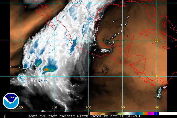
Lilbump, you can see it here clearly on this 6Z 300MB vorticity map...it's the band of high vorticity over the plains stretching from Texas to the Dakotas. This will dip southward into the northern GOM over the next day or so. Should become more visible in water vapor imagery as it becomes a little more defined.

0 likes
-
lilbump3000
- Category 4
- Posts: 966
- Age: 38
- Joined: Sat Sep 20, 2003 10:09 am
- Location: New Orleans, Louisiana
- Contact:
-
Stormsfury

- Category 5

- Posts: 10549
- Age: 53
- Joined: Wed Feb 05, 2003 6:27 pm
- Location: Summerville, SC
lilbump3000 wrote:May somebody please point this shortwave trough out to me that is suppose to be coming down. I been hearing about it for days but havent seen one pic of it.
It's going to dig down into the region ... this isn't exactly the one that I'm expecting but look along the Rio Grande Valley of TX/MX and notice the mid-level twist in the convection there ...
http://www.ssd.noaa.gov/PS/TROP/DATA/RT ... -loop.html
0 likes
-
Stormcenter
- S2K Supporter
- Posts: 6687
- Joined: Wed Sep 03, 2003 11:27 am
- Location: Houston, TX
Maybe...
lilbump3000 wrote:Then how come in the lastest tropical weather outlook there saying conditions will become more favorable for development in the next day or so.
Maybe the NHC and their million computers are wrong?
Naaaaaaaaaaaahhhhhhhhhhhhh.
0 likes
-
Dean4Storms
- S2K Supporter
- Posts: 6358
- Age: 62
- Joined: Sun Aug 31, 2003 1:01 pm
- Location: Miramar Bch. FL
Anytime you have a broad low over the tropical waters where SST's are 80+ and convection there is potential. Now, I would agree that if any closed low develops it will be hard pressed to deepen much or organize at this stage. But, I can't rule out the possibility that a weak TS could become of this before it is all over. Supercane is correct in that heavy rain with some waterspouts possibly moving onshore is the greatest threat from this system at this time. Still, this system has some potential and must be monitored.
0 likes
My opinion and statements DO NOT represent the opinion of the EMA, NHC, NWS, or any other professional agency, organization, or group. For official information, please refer to the NHC and NWS products.
-
Dean4Storms
- S2K Supporter
- Posts: 6358
- Age: 62
- Joined: Sun Aug 31, 2003 1:01 pm
- Location: Miramar Bch. FL
Here you go Lilbump (I like that),
You will see the drier air coming across TX strecthnig all the way up to Canada.
http://www.rap.ucar.edu/weather/satelli ... g&itype=wv
You will see the drier air coming across TX strecthnig all the way up to Canada.
http://www.rap.ucar.edu/weather/satelli ... g&itype=wv
0 likes
My opinion and statements DO NOT represent the opinion of the EMA, NHC, NWS, or any other professional agency, organization, or group. For official information, please refer to the NHC and NWS products.
-
Anonymous
Dean4Storms wrote:Anytime you have a broad low over the tropical waters where SST's are 80+ and convection there is potential. Now, I would agree that if any closed low develops it will be hard pressed to deepen much or organize at this stage. But, I can't rule out the possibility that a weak TS could become of this before it is all over. Supercane is correct in that heavy rain with some waterspouts possibly moving onshore is the greatest threat from this system at this time. Still, this system has some potential and must be monitored.
Agree...though with this system, the development potential we're talking about is extremely low imo. Nonetheless, nasty weather is in store for a lot of areas along the northern Gulf coast.
0 likes

-
lilbump3000
- Category 4
- Posts: 966
- Age: 38
- Joined: Sat Sep 20, 2003 10:09 am
- Location: New Orleans, Louisiana
- Contact:
-
ColdFront77
Stormsfury wrote:It's going to dig down into the region ... this isn't exactly the one that I'm expecting but look along the Rio Grande Valley of TX/MX and notice the mid-level twist in the convection there ...
http://www.ssd.noaa.gov/PS/TROP/DATA/RT ... -loop.html
We have seen disturbances in the Gulf of Mexico moving more NNE, NE and even ENE as well as E during their existence with these digging shortwave troughs.
0 likes
-
Anonymous

-
HURAKAN

- Professional-Met

- Posts: 46086
- Age: 38
- Joined: Thu May 20, 2004 4:34 pm
- Location: Key West, FL
- Contact:
You may say that the system doesn't look all that impressive, and its OK. But let me tell you something, the system has been trying very hard, going from an ULL to what we have now, a purely developed tropical superficial low. The system may not develop into something but we to give it credit for trying. I still think the story has not been fully written.
0 likes
Who is online
Users browsing this forum: No registered users and 46 guests