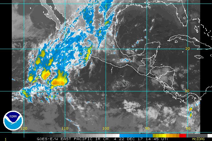
Looks like the EPAC is...
Moderator: S2k Moderators
Forum rules
The posts in this forum are NOT official forecasts and should not be used as such. They are just the opinion of the poster and may or may not be backed by sound meteorological data. They are NOT endorsed by any professional institution or STORM2K. For official information, please refer to products from the National Hurricane Center and National Weather Service.
- Typhoon_Willie
- Category 5

- Posts: 1042
- Joined: Mon Jun 09, 2003 3:19 pm
- Location: Greenacres City, Florida
Looks like the EPAC is...
increasing in convection today...Would that have anything to do with the progression of the MJO?
0 likes
-
Anonymous
-
chadtm80
-
Anonymous
Yes, the negative MJO that has helped produced all the recent typhoons is now edging into the EPAC. Models pick up on (but aren't eager to develop) the main area of convection just east of 110ºW...so if it becomes anything I doubt it'll be significant. However, the GFS, NOGAPS, and UKMET are all starting to show a more potent TC to develop south of the Gulf of Tehuantepec later in the forecast period...I'd like to see model consistency and other models jump in such as ECMWF before I get too excited about it though. In any case...I'll be rather surprised if we don't see EPAC development in the next 2 weeks given the MJO combined with the time of the year.
0 likes
Who is online
Users browsing this forum: No registered users and 39 guests


