18z GFS rolling in..
Moderator: S2k Moderators
Forum rules
The posts in this forum are NOT official forecasts and should not be used as such. They are just the opinion of the poster and may or may not be backed by sound meteorological data. They are NOT endorsed by any professional institution or STORM2K. For official information, please refer to products from the National Hurricane Center and National Weather Service.
18z GFS rolling in..
At H-144 model still depicts storm heading towards the islands...
http://www.nco.ncep.noaa.gov/pmb/nwprod ... p_144l.gif
http://www.nco.ncep.noaa.gov/pmb/nwprod ... p_144l.gif
0 likes
- hurricanetrack
- HurricaneTrack.com

- Posts: 1781
- Joined: Tue Dec 02, 2003 10:46 pm
- Location: Wilmington, NC
- Contact:
204 hours
But the weakness seems to have little affect on whatever is there at 204 hours....
http://www.nco.ncep.noaa.gov/pmb/nwpara ... 0_204s.gif
http://www.nco.ncep.noaa.gov/pmb/nwpara ... 0_204s.gif
0 likes
18z brings storm to S.Fl
18z continues the trend of bringing this system west after crossing the islands/PR and in fact like the 12z run brings the system over S Fl
http://www.nco.ncep.noaa.gov/pmb/nwprod ... p_276l.gif
http://www.nco.ncep.noaa.gov/pmb/nwprod ... p_276l.gif
0 likes
-
Anonymous
- cycloneye
- Admin

- Posts: 149505
- Age: 69
- Joined: Thu Oct 10, 2002 10:54 am
- Location: San Juan, Puerto Rico
TropicalWxWatcher wrote:This really isn't anything new. The GFS has been showing a similar track forecast for days. The only question is whether or not the wave will track across the Caribbean or head JUST north of PR into the western Atlantic.
The track depends if the wave gets into a weakness and if that is the case it will go north of the islands and more than that in terms of development that model doesn't take into account if there is SAL in the track where the wave will go thru.I would like to see more models other than the GFS jumping on it.
Last edited by cycloneye on Wed Jul 07, 2004 6:17 pm, edited 2 times in total.
0 likes
Visit the Caribbean-Central America Weather Thread where you can find at first post web cams,radars
and observations from Caribbean basin members Click Here
and observations from Caribbean basin members Click Here
- hurricanetrack
- HurricaneTrack.com

- Posts: 1781
- Joined: Tue Dec 02, 2003 10:46 pm
- Location: Wilmington, NC
- Contact:
18Z GFS and SAL
For what it's worth- the GFS that shows (agreed it's hard to believe a forecast 240+ hours out) a storm hitting the Southeast is interesting since the 2:05 TWD mentions the leading edge of the SAL moving in to the Caribbean by week's end. So- perhaps the strongest part of the SAL will be out of the picture by the time the low that the GFS spins up acutally takes shape. Others have said this too- that maybe the current tropical wave that was so exciting a day ago is the sacrificial lamb for what comes next....we'll see. Those are some low pressures over Africa.
0 likes
-
Anonymous
The off hour runs of the GFS at 6z and 18z are BEST for establishing trends. The 12z GFS run from earlier today had the same 1008mb closed low east of the Islands on 7/13 relatively in the same position. Before getting OVERLY excited here about anything, lets wait and see if we can get any continuity to develop in the data over the next few days WRT this system. After all folks this is THE GFS and eventhough it's preformance has been MUCH improved last season, it is nice to see SOME agreement among the models.
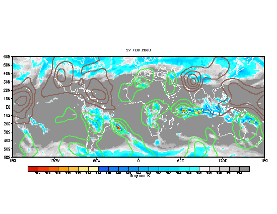
Now that the MJO pulse has reached the Atlantic basin, we MAY be able to get something going, after all it has helped in some ways to enhance activity in the WPAC not too long ago. But already, the day phase is building between 120E and the dateline, which will eventually track EWD (see below).

and to think when the MJO was first researched by Roland Madden and Paul Julian back in the 70s and the 80s, many other researchers questioned it's relevance.
Feels good to be back BTW
Now that the MJO pulse has reached the Atlantic basin, we MAY be able to get something going, after all it has helped in some ways to enhance activity in the WPAC not too long ago. But already, the day phase is building between 120E and the dateline, which will eventually track EWD (see below).

and to think when the MJO was first researched by Roland Madden and Paul Julian back in the 70s and the 80s, many other researchers questioned it's relevance.
Feels good to be back BTW
0 likes
- hurricanetrack
- HurricaneTrack.com

- Posts: 1781
- Joined: Tue Dec 02, 2003 10:46 pm
- Location: Wilmington, NC
- Contact:
What causes a SAL?
I would like to know what causes a SAL outbreak to happen? Why is it there sometimes and not others? Example: 1996 TW that begat "Bertha". Was there a SAL near that wave? What about other famous names like "Isabel" or "Hugo"? Where was the SAL then?
Thouhgts?
Thouhgts?
0 likes
- cycloneye
- Admin

- Posts: 149505
- Age: 69
- Joined: Thu Oct 10, 2002 10:54 am
- Location: San Juan, Puerto Rico
http://cimss.ssec.wisc.edu/tropic/real- ... round.html
http://cimss.ssec.wisc.edu/tropic/real- ... ginfo.html
Mark I dont know if these links I posted has the answer to your question about the SAL but here they are.
http://cimss.ssec.wisc.edu/tropic/real- ... ginfo.html
Mark I dont know if these links I posted has the answer to your question about the SAL but here they are.
0 likes
Visit the Caribbean-Central America Weather Thread where you can find at first post web cams,radars
and observations from Caribbean basin members Click Here
and observations from Caribbean basin members Click Here
Re: What causes a SAL?
hurricanetrack wrote:I would like to know what causes a SAL outbreak to happen? Why is it there sometimes and not others? Example: 1996 TW that begat "Bertha". Was there a SAL near that wave? What about other famous names like "Isabel" or "Hugo"? Where was the SAL then?
Thouhgts?
Mark, The term SAL was first coined by Atmospheric Chemist Joe prospero, and an associate of his, Toby Carlson of PSU.
SAL forms in a very dry and well-mixed environment over the Sahel region of Africa that propagates westward and eventually is undercut by an area of cool and more moist air (since cooler air is more dense it sinks) after coming off the coast. The airmass is VERY DRY and consists of Mineral dust lifted from the Surface of the desert.
WHy and How does SAL effect tropical systems? The answer is b/c SAL is associated with significant increases in VERTICAL shear in response to the development of a stronger easterly jet, temperature inversion (w/ a pronounced warm layer above the cooler air) and of course DRY AIR.
All of these things can inhibit TC development.
0 likes
-
Anonymous
18Z AVN agrees  -I know they are the same model but Here is the loop http://bricker.met.psu.edu/trop-cgi/avn ... =Animation
And looking at the loop, it would appear that the system would clip the northern islands (extrapolated)
And looking at the loop, it would appear that the system would clip the northern islands (extrapolated)
0 likes
Jekyhe32210 wrote:18Z AVN agrees-I know they are the same model but Here is the loop http://bricker.met.psu.edu/trop-cgi/avn ... =Animation
And looking at the loop, it would appear that the system would clip the northern islands (extrapolated)
The GFS was the combined product of the AVN and MRF output.
What im looking for is the canadian GGEM, UKMET, ECMWF and ensembles to jump on the bandwagon consistently.
00z GGEM from last night had NO signs of it


0 likes
0z THU canadian GGEM still says the 12z/18z WED GFS is hallucinating.


Notice ... NO closed low at 1008mb near the Islands next TUE as the GFS was suggesting. The latest ECMWF tends to agree as does the 12z 7/7 NOGAPS and 12z 7/7 JMA.
0z 7/8 GFS has not backed off and continues to show the same 1008mb low near 50W at 18z TUE


Notice ... NO closed low at 1008mb near the Islands next TUE as the GFS was suggesting. The latest ECMWF tends to agree as does the 12z 7/7 NOGAPS and 12z 7/7 JMA.
0z 7/8 GFS has not backed off and continues to show the same 1008mb low near 50W at 18z TUE

0 likes
- stormchazer
- Category 5

- Posts: 2462
- Joined: Fri Aug 29, 2003 12:00 pm
- Location: Lakeland, Florida
- Contact:
Interesting...this mornings Tropical Update on TWC mentioned that the models are jumping on the latest wave moving off Africa as developing North of PR on about the Monday time frame. We shall see....
0 likes
The posts or stuff said are NOT an official forecast and my opinion alone. Please look to the NHC and NWS for official forecasts and products.
Model Runs Cheat Sheet:
GFS (5:30 AM/PM, 11:30 AM/PM)
HWRF, GFDL, UKMET, NAVGEM (6:30-8:00 AM/PM, 12:30-2:00 AM/PM)
ECMWF (1:45 AM/PM)
TCVN is a weighted averaged
Opinions my own.
Model Runs Cheat Sheet:
GFS (5:30 AM/PM, 11:30 AM/PM)
HWRF, GFDL, UKMET, NAVGEM (6:30-8:00 AM/PM, 12:30-2:00 AM/PM)
ECMWF (1:45 AM/PM)
TCVN is a weighted averaged
Opinions my own.
Well this comes as little shock to ME at least. 12z 7/8 GFS BACKS OFF on the disturbance east of the Islands on TUE and back into closer agreement w/ the rest of the data from yesterday.


Notice NO closed low is evident anymore at any level, however the disturbance is by no means GONE. now that said ... The 06z run STILL heald the closed low at the SFC

This COULD be the start of a trend in the GFS taking it into better agreement w/ the 0z GGEM and others from Yesterday or it may just be the GFS waffle magic at work again, meaning that the 18z run should back up to what the previous 12z/18z/0z and 06z runs were indicating from yesterday and the overnight. We shall see.


Notice NO closed low is evident anymore at any level, however the disturbance is by no means GONE. now that said ... The 06z run STILL heald the closed low at the SFC

This COULD be the start of a trend in the GFS taking it into better agreement w/ the 0z GGEM and others from Yesterday or it may just be the GFS waffle magic at work again, meaning that the 18z run should back up to what the previous 12z/18z/0z and 06z runs were indicating from yesterday and the overnight. We shall see.
0 likes
Who is online
Users browsing this forum: Ulf and 203 guests


