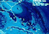
ANOTHER scenario....
Moderator: S2k Moderators
Forum rules
The posts in this forum are NOT official forecasts and should not be used as such. They are just the opinion of the poster and may or may not be backed by sound meteorological data. They are NOT endorsed by any professional institution or STORM2K. For official information, please refer to products from the National Hurricane Center and National Weather Service.
- charleston_hugo_veteran
- S2K Supporter

- Posts: 1590
- Joined: Thu Sep 04, 2003 12:47 pm
- Location: Charleston, S.C.
ANOTHER scenario....
0 likes
-
PurdueWx80
- Professional-Met

- Posts: 2720
- Joined: Fri Aug 13, 2004 8:33 pm
- Location: Madison, WI
- Contact:
- charleston_hugo_veteran
- S2K Supporter

- Posts: 1590
- Joined: Thu Sep 04, 2003 12:47 pm
- Location: Charleston, S.C.
I can never make sense out of this type of map. It takes me a long time just to find the outline of the U.S.!
So, Hugo Vet, are you at all worried it will hit up here? It looks like FL for sure to me. I'm not the least bit concerned right now although earlier a couple of the models, the ones with lines, lol, showed a straight N shot towards us.
So, Hugo Vet, are you at all worried it will hit up here? It looks like FL for sure to me. I'm not the least bit concerned right now although earlier a couple of the models, the ones with lines, lol, showed a straight N shot towards us.
0 likes
-
PurdueWx80
- Professional-Met

- Posts: 2720
- Joined: Fri Aug 13, 2004 8:33 pm
- Location: Madison, WI
- Contact:
- charleston_hugo_veteran
- S2K Supporter

- Posts: 1590
- Joined: Thu Sep 04, 2003 12:47 pm
- Location: Charleston, S.C.
krisj wrote:I can never make sense out of this type of map. It takes me a long time just to find the outline of the U.S.!
So, Hugo Vet, are you at all worried it will hit up here? It looks like FL for sure to me. I'm not the least bit concerned right now although earlier a couple of the models, the ones with lines, lol, showed a straight N shot towards us.
not sure about here....it is looking better for us!
0 likes
Re: ANOTHER scenario....
charleston_hugo_veteran wrote:http://www.nco.ncep.noaa.gov/pmb/nwprod/analysis/carib/gfs/18/index_ten_m_loop.shtml
that was the operational GFS 18z run from yesterday, and it's scenario regarding ivan is suspicious to say the least. it looks even more extreme than the 0z ECMWF.
of the 12z tropical models, the BAM Medium is the FURTHEST east with Ivan, and even that is WEST of the 0z ECMWF and 18z 9/7 GFS tracks.
http://www.sfwmd.gov/org/omd/ops/weathe ... orm_09.gif
Plus one also has to consider the location of Ivan (which is at a VERY LOW Latitude). a SHARP turn to the NW and eventually NNW would have to take place in order for that run of the GFS to pan out.
0 likes
Who is online
Users browsing this forum: No registered users and 110 guests


