Houston Mets getting a little concerned
Moderator: S2k Moderators
Forum rules

The posts in this forum are NOT official forecasts and should not be used as such. They are just the opinion of the poster and may or may not be backed by sound meteorological data. They are NOT endorsed by any professional institution or STORM2K. For official information, please refer to products from the National Hurricane Center and National Weather Service.
-
HouTXmetro

- Category 5

- Posts: 3949
- Joined: Sun Jun 13, 2004 6:00 pm
- Location: District of Columbia, USA
Houston Mets getting a little concerned
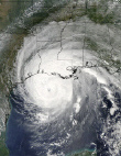
Although it's a slim chance Ivan will head this way, the Houston mets are finally taking Ivan more seriously as the Cone keeps slowy shifting west. Just a few days ago most of the major stations were very confident Ivan wouldn't affect us. Tonight it's a slightly different story. One of the Mets said the next Trough won't be strong enough to pick up IVAN so we will have to watch very carefully for the definative North turn.
0 likes
[Disclaimer: My Amateur Opinion, please defer to your local authorities or the NHC for Guidance.]
-
crazycajuncane

- S2K Supporter

- Posts: 1097
- Joined: Sun Aug 15, 2004 2:51 pm
- Location: Lafayette, Louisiana
- Contact:
-
dennis1x1
-
HouTXmetro
- Category 5
- Posts: 3949
- Joined: Sun Jun 13, 2004 6:00 pm
- Location: District of Columbia, USA
Well if this current Trough doesn't complety pull Ivan with it we have every reason to be concerned. The second Trough does appear to far north to pull Ivan so alot can happen. And usually the Houston mets will wait till the storm is knocking on our door before the raise a concern. So thats why I was suprised they are telling us to watch Ivan carefully for the definative north turn.
0 likes
[Disclaimer: My Amateur Opinion, please defer to your local authorities or the NHC for Guidance.]
-
dennis1x1
well "the turn" that keeps houston out of this discussion has already happened some time ago now.....and i just havent seen anything remotely suggesting that anything would come along and weaken the ridge to the west of the storm to allow a westward movement into houston...
oh well...it is the media...
oh well...it is the media...
0 likes
I'm watching!
Although I see Ivan visiting the Dauphin Island, Alabama area, we on the Texas/Louisiana coastal border have our eyes wide open. This Ivan is a weird dude! Seems to have a mind of his own. Meanwhile, we need all of you folks in "the cone" to head north and hunker down. Take care of yourselves. 
0 likes
-
Anonymous
Looks like Tampa is concerned too
WEST CENTRAL AND SOUTHWEST FLORIDA FORECAST DISCUSSION
NATIONAL WEATHER SERVICE TAMPA BAY AREA - RUSKIN FL
900 PM EDT MON SEP 13 2004
.DISCUSSION...WATER VAPOR AND RUC SHOW SHORT WAVE TROUGH MOVING
THROUGH THE GULF COAST WITH A RIDGE OVER AND EAST OF FL. AT THE
SURFACE A RIDGE EXTENDS ALONG THE EASTERN SEA BOARD FROM EASTERN
CANADA WITH HURRICANE IVAN OFF THE WEST END OF CUBA. ALL RESIDENTS
ARE ADVISED TO MONITOR THE PROGRESS OF THIS STORM. THE AFTERNOON
CONVECTION HAS ALL DIED OFF OR MOVED NORTH. HOWEVER SOME BANDS OF
RAIN AND SHOWERS ACROSS THE KEYS AND SOUTH FL ARE LIFTING NORTH
AND WOULD EXPECT SOME PCPN ACROSS THE CWFA THROUGH OUT THE NIGHT
AND WILL KEEP ISOLATED POPS IN BUT DROP THE TSTMS. 00Z RAOB SUPPORTS
10 OR 10-15 MPH AND MINS IN THE MID 70S LOOK GOOD...SO WILL MAKE NO
OTHER CHANGES FOR TONIGHT'S PUBLIC ZONES.
&&
.MARINE...BUOY DATA SHOWERS COASTAL WATERS ON TRACK WITH SCA ON THE
SOUTHERN OFFSHORE AREA WITH SCEC FOR NEAR SHORE SOUTH AND ALSO THE
NORTHERN WATERS. THE FORECAST WILL BE ISSUED BY 1020 PM WITH LITTLE
CHANGE. MARINERS SHOULD STAY UP TO DATE ON THE LATEST FORECASTS
FROM THE NHC FOR HURRICANE IVAN AS IT MOVES INTO THE GULF.
0 likes
-
southerngale

- Retired Staff

- Posts: 27418
- Joined: Thu Oct 10, 2002 1:27 am
- Location: Southeast Texas (Beaumont area)
Who is online
Users browsing this forum: gib and 97 guests