JOG..................
Moderator: S2k Moderators
Forum rules

The posts in this forum are NOT official forecasts and should not be used as such. They are just the opinion of the poster and may or may not be backed by sound meteorological data. They are NOT endorsed by any professional institution or STORM2K. For official information, please refer to products from the National Hurricane Center and National Weather Service.
-
Foladar
-
caneman
Hyperstorm wrote:logybogy wrote:Hyperstorm, look at the radar.
It's moving due west. I don't know how many times I can say it.
I guess people will want to see what they want to see.
The eye is clearly moving 270, any apparent north job is because of the elliptical nature of the eye. As it rotates again, it'll appear to jog south and someone will surely start another WSW jog thread!
No. The hurricane is starting to have a northward component.
Watch and wait...
Looks like it could have just been a land interaction wobble. Last frame looks back WEst. At most it is WNW.
0 likes
good work Colin.....
Whether a jog or more of a N component, JEANNE is now further north than where she was forecast to be. NHC as of 11AM had her at 27.0 N at 11PM tonight. She will be north of that by then it seems. Stay safe in Melbourne and north.
0 likes
-
Hyperstorm

- Category 5

- Posts: 1500
- Joined: Sun Sep 07, 2003 3:48 am
- Location: Ocala, FL
caneman wrote:Hyperstorm wrote:logybogy wrote:Hyperstorm, look at the radar.
It's moving due west. I don't know how many times I can say it.
I guess people will want to see what they want to see.
The eye is clearly moving 270, any apparent north job is because of the elliptical nature of the eye. As it rotates again, it'll appear to jog south and someone will surely start another WSW jog thread!
No. The hurricane is starting to have a northward component.
Watch and wait...
Looks like it could have just been a land interaction wobble. Last frame looks back WEst. At most it is WNW.
Oh sure. This is not a NW or NNW motion at all. It is a start of WNW track that could mean some changes in the track at later times since it was not forecasted to have this northward component to the motion until just before landfall...
0 likes
-
VERMONTsnow
- Tropical Depression

- Posts: 51
- Joined: Mon Sep 13, 2004 8:59 am
-
Hyperstorm
- Category 5
- Posts: 1500
- Joined: Sun Sep 07, 2003 3:48 am
- Location: Ocala, FL
Just to give you a perspective...
Take a look at this IR loop:
http://www.ssd.noaa.gov/PS/TROP/DATA/RT ... -loop.html
Tell me what you see...
You will see that at the start of the loop the hurricane's eye was heading straight toward the island of Freeport in the extreme NW Bahamas. Well, what happened? The hurricane's eye is now just NORTH of that island.
Therefore, you can see for yourself that the hurricane has traveled slightly north of due west...and it should continue.
Last edited by Hyperstorm on Sat Sep 25, 2004 11:46 am, edited 1 time in total.
0 likes
-
Anonymous
Hyperstorm wrote:The motion you see is a start of a WNW track that if it continues (as I expect) will take the center north of West Palm Beach.
People, this was LONG advertised by the models and is now coming to fruition. I know the westward heading it has had is tempting...but the hurricane WILL turn WNW eventually...and it looks like this is the start of it...
Now thats a astounding fact that it will turn WNW then what maybe N with time?? I think someone told me this is called the Coriolis effect . Didn't need anyone to predict a storm moving northward away from the equator would move north as it gains latitude on the earth, just not a stunning prediction.
0 likes
not a met
not a radar expert
CAN read a map.
eye over my house.
eye now 60 miles north of my house and to the west.
eye no longer west but north.
sorry, but they haven't moved little abaco since this am and it is over little abaco according to miami radar.
easy to tell because no rain over little abaco which is way far north of marsh harbour where the eye was.
you cannot get from marsh harbour to little abaco by going WEST.
definitely some northern compent now.
may not last, but the stationary pieces of rock don't lie.
0 likes
logybogy wrote:Hyperstorm, look at the radar.
It's moving due west. I don't know how many times I can say it.
I guess people will want to see what they want to see.
The eye is clearly moving 270, any apparent north job is because of the elliptical nature of the eye. As it rotates again, it'll appear to jog south and someone will surely start another WSW jog thread!
Yes, those incompetent fools in the AF Recon aircraft inside the storm are just seeing what they want to see; (26 degrees 35 minutes N at 1429Z, 26 degrees 46 minutes N at 16:06Z)...how dare they conflict with some random unqualifed person staring at a radar loop on their computer!
0 likes
-
Hyperstorm
- Category 5
- Posts: 1500
- Joined: Sun Sep 07, 2003 3:48 am
- Location: Ocala, FL
MPH101 wrote:Hyperstorm wrote:The motion you see is a start of a WNW track that if it continues (as I expect) will take the center north of West Palm Beach.
People, this was LONG advertised by the models and is now coming to fruition. I know the westward heading it has had is tempting...but the hurricane WILL turn WNW eventually...and it looks like this is the start of it...
Now thats a astounding fact that it will turn WNW then what maybe N with time?? I think someone told me this is called the Coriolis effect . Didn't need anyone to predict a storm moving northward away from the equator would move north as it gains latitude on the earth, just not a stunning prediction.
Some people are still unable to understand that fact, unfortunately...
0 likes


-
VERMONTsnow
- Tropical Depression
- Posts: 51
- Joined: Mon Sep 13, 2004 8:59 am
-
HurryKane

- Category 5
- Posts: 1941
- Joined: Sun Sep 12, 2004 8:08 pm
- Location: Diamondhead, Mississippi
Kevin_Cho wrote:Jevo wrote:Bottom line is this storm needs to move 292 right now to make forecast landfall location.
Bottom line
What does the 292 mean? I'm still fairly amatuer...
Hi Kevin, it means it is traveling on a heading of 292 degrees on the N/E/S/W circle. N = 0 or 360 degrees, E = 90 degrees, S = 180 degrees, W = 270 degrees:
 and
and 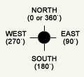
292 degrees means it is in the W by N or WNW area in movement.
0 likes

I love MR vermont a troll who since last night has been doom and gloom.This is the only board i know that has a fit if someone sees something that would not cause great damage.
It may be a wobble as they do all the time but it do move north.I wish i could understand some people who at times act like they are wishing this to come across the state.
It my but gezz give the people some hope guys.
If they want to ban my account that is fine but i have never seen a bunch of guys argue over a wobble and fight about it.Why not pray and hope lives are spared and this does go north but if God wants it to go west then it will but other then that right now it has moved some north so gezz give the people some hope rahter then the doom gloom thing.
0 likes


Just in from NHC at 1pm
AT 1 PM EDT...1700Z...THE EYE OF HURRICANE JEANNE WAS LOCATED
NEAR LATITUDE 26.8 NORTH...LONGITUDE 77.9 WEST ABOUT 35 MILES...50
KM...NORTHEAST OF FREEPORT GRAND BAHAMA ISLAND. THIS POSITION IS
ALSO ABOUT 135 MILES...215 KM...EAST OF THE SOUTHEASTERN COAST OF
FLORIDA.
JEANNE IS NOW MOVING A LITTLE NORTH OF DUE WEST NEAR 14 MPH...22
KM/HR. ON THIS TRACK...THE CORE OF JEANNE WILL CONTINUE NEAR OR
OVER THE REMAINDER OF THE NORTHWESTERN BAHAMAS TODAY...AND APPROACH
THE SOUTHEASTERN COAST OF FLORIDA TONIGHT OR EARLY SUNDAY.
0 likes

