THE STORM PREDICTION CENTER HAS ISSUED A SEVERE THUNDERSTORM WATCH UNTIL 4:00PM CDT
Sel2
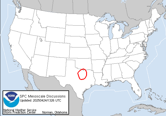
spc Ww 071505 2100 -
Urgent - Immediate Broadcast Requested Severe Thunderstorm Watch Number 112 Storm Prediction Center Norman Ok 1005 AM CDT Mon Apr 7 2003
The Storm Prediction Center Has Issued A Severe Thunderstorm Watch For Portions Of
Southern Louisiana Southern Mississippi Southeast Texas Coastal Waters
Effective This Monday Morning And Afternoon From 1005 AM Until 400 PM CDT.
Hail To 2 Inches In Diameter... Thunderstorm Wind Gusts To 70 Mph... And Dangerous Lightning Are Possible In These Areas.
The Severe Thunderstorm Watch Area Is Along And 65 Statute Miles North And South Of A Line From 25 Miles West Northwest Of Galveston Texas To 50 Miles Northeast Of Gulfport Mississippi.
Remember... A Severe Thunderstorm Watch Means Conditions Are Favorable For Severe Thunderstorms In And Close To The Watch Area. Persons In These Areas Should Be On The Lookout For Threatening Weather Conditions And Listen For Later Statements And Possible Warnings. Severe Thunderstorms Can And Occasionally Do Produce Tornadoes.
Other Watch Information... Continue... Ww 111...
Discussion... Scattered Strong/Severe Thunderstorms Are Increasing Off The LA Coast... And Over Parts Of Southeast LA/Southern MS. Steep Mid Level Lapse Rates And Moderate Instability Suggest The Potential For Large Hail And Damaging Winds In Stronger Cells.
Aviation... A Few Severe Thunderstorms With Hail Surface And Aloft To 2 Inches. Extreme Turbulence And Surface Wind Gusts To 60 Knots. A Few Cumulonimbi With Maximum Tops To 500. Mean Storm Motion Vector 26030.
... Hart
Severe Weather Possible in SE Tx/La/Ms
Moderator: S2k Moderators
Forum rules

The posts in this forum are NOT official forecast and should not be used as such. They are just the opinion of the poster and may or may not be backed by sound meteorological data. They are NOT endorsed by any professional institution or STORM2K.
-
southerngale

- Retired Staff

- Posts: 27418
- Joined: Thu Oct 10, 2002 1:27 am
- Location: Southeast Texas (Beaumont area)
Severe Weather Possible in SE Tx/La/Ms
0 likes
Please support Storm2k by making a donation today. It is greatly appreciated! Click here: 
 my Cowboys my Rockets my Astros
my Cowboys my Rockets my Astros-
southerngale
- Retired Staff
- Posts: 27418
- Joined: Thu Oct 10, 2002 1:27 am
- Location: Southeast Texas (Beaumont area)


-
southerngale
- Retired Staff
- Posts: 27418
- Joined: Thu Oct 10, 2002 1:27 am
- Location: Southeast Texas (Beaumont area)
-
vbhoutex

- Storm2k Executive

- Posts: 29141
- Age: 74
- Joined: Wed Oct 09, 2002 11:31 pm
- Location: Cypress, TX
- Contact:
The latest out of Houston/Galveston NWS:
SEVERE WEATHER STATEMENT
NATIONAL WEATHER SERVICE HOUSTON/GALVESTON TX
251 PM CDT MON APR 7 2003
...A SEVERE THUNDERSTORM WARNING CONTINUES FOR HARRIS AND FORT BEND
COUNTIES UNTIL 330 PM CDT...
AT 247 PM CDT DOPPLER RADAR INDICATED A SEVERE THUNDERSTORM IN
RICHMOND AND ROSENBERG...MOVING NORTHEAST AT 25 MPH.
LOCATIONS IN THE PATH OF THE SEVERE THUNDERSTORM INCLUDE
ROSENBERG...RICHMOND...PECAN GROVE...MISSION BEND...ADDICKS...AND
SPRING VALLEY.
AT 240 PM 3/4 INCH HAIL WAS REPORTED NEAR BEASLEY.
THIS STORM CAN PRODUCE LARGE DAMAGING HAIL...RESULTING IN EXTENSIVE
PROPERTY DAMAGE OR SERIOUS INJURY. AVOID WINDOWS AND TAKE COVER NOW!
DRIVERS MAY ENCOUNTER DAMAGING HAIL...STRONG WINDS AND BLINDING RAIN.
PULL OVER TO A STRONG SHELTER NOW. BRIDGES AND OVERPASSES ARE NOT
SAFE!
PLEASE REPORT SEVERE WEATHER TO THE COUNTY SHERIFF...LOCAL POLICE...
OR DEPARTMENT OF PUBLIC SAFETY. THEY WILL RELAY YOUR REPORT TO THE
NATIONAL WEATHER SERVICE.
A TORNADO WATCH REMAINS IN EFFECT UNTIL 6 PM.
TEXAS AREAL OUTLINE FOR SEVERE THUNDERSTORM WATCH NUMBER 113
NATIONAL WEATHER SERVICE FORT WORTH TX
ISSUED BY NATIONAL WEATHER SERVICE SHREVEPORT LA
111 PM CDT MON APR 7 2003
THIS SEVERE THUNDERSTORM WATCH IS IN EFFECT UNTIL 600 PM CDT AND
INCLUDES 34 COUNTIES IN THE FOLLOWING PARTS OF TEXAS...
IN TEXAS...THIS SEVERE THUNDERSTORM WATCH INCLUDES THE FOLLOWING
COUNTIES...
TXC015-039-089-157-185-201-239-321-339-373-407-473-477-481-072300-
IN SOUTHEAST TEXAS THIS WATCH INCLUDES...
POLK SAN JACINTO GRIMES MONTGOMERY
WASHINGTON WALLER HARRIS AUSTIN
COLORADO FORT BEND WHARTON JACKSON
BRAZORIA MATAGORDA
GMZ330-335-TXZ163-164-176>179-195>200-210>214-226-227-235>238-081200-
HAZARDOUS WEATHER OUTLOOK
NATIONAL WEATHER SERVICE HOUSTON/GALVESTON TX
935 AM CDT MON APR 7 2003
THIS HAZARDOUS WEATHER OUTLOOK IS FOR SOUTHEAST TEXAS.
...SEVERE THUNDERSTORMS POSSIBLE LATE THIS AFTERNOON AND THIS
EVENING OVER SOUTHEAST TEXAS...
.DAY ONE...THIS AFTERNOON AND TONIGHT.
A SLOW MOVING COLD FRONT WILL COMBINE WITH VERY MOIST AIR TO HELP
DEVELOP SCATTERED SHOWERS AND THUNDERSTORMS THIS AFTERNOON AND
TONIGHT. THE COLD FRONT IS EXPECTED TO REACH THE COAST BETWEEN 3 AND 6
AM. ISOLATED THUNDERSTORMS ARE LIKELY THIS AFTERNOON...AND STRONG TO
SEVERE THUNDERSTORMS ARE POSSIBLE LATER TONIGHT. IT APPEARS THE
GREATEST THREAT WILL BE FROM HAIL AND STRONG WINDS IN CENTRAL AND
SOUTHERN PARTS OF THE AREA. ISOLATED RAINFALL AMOUNTS OF AROUND 1 INCH
MAY ACCOMPANY THE STORMS AS WELL.
SPOTTER ACTIVATION MAY BE NEEDED LATER TONIGHT.
.DAYS TWO THROUGH SEVEN...TUESDAY THROUGH SUNDAY.
BREEZY TO WINDY CONDITIONS EXPECTED TUESDAY AND WEDNESDAY. WIND
ADVISORIES MAY BE NEEDED. NORTH WINDS BEHIND THE COLD FRONT WILL
STRENGTHEN QUICKLY TUESDAY MORNING. SUSTAINED WINDS OF 25 MPH WITH
HIGHER GUSTS ARE LIKELY THROUGH WEDNESDAY.
.SPOTTER INFORMATION STATEMENT...
SPOTTER ACTIVATION IS NOT ANTICIPATED.
And the current radar image from Intellicast-
http://www.intellicast.com/Local/USLocalWide.asp?loc=kiah&seg=LocalWeather&prodgrp=RadarImagery&product=MetroRadar&prodnav=none&pid=none
0 likes
Skywarn, C.E.R.T.
Please click below to donate to STORM2K to help with the expenses of keeping the site going:
Please click below to donate to STORM2K to help with the expenses of keeping the site going:
-
vbhoutex
- Storm2k Executive
- Posts: 29141
- Age: 74
- Joined: Wed Oct 09, 2002 11:31 pm
- Location: Cypress, TX
- Contact:
Here is the latest intellicast metro radar on it. I'm just N of the red part!
http://www.intellicast.com/Local/USLoca ... e&pid=none
And it is calm here right now!!????
Well, it changed direction a little more to the east and went just s of me. People about 8 miles s of me are probably getting slammed right now!
Latest image- http://www.intellicast.com/Local/USLoca ... e&pid=none
0 likes
Skywarn, C.E.R.T.
Please click below to donate to STORM2K to help with the expenses of keeping the site going:
Please click below to donate to STORM2K to help with the expenses of keeping the site going:
-
southerngale
- Retired Staff
- Posts: 27418
- Joined: Thu Oct 10, 2002 1:27 am
- Location: Southeast Texas (Beaumont area)
-
Guest

-
vbhoutex
- Storm2k Executive
- Posts: 29141
- Age: 74
- Joined: Wed Oct 09, 2002 11:31 pm
- Location: Cypress, TX
- Contact:
Everything passed south of me this afternoon. Areas to my south got dime sized hail. We only picked up about .2" of rain.
I don't like the radar west of SA though. that all has to come this way. Hopefully it will disapate before we get it or it will pass by us.
Everyone else stay safe!!
I don't like the radar west of SA though. that all has to come this way. Hopefully it will disapate before we get it or it will pass by us.
Everyone else stay safe!!
0 likes
Skywarn, C.E.R.T.
Please click below to donate to STORM2K to help with the expenses of keeping the site going:
Please click below to donate to STORM2K to help with the expenses of keeping the site going:
Return to “USA & Caribbean Weather”
Who is online
Users browsing this forum: No registered users and 63 guests