Storm off of Bermuda
Moderator: S2k Moderators
Forum rules

The posts in this forum are NOT official forecasts and should not be used as such. They are just the opinion of the poster and may or may not be backed by sound meteorological data. They are NOT endorsed by any professional institution or STORM2K. For official information, please refer to products from the National Hurricane Center and National Weather Service.
-
HalloweenGale

- Category 1

- Posts: 377
- Joined: Sun Aug 01, 2004 7:31 pm
- Location: Nantucket Ma
- Contact:
Storm off of Bermuda
could explosively deepen into a baroclinic storm.... will keep my eyes on this.
0 likes
-
HalloweenGale
- Category 1
- Posts: 377
- Joined: Sun Aug 01, 2004 7:31 pm
- Location: Nantucket Ma
- Contact:
-
HalloweenGale
- Category 1
- Posts: 377
- Joined: Sun Aug 01, 2004 7:31 pm
- Location: Nantucket Ma
- Contact:
STORM WARNING
...N WALL OF THE GULF STREAM NEAR 37N 71.4W...37.7N 70.8W...
38.2N 68.8W...38.1N 67.6W...37.7N 67.2W...
THIS AFTERNOON
E OF 1000 FMS...NE WINDS 25 TO 35 KT...EXCEPT
TO 45 KT IN THE GULF STREAM. SEAS 13 TO 18 FT...EXCEPT BUILDING
TO 24 FT IN THE GULF STREAM. SCATTERED SHOWERS. W OF 1000
FMS...NE WINDS 20 TO 25 KT. SEAS 9 TO 13 FT...HIGHEST SE.
TONIGHT
E OF 1000 FMS...NE WINDS INCREASING TO 30 TO 40 KT...
EXCEPT TO 50 KT OVER THE GULF STREAM. SEAS 14 TO 20 FT...EXCEPT
TO 28 FT IN THE GULF STREAM. SCATTERED SHOWERS. W OF 1000 FMS...
NE WINDS 20 TO 30 KT. SEAS 10 TO 14 FT...HIGHEST SE.
SAT
E OF 71W...N TO NE WINDS 30 TO 40 KT...EXCEPT TO 50 KT
OVER E PORTION AND NEAR THE GULF STREAM. SEAS 18 TO 23 FT...
EXCEPT TO 30 FT OVER E PORTION AND NEAR THE GULF STREAM.
SCATTERED SHOWERS. W OF 71W...N TO NE WINDS 20 TO 30 KT. SEAS 10
TO 14 FT...EXCEPT TO 18 FT E OF 1000 FMS.
SAT NIGHT
E OF 71W...N TO NE WINDS 30 TO 40 KT...EXCEPT TO 50
KT NEAR THE GULF STREAM. SEAS 20 TO 24 FT...EXCEPT TO 30 FT NEAR
THE GULF STREAM. SCATTERED SHOWERS. W OF 71W...NE WINDS 20 TO 30
KT...EXCEPT DECREASING TO 10 TO 20 KT W OF 1000 FMS LATE. SEAS
10 TO 15 FT... EXCEPT TO 20 FT E OF 1000 FMS.
0 likes
-
HalloweenGale
- Category 1
- Posts: 377
- Joined: Sun Aug 01, 2004 7:31 pm
- Location: Nantucket Ma
- Contact:
-
cycloneye

- Admin

- Posts: 148849
- Age: 69
- Joined: Thu Oct 10, 2002 10:54 am
- Location: San Juan, Puerto Rico
HalloweenGale wrote:i wonder if i could get a sattelite image of this system
http://weather.msfc.nasa.gov/GOES/goeseasthurrir.html
You got it at link above.Move your mouse to where the system is and press there and you will see a closeup pic of it.I dont see this turning subtropical.
0 likes
Here's a couple of interesting maps.
http://coolwx.com/buoydata/data/t-01/at ... alysis.png
http://coolwx.com/buoydata/data/t-01/at ... alysis.png
Storm looks to be at about 35N X67W
http://coolwx.com/buoydata/data/t-01/at ... alysis.png
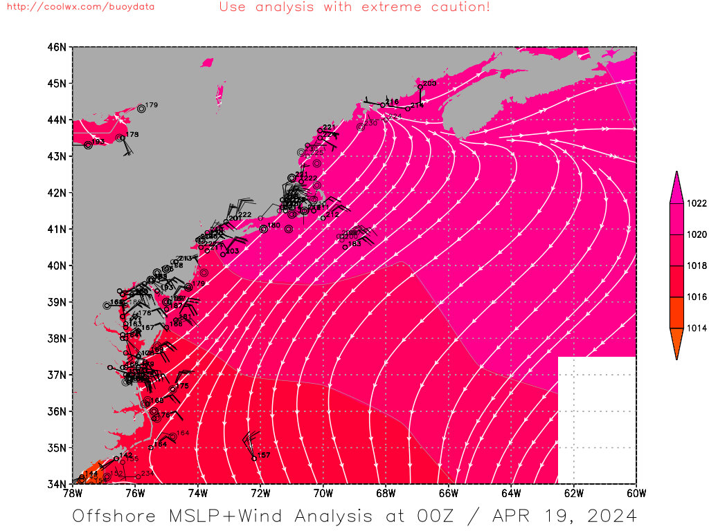
http://coolwx.com/buoydata/data/t-01/at ... alysis.png
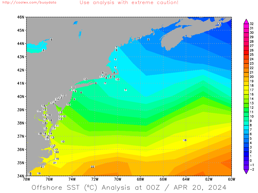
Storm looks to be at about 35N X67W
0 likes
-
HalloweenGale
- Category 1
- Posts: 377
- Joined: Sun Aug 01, 2004 7:31 pm
- Location: Nantucket Ma
- Contact:
cycloneye wrote:HalloweenGale wrote:i wonder if i could get a sattelite image of this system
http://weather.msfc.nasa.gov/GOES/goeseasthurrir.html
You got it at link above.Move your mouse to where the system is and press there and you will see a closeup pic of it.I dont see this turning subtropical.
May have a chance as the trajectory is now SE away from cold water.
0 likes
Who is online
Users browsing this forum: No registered users and 55 guests