Mod Severe Risk, S.IN, S.OH, N.KY, S.IL! Tornadoes!

U.S. & Caribbean Weather Discussions and Severe Weather Events

Moderator: S2k Moderators

Forum rules

The posts in this forum are NOT official forecast and should not be used as such. They are just the opinion of the poster and may or may not be backed by sound meteorological data. They are NOT endorsed by any professional institution or STORM2K.

Help Support Storm2K
Message
Author
Guest

Mod Severe Risk, S.IN, S.OH, N.KY, S.IL! Tornadoes!

#1 Postby Guest » Wed Nov 24, 2004 4:10 am

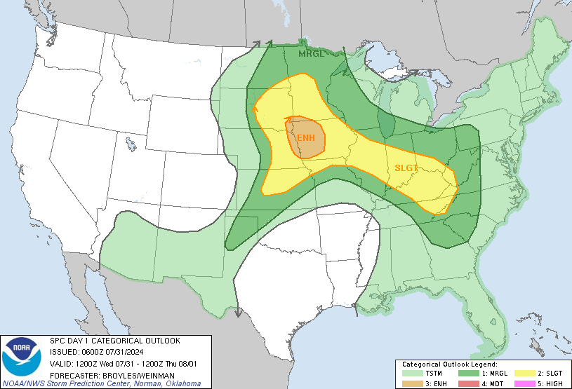
Heads up Ohio Valley for today! Things are looking grim there especially for holiday travelers!
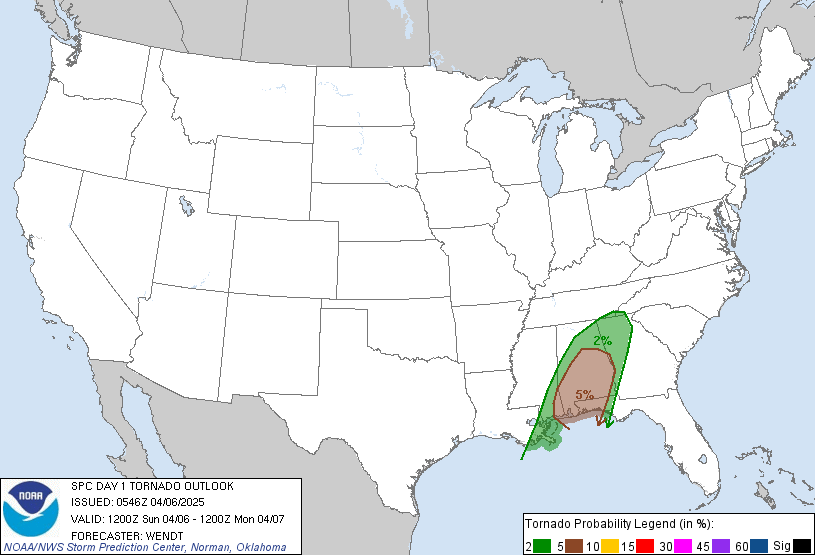
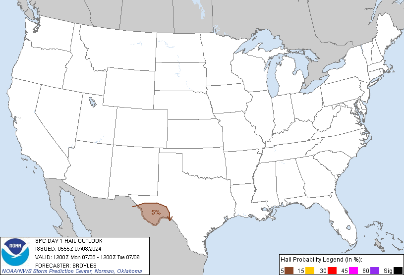
SPC has placed a good chunk of the region under a moderate risk for severe weather today! Main threats look to be Tornadoes, and Large Hail!
Image


Tornado Threat!
Image

Large Hail threat!
Image

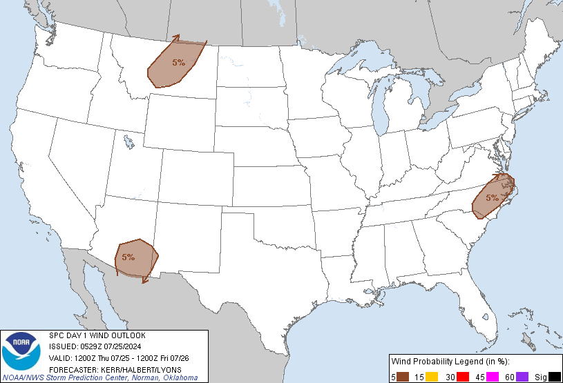
Damaging winds threat!
Image


SPC Discussion!
...SYNOPSIS...
POWERFUL UPPER TROUGH LOCATED OVER NRN TX LATE TONIGHT WILL RACE
NEWD ACROSS THE MIDDLE MS VALLEY THROUGH WEDNESDAY AFTERNOON...AND
THEN ACROSS THE OH VALLEY THROUGH EARLY THANKSGIVING DAY. IN
RESPONSE TO VERY INTENSE DYNAMIC FORCING FOR ASCENT WITHIN LEFT EXIT
REGION OF 90-100KT MID LEVEL JET...DEEPENING SURFACE CYCLONE WILL
DEVELOP RAPIDLY NEWD FROM THE MO BOOTHEEL TO SRN QUEBEC DURING THIS
FORECAST PERIOD. WARM/MOIST AIR MASS PRECEEDING A STRONG COLD FRONT
AND INTENSIFYING SURFACE LOW WILL BE CHANNELED RAPIDLY NORTH TO THE
OH VALLEY THROUGH THIS AFTERNOON AIDED BY LOW LEVEL SLY FLOW OF
50-60KT. PREFRONTAL SQUALL LINE SHOULD CONTINUE TO CONSOLIDATE OVER
MS/AL THIS MORNING AND THEN SWEEP EAST ACROSS THE REST OF THE DEEP
SOUTH AND EXTEND FROM THE PIEDMONT OF NC TO NRN FL BY THIS EVENING.
WITH THE EXCEPTION OF PARTS OF THE NORTHEAST...ENTIRE PREFRONTAL
CONVECTIVE BAND SHOULD BE ON OR JUST OFFSHORE MOST OF THE ERN
SEABOARD BY EARLY THURSDAY.

...OH VALLEY...
DEEPENING SURFACE CYCLONE WILL TRACK NEWD ACROSS SRN IL AND IND
COINCIDENT WITH WEAK DIURNAL DESTABILIZATION WITHIN PRONOUNCED MID
LEVEL DRY SLOT. SUFFICIENT INSTABILITY /MLCAPE 300-800 J PER KG/ IS
FORECAST BY LATEST SREF AND ETA FOR SCATTERED SURFACE-BASED TSTM
DEVELOPMENT IN THE LOWER OH VALLEY AREA BETWEEN 18-21Z. INTENSE
FORCING FOR ASCENT AHEAD OF THE SURFACE LOW...COUPLED WITH VERY
STRONG LOW LEVEL AND DEEP LAYER SHEAR...WILL CONTRIBUTE TO FAVORABLE
ENVIRONMENT FOR FAST MOVING LOW-TOPPED SUPERCELLS. IN ADDITION TO
LARGE HAIL...A FEW TORNADOES WILL BE POSSIBLE ACROSS THE MDT RISK
AREA DURING THE AFTERNOON. THIS ACTIVITY MAY CONSOLIDATE INTO SHORT
LINE SEGMENTS WITH WIND DAMAGE/HAIL AND ISOLATED TORNADO POTENTIAL
SPREADING NEWD INTO OH DURING THE EVENING...AND POSSIBLY AS FAR EAST
AS WRN PA OVERNIGHT.

...TN VALLEY....SOUTH AND SOUTHEAST...
EXTENSIVE SQUALL LINE SHOULD CONTINUE DEVELOPING EWD ACROSS THE
SOUTH THROUGH THE DAY. LAPSE RATES ARE NOT PARTICULARLY STEEP AND
PRE-CONVECTIVE ENVIRONMENT IS NOT EXPECTED TO BECOME HIGHLY UNSTABLE
DUE TO CLOUD COVER. HOWEVER...STRONG LARGE SCALE FORCING FOR ASCENT
IN THE FORM OF 60-90M HEIGHT FALLS PER 12H...MID LEVEL DRY
SLOT...AND INCREASINGLY STRONG TROPOSPHERIC FLOW WILL ALL CONTRIBUTE
TO A CONTINUING SEVERE WIND AND ISOLATED TORNADO THREAT SPREADING
EAST WITH TIME. GREATEST POTENTIAL FOR DAMAGING WINDS FROM BOWING
LINE SEGMENTS...AND POSSIBLY EMBEDDED TORNADIC SUPERCELLS...WILL
EXIST FROM CNTRL/WRN AL INTO WRN GA DURING THE AFTERNOON WHERE
RICHER BOUNDARY LAYER MOISTURE AND GREATER DESTABILIZATION IS
POSSIBLE.

ISOLATED ACTIVITY...POSSIBLY SUPERCELLS...COULD DEVELOP ACROSS PARTS
OF ERN SC/NC WELL AHEAD OF THE LARGER SCALE SQUALL LINE AS LOW LEVEL
FLOW BACKS AND TRANSPORTS GULF STREAM AIRMASS INLAND. WHILE VERTICAL
SHEAR IS FORECAST TO STRENGTHEN WITH TIME ACROSS THESE
AREAS...FORECAST SOUNDINGS DEPICT A MID LEVEL WARM LAYER WHICH MAY
TEMPER UPDRAFT STRENGTH THUS LIMITING SEVERE POTENTIAL.
0 likes   

PurdueWx80
Professional-Met
Professional-Met
Posts: 2720
Joined: Fri Aug 13, 2004 8:33 pm
Location: Madison, WI
Contact:

#2 Postby PurdueWx80 » Wed Nov 24, 2004 9:22 am

Looks like the call I made over the weekend is coming to fruition. I'm giving big props to the Eta for calling the track of the surface low and the dry slot expected to clear out skies here in a bit. I'm right dead smack in the middle of the moderate risk, so I'll probably be online most of the day (off and on because my parents have dial-up and it's driving me crazy already). It's very muggy now w/ temps approaching 60, crazy for this time of year. Meanwhile back in Lafayette, they are expecting about 2" of snow tonight...I must say I'd prefer the expected low-topped supercells to that right now. In any case, dewpoints will obviously be in the 60's later today, and the amount of clearing already suggests we'll get surface temps close to 70, if not a bit above. These will be the kind of supercells that will spin up quick tornadoes, but I wouldn't be surprised if one or two become relatively long-tracked, especially if we get CAPEs above 1000-1500 early this afternoon. Everyone along the Ohio Valley should watch out...also I see most of GA, the FL panhandle and southern AL are in a moderate risk now as well. Stay tuned and alert today, folks!
0 likes   

PurdueWx80
Professional-Met
Professional-Met
Posts: 2720
Joined: Fri Aug 13, 2004 8:33 pm
Location: Madison, WI
Contact:

#3 Postby PurdueWx80 » Wed Nov 24, 2004 11:47 am

Skies brightening up here quite a bit - we're right on the edge of the clearing slot. Within another couple of hours a lot of the low-level cloudiness should mix out so it will warm up. Temps are near 60-62 in the Louisville area. Note the deepening cumulus convection along and ahead of the cold front (basically right along the MS river). Storms will be erupting like mad within the next hour. The surface low is already down to 992 mb (lower than forecast at this time) and still deepening with excellent pressure falls along the warm front. This is going to be a crazy afternoon...I'm heading to a coffee shop with free high-speed wireless..can't stand this dial-up crap!

Image
0 likes   

PurdueWx80
Professional-Met
Professional-Met
Posts: 2720
Joined: Fri Aug 13, 2004 8:33 pm
Location: Madison, WI
Contact:

#4 Postby PurdueWx80 » Wed Nov 24, 2004 11:56 am

Skies brightening up here quite a bit - we're right on the edge of the clearing slot. Within another couple of hours a lot of the low-level cloudiness should mix out so it will warm up. Temps are near 60-62 in the Louisville area. Note the deepening cumulus convection along and ahead of the cold front (basically right along the MS river). Storms will be erupting like mad within the next hour. The surface low is already down to 992 mb (lower than forecast at this time) and still deepening with excellent pressure falls along the warm front. This is going to be a crazy afternoon...I'm heading to a coffee shop in Louisville, KY with free high-speed wireless..can't stand this dial-up crap!

Image

Winds are still from the SE here. Note also the VERY brisk winds to the north of the low, now gusting to near 45 mph in central IL. Once the rain changes to snow in these areas, visibilities will drop to near zero at times.

Image

Finally, the new SPC day1 outlook maintains a moderate risk along the Ohio River valley, but they have expanded it somewhat towards the TN river valley. Tornadoes and some hail are expected, but they have increased the probabilities of damaging wind given the orientation of the flow and the low/mid level jets.

...MID MS RIVER VALLEY ACROSS THE OH AND TN RIVER VALLEYS...
SURFACE LOW NOW LOCATED OVER FAR SRN IL WILL CONTINUE TRACKING NEWD
ACROSS SRN IND AND INTO CENTRAL OH THIS AFTERNOON. THOUGH CLOUDS
AND PRECIPITATION ARE OVERSPREADING PARTS OF THE REGION THIS
MORNING...PRONOUNCED DRY INTRUSION ON WV IMAGERY AND ASSOCIATED
CLEARING WILL OVERSPREAD SURFACE COLD FRONT AND SUPPORT DEVELOPMENT
OF A NARROW AREA OF STEEP LOW-MID LEVEL LAPSE RATES THIS AFTERNOON.
IN FACT...TCU AND SMALL CBS ARE ALREADY DEVELOPING WITHIN MARGINALLY
UNSTABLE AND WEAKLY CAPPED AIR MASS OVER WRN TN INTO NRN MS /REF
SWOMCD 2462/. EXPECT AN INCREASING TREND WITH THIS ACTIVITY INTO
THE EARLY AFTERNOON AS COLD FRONT AND SURFACE LOW MOVE QUICKLY
EWD...WITH EVOLUTION INTO DISCRETE LOW-TOPPED SUPERCELLS AND SMALL
BOW ECHOES AS STORMS RACE ENEWD THROUGH THE EVENING. THOUGH CAPE
WILL REMAIN MODEST AT BEST...STEEP LAPSE RATES AND EXTREME SHEAR
SUGGEST SEVERE THREAT COULD BE ENHANCED ONCE STORMS INTENSIFY. FAST
STORM MOTIONS...STRONG MID LEVEL DRY INTRUSION...AND ORIENTATION OF
CONVECTIVE LINES PERPENDICULAR TO VERY STRONG SWLY FLOW JUST ABOVE
THE SURFACE SUGGEST WIND DAMAGE COULD BE WIDESPREAD. THE POTENTIAL
FOR SEVERAL TORNADOES IS ALSO EXPECTED GIVEN THE EXTREME SHEAR AND
LIKELY PRESSURE FALL MAXIMUM AHEAD OF SURFACE LOW. EXPECT SEVERE
THREAT WILL RE-DEVELOP SWD INTO THE TN RIVER VALLEY AND POSSIBLY
EFFECT THE SRN APPALACHIANS BY LATER TODAY. WIND DAMAGE/TORNADO
THREAT SHOULD GRADUALLY DIMINISH AFTER DARK INTO THE UPPER OH RIVER
VALLEY AND CENTRAL APPALACHIANS.
Last edited by PurdueWx80 on Wed Nov 24, 2004 12:03 pm, edited 1 time in total.
0 likes   

Guest

#5 Postby Guest » Wed Nov 24, 2004 11:57 am

So, take a drive along I-70 going east. You have snow in the Kansas City/Columbia, MO area; rain/snow mix in St. Louis; and just a measly 100 miles east of STL, you have a moderate risk of severe weather and tornadoes. Nutty day!
0 likes   

User avatar
isobar
Category 5
Category 5
Posts: 2002
Joined: Thu Feb 06, 2003 9:05 am
Location: Louisville, KY

#6 Postby isobar » Wed Nov 24, 2004 12:00 pm

You're right about pressure falls, Purdue. I'm in SW IN, and we've dropped 20 mb in the last 14 hrs. Sun poked thru a couple times. Not good news!

Order an extra large java, it's going to be a long day.
0 likes   


Return to “USA & Caribbean Weather”

Who is online

Users browsing this forum: AnnularCane and 14 guests