Grafic of all the tracks for 2004 systems in the Atlantic

This is the general tropical discussion area. Anyone can take their shot at predicting a storms path.

Moderator: S2k Moderators

Forum rules

The posts in this forum are NOT official forecasts and should not be used as such. They are just the opinion of the poster and may or may not be backed by sound meteorological data. They are NOT endorsed by any professional institution or STORM2K. For official information, please refer to products from the National Hurricane Center and National Weather Service.

Help Support Storm2K
Message
Author
User avatar
cycloneye
Admin
Admin
Posts: 148503
Age: 69
Joined: Thu Oct 10, 2002 10:54 am
Location: San Juan, Puerto Rico

Grafic of all the tracks for 2004 systems in the Atlantic

#1 Postby cycloneye » Sat Jan 15, 2005 6:16 pm

Image

Look at all those lines toward the US.There were less fish systems in 2004 vs more landfalling ones in the whole Atlantic Basin.
0 likes   

User avatar
HURAKAN
Professional-Met
Professional-Met
Posts: 46086
Age: 38
Joined: Thu May 20, 2004 4:34 pm
Location: Key West, FL
Contact:

#2 Postby HURAKAN » Sat Jan 15, 2005 6:35 pm

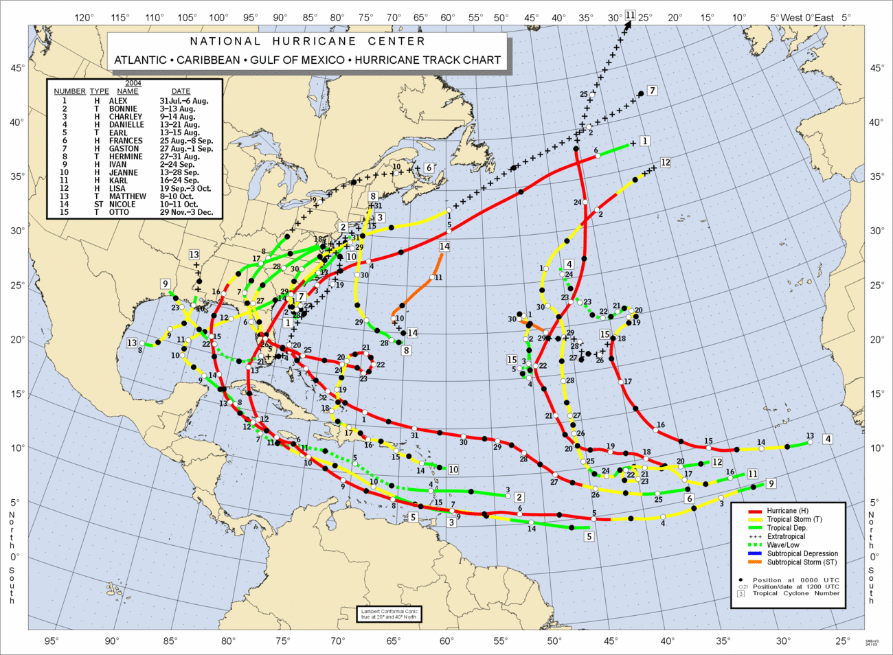
All the tropical systems that made landfall did it in the USA or Caribbean nations, but from LA/TX boarder where Iván II made lanfall and down, including México, and all Centro-american nations were not even menaced by a system this year which is a little weird.
0 likes   

cyclonaut

#3 Postby cyclonaut » Sun Jan 16, 2005 9:24 pm

What a season!!

What will 2005 bring??

Stay tuned!
0 likes   


Return to “Talkin' Tropics”

Who is online

Users browsing this forum: Hurricanehink and 588 guests