Last week’s discussion raised a number of issues of what one might expect for the February 6-20, 2005 period.
• Currently the MJO is in Stage 6. Within 8-12 days, it should be at Stage 8.
On February 10, the MJO reached Stage 7. It still appears likely that it will reach Stage 8 by around mid-month.
• From Washington, DC to Boston, temperatures will run near to somewhat above normal to around February 10-11 (with the 11th being a day later than identified in last week’s pattern discussion). Afterward, temperatures will run somewhat below normal until around mid-month. Then, the potential exists for temperatures to shift to much below normal after mid-month.
This period proved warmer than I had anticipated. Temperatures ran 5.2° above normal in Washington, DC, 8.3° above normal in NYC, and 4.2° above normal in Boston during the first 10 days of February. A cooler air mass overspread the region late on the 10th and on the 11th. However, it was not very cold. Model guidance suggested that the first part of next week would likely run near or somewhat above normal.
After February 10, the threat of accumulating snow will increase. I expect that there will be accumulations in both New York City and Boston before mid-month. And, the threat of a possible major storm from the Mid-Atlantic to New England might be on the increase after February 14. Given the return of cold air, a more active southern jet, and some hints among the ensembles, this is a matter that will bear watching.
Boston picked up 1.1” snow during the February 10-11 period. There remain indications on some of the computer guidance and in the GFS ensembles that the idea of a possible major storm affecting at least part of the East Coast is very viable after February 14. This will likely occur after the pattern change that appears likely to commence after the middle of next week.
• February 9-10 should see the return of accumulating snow in the Midwest and Ohio Valley. Chicago, Detroit, and Cleveland should all see accumulations. Some rain prior to the change to snow cannot be ruled out. At the same time, I would not be surprised if at least one of these cities, particularly Detroit or Cleveland has a chance at a significant snowfall of 6” or more. Early the following week (week of February 13) could see a renewed shot of cold air, perhaps colder than the shot that follows the aforementioned threat of snow.
The February 9-10 period saw all three cities receive accumulating snow, but none of the cities saw a significant snowfall:
Chicago: 0.4”
Cleveland: 1.6”
Detroit: 1.7”
• The Southeast will likely see a cooling trend commence around February 10, as well. However, the prospects for snow and ice probably won’t increase markedly until after mid-month when the pattern could become more suppressed… Before then, midweek (around February 8-9) it is entirely possible that parts of the Southeast, including Atlanta, could see thunderstorms before colder air returns.
Following 0.77” of rain in Atlanta on February 8-9, noticeably colder air moved into the Southeast for February 10-11. Recent temperature anomalies for Atlanta:
February 7: +7°
February 8: +7°
February 9: +10°
February 10: -6°
February 11: -9°
• The Plains states will be a battleground between milder air and much colder air. The first surge of cold air should arrive around February 8-9. Precipitation could end as snow in such cities as Kansas City and Omaha. Although temperatures could moderate near or during the weekend, another shot of cold air could arrive early the following week.
Colder air arrived in the Central Plains states during the February 7-8 period. Temperatures during the February 7-9 period averaged much below normal at Omaha. On February 9, the low temperature there was 3°. Kansas City saw the mercury come in well below normal during February 8-9. The morning low on February 9 was 10° at Kansas City. Both cities saw accumulating snow. Omaha received 4.4” during the February 6-8 period. Kansas City received 2.2” on February 8. A moderating trend set in as the workweek neared an end.
• A noticeably wetter pattern could develop across California beginning in the February 14-16 timeframe and that pattern could persist for at least a week. This wetter pattern should spread east to Texas during the February 16-19 timeframe and should also persist for at least a week.
The wet pattern developed earlier than I had anticipated. February 11 saw 1.50” of rain fall across downtown Los Angeles. Consequently, I expect the wet period to develop this weekend across the Plains and Texas.
• February 6-9 should see temperatures remain below normal across the Pacific Northwest. Seattle could see the temperature slip below freezing on one or more days during this timeframe. Some snow showers are possible on February 6. By midweek, a slow moderating trend should get underway as the trough heads eastward. After mid-month, temperatures likely will be running above normal in the Pacific Northwest.
The February 5-9 period saw the temperature average below normal each day at Seattle. On February 8, the low temperature was 31° and on February 10 it was 29°. There was no snow. The temperature rebounded to 51° on the 10th.
The February 13-28 Ideas:
I believe the case for a dramatic shift in the pattern around or just after mid-month is very strong. A combination of model guidance (led by the ECMWF), ensembles, climatology, and analogs all make a very strong case that the pattern change should take place. My lengthy post on that shift offers my reasoning in favor of that change.
This pattern change will likely dominate the sensible weather for the remainder of the month and possibly into early March once it unfolds. Overall, a cold and sometimes stormy scenario appears likely to develop. Some of the storms will likely be suppressed and a significant arctic outbreak is possible.
• The February 13-16 period should see temperatures run near to somewhat above normal in the Mid-Atlantic and Northeast. Sunday (13th) could be cooler than normal. Some rain, possibly beginning as some frozen precipitation, could occur late on Monday into Tuesday but amounts won’t be significant. The above-noted pattern change should begin in earnest on Thursday (February 17) in this region. A clipper could deposit a minor accumulation of snow, particularly from Philadelphia to Boston. Afterward, a cold air mass could send minimum temperatures to the upper teens and lower 20s from Philadelphia northward. The most likely timing for these readings would be the February 18-19 period.
After the 20th, the potential will exists for a possible Arctic outbreak. With the NAO projected to tank—and strong support for such a situation—the closing 7-days of February could average much below normal in the East. In addition, there should be accumulations of snow from Richmond to Boston. Some part of the East Coast could see a major snowstorm during that week. With an active southern jet, abundant cold air available, and increasing blocking, a cold and stormy pattern should set up.
• The Southeastern U.S. will likely see colder weather move into the region on the 17th. The cold air mass won’t be all that impressive. However, the period of February 21-28 will likely see temperatures average below normal across the region including such cities as Atlanta and Raleigh. The potential exists for at least some snow in Raleigh during this period. Ice even as far south as Atlanta is a good possibility.
• The Central Plains should see a important rainstorm affect the region this weekend (12th and 13th). A cold air mass should bring colder weather to such cities as Omaha and Kansas City by midweek (February 16). Milder air will attempt to return. However, a storm could move across the central or southern Plains by next weekend and bring behind it a significantly colder air mass.
• Rain from the Central Plains should move into the Ohio Valley and Midwest on Monday (February 14). Colder weather should arrive on the 16th and some flurries or light snow could precede it. The February 21-28 period could be colder to much colder than normal.
• The Pacific Northwest will see moderate temperatures turn colder for a brief period. However, after the February 13-16 timeframe, temperatures will grow gradually milder. The remainder of the month could see readings average warmer than normal. Before the warmup, the temperature could fall below freezing for at least one night in Seattle.
• California will likely see wetter than normal conditions continue through at least February 20 and perhaps longer as the southern jet remains energetic. Wetter conditions should also extend into the Southwest.
Winter 2005-06: The Return of La Niña?
Recently, AccuWeather senior meteorologist Joe Bastardi raised the possibility of a La Niña winter. However, he did not forecast such a winter for next season. He only mentioned the possibility. Over the past four weeks, all of the ENSO regions have seen cooling. The cool anomaly in Region 1+2 has become quite pronounced:
Region 1+2:
Week of January 5, 2005: -0.2°C
Week of February 2, 2005: -0.8°C
Region 3.4:
Week of January 5, 2005: +0.6°C
Week of February 2, 2005: +0.2°C
As a result, a look ahead is in order. One should bear in mind that the Winter ENSO state is far from certain. The major question to be addressed is specifically whether Winter 2005-06 is likely to see a La Niña.
• ENSO Models:
The ENSO models extend out to the September-November period. By that time, 3 (25%) are cool and 9 (75%) are warm. Just 1 of the cool models meets the La Niña threshold. In contrast, 7 of the warm models meet El Niño criteria. The lone model showing La Niña is the Australian POAMA Model. The CFS Model is cool but does not reach La Niña criteria. However, the cooling that now appears to be getting underway and is picked up by the models is forecast by an overwhelming number of the models to peak in the June-August period with slow warming afterward.
• CFS Ensembles:
The CFS ensemble mean reaches a cool anomaly and maintains that anomaly to the September-November period. 9 (45%) of its members are warm and 11 (55%) are cool. Of the warm members, 4 meet El Niño criteria. Of the cool members, 7 meet La Niña criteria. Although the CFS offers one of the colder solutions, it too picks up a gradual warming toward the end of its range.
• ENSO Analogs:
Using the 6-month Multivariate ENSO Index (MEI) as a starting point, there were 8 seasons that were quite similar to the current one (came within 0.500 of the 2004-05 values all 6 months). For the winter, 7 of the 8 (88%) analogs wound up with neutral or El Niño conditions; 1 of 8 (13%) saw a La Niña. Extrapolating the numbers using the January 2005 Region 3.4 anomaly as a starting point, 4 (50%) had cool anomalies during the December-February period and 4 (50%) had warm anomalies. However, just 1 met La Niña criteria. In contrast, 2 met El Niño criteria.
• Historic Experience:
The last winter La Niña occurred during Winter 2000-01. Winter 2000-01 was the last of three consecutive winters with La Niña conditions. Such a situation occurred on three prior occasions going back to 1868: 1871-72 through 1875-76, 1954-55 through 1956-57, and 1973-74 through 1975-76. The interval of time before the next La Niña winter came to 11 years, 8 years, and 5 years respectively. Thus, the average wait was 8 years and under just one of the three past occurrences was the timing consistent with 2005-06 seeing a La Niña winter.
• CPC Diagnostic Discussion:
The February 10, 2005 CPC Diagnostic Discussion stated: Based on the recent evolution of oceanic and atmospheric conditions and on a majority of the statistical and coupled model forecasts, it seems most likely that weak warm episode (El Niño) conditions will gradually weaken during the next three months and that ENSO-neutral conditions will prevail during the last half of 2005. CPC has enormous expertise when it comes to large-scale patterns, so CPC’s opinion is given significant weight.
In my view, when all the evidence is weighed, it is unlikely that Winter 2005-06 will be a La Niña winter. Whether or not it is ENSO-neutral or sees another El Niño is less certain. With the possible transition to a generally negative PDO phase possibly continuing to evolve, odds might lean toward an ENSO-neutral winter.
February 13-28, 2005 Pattern Discussion
Moderator: S2k Moderators
Forum rules
 The posts in this forum are NOT official forecast and should not be used as such. They are just the opinion of the poster and may or may not be backed by sound meteorological data. They are NOT endorsed by any professional institution or STORM2K.

The posts in this forum are NOT official forecast and should not be used as such. They are just the opinion of the poster and may or may not be backed by sound meteorological data. They are NOT endorsed by any professional institution or STORM2K.
-
donsutherland1
- S2K Analyst

- Posts: 2718
- Joined: Mon Sep 15, 2003 8:49 pm
- Location: New York
February 13-28, 2005 Pattern Discussion
Last edited by donsutherland1 on Wed Feb 16, 2005 11:50 pm, edited 1 time in total.
0 likes

Don:
Thanks sooo much-excellent as always!! Excellent read and I learn so much from them. It is quite interesting to me, that one can follow the PNA and many times equate it to winter weather here for this area. If I remember correctly, next weekend and mid next week the PNA is progged to go to between 0 and positive 1.5-that is a pretty good number for us-not perfect, but not bad-and not surprisingly, the models have began to show the possibility of some winter precip. for that time period just as you had stated. Looking at past records, months where the PNA averaged between -1 and +1, we saw good snows-anything less or more than that, we were hurtin for certain. Based on the PNA and EURO, although they seem to be going back and forth a bit, i totally agree that in the next 10 days we could see some winter weather. Yes, we are going to get quite a bit of rain here this weekend-after this weekend, we may be 3 1/2 inches above normal for 2005-wild stuff-and we only have 5 inches of snow and 1/2 inch of ice to show for it-and it has been cold here-just shows how much timing plays into things for this area in winter. This also makes me very nervous about this summer-we can have 3-4 months of wet weather then bang it shuts down for 2-3 months-that equates to one hot and dry summer here!!
Thanks sooo much-excellent as always!! Excellent read and I learn so much from them. It is quite interesting to me, that one can follow the PNA and many times equate it to winter weather here for this area. If I remember correctly, next weekend and mid next week the PNA is progged to go to between 0 and positive 1.5-that is a pretty good number for us-not perfect, but not bad-and not surprisingly, the models have began to show the possibility of some winter precip. for that time period just as you had stated. Looking at past records, months where the PNA averaged between -1 and +1, we saw good snows-anything less or more than that, we were hurtin for certain. Based on the PNA and EURO, although they seem to be going back and forth a bit, i totally agree that in the next 10 days we could see some winter weather. Yes, we are going to get quite a bit of rain here this weekend-after this weekend, we may be 3 1/2 inches above normal for 2005-wild stuff-and we only have 5 inches of snow and 1/2 inch of ice to show for it-and it has been cold here-just shows how much timing plays into things for this area in winter. This also makes me very nervous about this summer-we can have 3-4 months of wet weather then bang it shuts down for 2-3 months-that equates to one hot and dry summer here!!
0 likes
-
donsutherland1
- S2K Analyst
- Posts: 2718
- Joined: Mon Sep 15, 2003 8:49 pm
- Location: New York
Don:
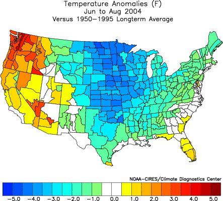
Last summer was just absolutely crazy-it was the coolest summer over all I can ever remember. I was bass fishing in sweat shirts the first of August in the middle of the day and building a boat launch with North winds gusting to 20 MPH for 2 days in the same time frame. With that in mind, as the old wise tail goes, pay backs are harsh!!!!
Last summer was just absolutely crazy-it was the coolest summer over all I can ever remember. I was bass fishing in sweat shirts the first of August in the middle of the day and building a boat launch with North winds gusting to 20 MPH for 2 days in the same time frame. With that in mind, as the old wise tail goes, pay backs are harsh!!!!
0 likes
-
donsutherland1
- S2K Analyst
- Posts: 2718
- Joined: Mon Sep 15, 2003 8:49 pm
- Location: New York
Don:
Thanks for the map!! Sorry to keep bugging you with this stuff, but I was wondering if you thought my ideas of the PNA make any kind of sense. Like I've said before, I'm a History/Latin teacher by trade but have always liked weather and really become kind of obsessed this year. I have been posting ideas in the Lawrence/KC thread and I guess I just hope I'm at least on the right track even if it is just on the on ramp or the shoulder!!!
Thanks for the map!! Sorry to keep bugging you with this stuff, but I was wondering if you thought my ideas of the PNA make any kind of sense. Like I've said before, I'm a History/Latin teacher by trade but have always liked weather and really become kind of obsessed this year. I have been posting ideas in the Lawrence/KC thread and I guess I just hope I'm at least on the right track even if it is just on the on ramp or the shoulder!!!
0 likes
-
donsutherland1
- S2K Analyst
- Posts: 2718
- Joined: Mon Sep 15, 2003 8:49 pm
- Location: New York
Sertorius,
I don't have much data for the Plains States. Here's how St. Louis fared given various PNA averages for the winter:
• Positive: 22.7"
• +1.00 or above: 16.9"
• Positive but < +1.00: 24.8"
• Negative: 17.8"
• Negative but > -1.00: 18.1"
• -1.00 or below: 17.1"
• -1 to +1: 20.6"
Those are seasonal averages. Given the active southern stream and the cold pattern (at least as envisioned by the ECMWF), I believe the Plains should be in the hunt for at least some accumulating snow. Before the season is over, I am confident that MO will see more accumulations.
0 likes
Don:
Thanks for replying to my post-I really appreciate it as I know you have many more things to do!!! But, your stats. for St. Louis are very similar for here-if the PNA is between negative 1 and plus 1, we have a pretty good shot. Based on the forecast, the PNA will be in that range at times thru the first of March. It is amazing, that even looking at this winter, when the PNA was in that range, was exactly when we had our winter weather. Thanks again for repsonding to me this evening-if it wasn't for you and your arcticles, I never would have researched the PNA!!!!!
Thanks for replying to my post-I really appreciate it as I know you have many more things to do!!! But, your stats. for St. Louis are very similar for here-if the PNA is between negative 1 and plus 1, we have a pretty good shot. Based on the forecast, the PNA will be in that range at times thru the first of March. It is amazing, that even looking at this winter, when the PNA was in that range, was exactly when we had our winter weather. Thanks again for repsonding to me this evening-if it wasn't for you and your arcticles, I never would have researched the PNA!!!!!
0 likes
-
donsutherland1
- S2K Analyst
- Posts: 2718
- Joined: Mon Sep 15, 2003 8:49 pm
- Location: New York
Sertorius,
Thanks for the kind words. Different configurations e.g., PNA, etc., have a downstream impact farther east. I fully expect that Missouri has not seen its last snows. With an active southern branch--likely to persist through the rest of the month--there will be opportunities for snow. The second half of February should be a fun time for all who cherish winter.
Thanks for the kind words. Different configurations e.g., PNA, etc., have a downstream impact farther east. I fully expect that Missouri has not seen its last snows. With an active southern branch--likely to persist through the rest of the month--there will be opportunities for snow. The second half of February should be a fun time for all who cherish winter.
0 likes
Don:
As of right now, it sure looks like next weekend could be quite interesting (not to mention the flood watches for KC today-eastern Kansas is not in one mainly because most of the small rivers are all damned up with lakes!!) for Kansas, Missouri and Nebraksa-the modles have latched onto a pretty vigourous low comming out of the 4 corners for the past 2 days. Way way too early but it is something to watch for sure. Thanks again Don!! Oh, the PNA is forecast to be about .5-1 next weekend!!
As of right now, it sure looks like next weekend could be quite interesting (not to mention the flood watches for KC today-eastern Kansas is not in one mainly because most of the small rivers are all damned up with lakes!!) for Kansas, Missouri and Nebraksa-the modles have latched onto a pretty vigourous low comming out of the 4 corners for the past 2 days. Way way too early but it is something to watch for sure. Thanks again Don!! Oh, the PNA is forecast to be about .5-1 next weekend!!
0 likes
-
JETSTREAM BOB
- Tropical Storm

- Posts: 109
- Joined: Thu Oct 07, 2004 11:25 am
- Location: CHARLOTTE,N.C.
Don---With all due respect you have been saying that the east is going to get cold since Christmas...aint going to happen..the days are getting longer and longer..meaning getting closer to Spring....Except for the N.E. winter has yet to happen in the eastern 2/3 of the nation.....first time in 20 years when Charlotte,N.C. hasn't had at least an inch of snow....now I'm hearing that Summer is suppose to be scorcher...........HMMMMMMMMMM.........and next Winter to be mild in the East.............HMMMMMMMMMMMMMMMMMMM........... 
 --JSB
--JSB
0 likes
Patience JSB you will get your snow. Dont start loosing faith in don. Its only February 14th!JETSTREAM BOB wrote:Don---With all due respect you have been saying that the east is going to get cold since Christmas...aint going to happen..the days are getting longer and longer..meaning getting closer to Spring....Except for the N.E. winter has yet to happen in the eastern 2/3 of the nation.....first time in 20 years when Charlotte,N.C. hasn't had at least an inch of snow....now I'm hearing that Summer is suppose to be scorcher...........HMMMMMMMMMM.........and next Winter to be mild in the East.............HMMMMMMMMMMMMMMMMMMM...........
0 likes
-
donsutherland1
- S2K Analyst
- Posts: 2718
- Joined: Mon Sep 15, 2003 8:49 pm
- Location: New York
JETSTREAM BOB,
Let's take a closer look at what I've been saying, because it most definitely has not been a call for all cold all the time for the East.
• From December 31: The January 8-15 period should see readings in the East trend downward and cities from Philadelphia to Boston could see their readings average somewhat below normal. Washington, DC might be closer to normal but even there the possibility does exist for a turn to colder than normal conditions particularly after January 10.
Timing on this change was off at this point.
• From January 7: In the East, the unseasonable warmth has defined the opening days of January. Even as New England has been able to experience brief periods of cold along with snow, readings have averaged above to much above normal along the East Coast. That situation is likely to continue into the second week of the month.
However, there are growing signs that a significant pattern change could be unfolding, especially around or just after mid-month.
Verified. The second half of January saw much below normal temperatures.
• From January 14: Possible amplification in the closing 5-7 days of the month might heighten the risk of a significant snowfall.
The Blizzard of 2005 occurred January 22-23. My estimate was a little late.
• Also from January 14: February has reasonable potential to prove colder than normal and snowier than normal, especially from the northern Mid-Atlantic northward.
To be verified at the end of February.
• From January 21: The first week of February will likely see readings not far from normal but there might be additional storminess as the pattern relaxes to reload for more cold and snow later in the month per analogs.
It did grow milder and warmer than what I had thought would occur, however I expected a break from the severe cold of the 2nd half of January.
• From January 28: Relative to normal, the first 10-14 days should probably come in reasonably close to normal with some below normal readings but also some somewhat above normal readings. No extreme cold nor blowtorches appear likely. The second half of February looks to average colder than normal.
First 14 days were above normal. Warmer than I had expected but not a blowtorch and nowhere near comparable to those of the first half of January. The second half pattern change looks increasingly likely.
So, by no means was I expecting unrelenting cold, much less unrelenting extreme cold. I did see moderation from time to time, but just not quite as much warmth as actually occurred. This is something I'm keeping note of so as to assess biases at the end of the season and make such adjustments as might be necessary.
Let's see how the rest verifies. When I put out my post that the mid-month pattern change appeared "highly likely," there was very little model support for that idea and the "winter's over!" fever was raging. There was also a strongly positive NAO.
Today, finds a negative NAO, strong model support for the pattern change, and discussions appear to be increasingly focused on winter storm threats. Now, it's becoming less an issue of whether the change will take place--it appears very good--but what will be the details. All in all, I like how things have evolved and am very comfortable with ideas concerning the pattern change.
Last edited by donsutherland1 on Mon Feb 14, 2005 2:19 pm, edited 1 time in total.
0 likes
-
donsutherland1
- S2K Analyst
- Posts: 2718
- Joined: Mon Sep 15, 2003 8:49 pm
- Location: New York
JETSTREAM BOB,
As for my expectations, I do believe Summer 2005 will be warmer than last summer. Some analogs are pointing toward a hot one, but for me it's a little soon to make that call.
As for Winter 2005-06, I have no estimates of any kind on that. I only noted that I lean against the idea of a La Niña winter (which can have a differing impact):
• Moderate/Strong La Niña: warm in the East
• Weak La Niña/PDO +: cold in the East
• Weak La Niña/PDO -: warm in the East
0 likes
Who is online
Users browsing this forum: No registered users and 213 guests