Mid-Month Pattern Change Appears Highly Likely
Moderator: S2k Moderators
Forum rules
 The posts in this forum are NOT official forecast and should not be used as such. They are just the opinion of the poster and may or may not be backed by sound meteorological data. They are NOT endorsed by any professional institution or STORM2K.

The posts in this forum are NOT official forecast and should not be used as such. They are just the opinion of the poster and may or may not be backed by sound meteorological data. They are NOT endorsed by any professional institution or STORM2K.
-
donsutherland1
- S2K Analyst

- Posts: 2718
- Joined: Mon Sep 15, 2003 8:49 pm
- Location: New York
John,
I believe younger members and older ones can all contribute value. With regard to Krysof, I hope that he carefully assesses the assumptions on which his ideas were based and how things actually turned out. I believe that the lesson that could be gleaned is that objectivity can help one see things that might otherwise be obscured by emotions over let's say disappointment with the season to date, etc. In the long-run, objectivity provides the most realistic framework from which to proceed in laying out forecasts. It's no guarantee of perfection by any stretch of the imagination. However, it can help make for forecasts that are, on average, far better than they would be were objectivity limited.
I believe younger members and older ones can all contribute value. With regard to Krysof, I hope that he carefully assesses the assumptions on which his ideas were based and how things actually turned out. I believe that the lesson that could be gleaned is that objectivity can help one see things that might otherwise be obscured by emotions over let's say disappointment with the season to date, etc. In the long-run, objectivity provides the most realistic framework from which to proceed in laying out forecasts. It's no guarantee of perfection by any stretch of the imagination. However, it can help make for forecasts that are, on average, far better than they would be were objectivity limited.
0 likes

Yes Don i know what you mean. I wasnt trying to be mean to him i was just curious because im only 15.donsutherland1 wrote:John,
I believe younger members and older ones can all contribute value. With regard to Krysof, I hope that he carefully assesses the assumptions on which his ideas were based and how things actually turned out. I believe that the lesson that could be gleaned is that objectivity can help one see things that might otherwise be obscured by emotions over let's say disappointment with the season to date, etc. In the long-run, objectivity provides the most realistic framework from which to proceed in laying out forecasts. It's no guarantee of perfection by any stretch of the imagination. However, it can help make for forecasts that are, on average, far better than they would be were objectivity limited.
0 likes
-
donsutherland1
- S2K Analyst
- Posts: 2718
- Joined: Mon Sep 15, 2003 8:49 pm
- Location: New York
-
donsutherland1
- S2K Analyst
- Posts: 2718
- Joined: Mon Sep 15, 2003 8:49 pm
- Location: New York
Re: Mid-Month Pattern Change Appears Highly Likely
For purposes of completeness, the verification is added to this thread. I accidentally added it to another earlier today.
Verifications for the pattern change that commenced on February 17, 2005:
• In short, strong arguments can be made for the NAO to head negative. There are also hints of a shift to a strongly negative NAO.
The NAO went negative for three days beginning on February 15 before bouncing weakly positive for a day. It went negative on February 17 and remained there for the rest of the month. On February 25, the NAO fell to -5.955, the 16th lowest value of all-time. This was also the 7th strongest block on record.
• I have above average confidence that a mid-month pattern change will occur and that the eastern United States, including the Mid-Atlantic region, will see both colder than normal readings during the February 15-28 period and above normal snowfall for that time. I would estimate that Boston will likely see 15” or more snowfall, NYC 10” or more, and Washington, DC 6” or more.
February 15-28 Temperature Anomalies:
Boston: 3.6° below normal
New York City: 3.1° below normal
Philadelphia: 2.5° below normal
Washington, DC: 0.8° below normal
February 15-28 Snowfall:
Boston: 17.4"
New York City: 15.8"
Washington, DC: 5.2" (bust)
0 likes

-
donsutherland1
- S2K Analyst
- Posts: 2718
- Joined: Mon Sep 15, 2003 8:49 pm
- Location: New York
Re: Mid-Month Pattern Change Appears Highly Likely
Linda,
The cold pattern is, at least in my view, nearing its end. But that process will likely require 2-3 weeks before a warmer pattern moves into place.
First, a note from the earlier verification: The final NAO figures are even more impressive than the preliminary ones. On February 25, the NAO fell to -6.026, the 14th lowest value of all-time. This makes the 2005 block, the 5th strongest block on record.
Also, the 2005 block saw 9 days (using some very recent preliminary data) where the NAO was at or below -5.000. That ties the all-time record set in both the 1958 and 1962 super blocks.
Here's the way I see the pattern evolving, pieces of which were noted in some of the recent weekly pattern discussions, and some newer information:
1) Per the historic experience with past late-season extreme blocks and NAO/ENSO climatology, I believe the worst of the cold anomalies in the East will be finished 3/24 +/- a few days.
2) Even afterward, blockiness will probably be recurrent for a time, so this less cold period may still have some quite cold days interspersed with a growing number of milder ones (far more milder days relative to colder ones than the first 20 or so days of March).
The latest GFS ensembles (3/17 0z) show the NAO going negative after briefly reaching positive territory. This reinforces the idea of blockiness being recurrent until the positive NAO regime sets in.
3) Most of the extreme blocking situations saw the negative NAO replaced by a sustained positive NAO during the first 10 days of April (earliest: March 24; latest: April 18).
4) When the NAO undergoes a regime change, look for more widespread, persistent, and meaningful warmth. I believe April will average normal to above normal in the Mid-Atlantic/Southeast with New England being a tougher call (analogs are split between the cooler and milder option: the curse of backdoor cold fronts?). I would not be surprised if either the Mid-Atlantic or Southeast averaged several degrees above normal e.g., DCA saw a mean temperature of 58° or above for April but those are just initial thoughts.
5) Once the NAO pops positive, I believe that the threat of any KU-type storm will have effectively ended. Of course, at this point, I don't see such a threat on the horizon.
6) Once April arrives, at least per the analogs that are looking increasingly strong to me, the threat of meaningful snow in the Mid-Atlantic will be all but finished. I don't believe DCA will see more than a trace of snow in April and perhaps won't see anything. Even NYC probably won't see much, but perhaps a little more than a trace. I'll offer greater details in tomorrow's weekly pattern discussion.
0 likes
-
donsutherland1
- S2K Analyst
- Posts: 2718
- Joined: Mon Sep 15, 2003 8:49 pm
- Location: New York
-
TT-SEA
Do you have any ideas on the Pacific Northwest during this pattern change?
We seem to have switched to a wetter regime. We had widespread rain around Seattle yesterday and good mountain snow for the first time in a long time. We had 1.50 inches of rain at our house even though the official total at the airport was much less.
This weekend and early next week also looks wet. It has been 2 months since we have seen a pattern like this set up.
Do you think this will continue? What are the odds of a wet April around here?
0 likes
-
donsutherland1
- S2K Analyst
- Posts: 2718
- Joined: Mon Sep 15, 2003 8:49 pm
- Location: New York
TT-SEA,
First, the pattern change discussion actually concerned the mid-February pattern change.
Second, emerging analogs suggest that April could see normal to somewhat above normal precipitation in the Pacific Northwest. The recent showers (rains in some places) might well be an opening shot toward the change to a wetter pattern.
0 likes
donsutherland1 wrote:Linda,
I just thought I'd add where I believe things are going as perhaps you or others might have wanted an additional follow-up.
Best wishes.
Oh! Thank you very much!
I am in the deep south and I do not know what to think about this continuing damp, cold scenario. This is unusual for this region in March. Although we did have that blizzard in March of 93, which as you probably know is more than likely never going to happen again, not in March anyway.
0 likes
-
donsutherland1
- S2K Analyst
- Posts: 2718
- Joined: Mon Sep 15, 2003 8:49 pm
- Location: New York
-
donsutherland1
- S2K Analyst
- Posts: 2718
- Joined: Mon Sep 15, 2003 8:49 pm
- Location: New York
-
Stormsfury

- Category 5

- Posts: 10549
- Age: 53
- Joined: Wed Feb 05, 2003 6:27 pm
- Location: Summerville, SC
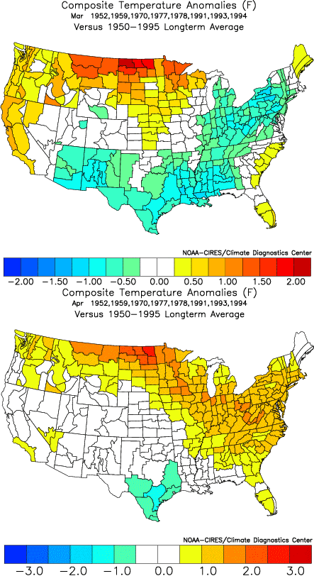
April 1991 in the Southeast was quite warm as a whole, with many afternoons w/scattered thunderstorms around on a local level. (based on memory).
Aprils 1993 and 1994 were somewhat variable but as a whole slightly ABV normal WRT to long term climo. I used to have all the numbers specifically from day to day from 1991-1997 as I used to keep daily logs of highs/lows, precip, winds, etc ... and still have those somewhere around here (on hardcopy) ...
SF
0 likes
Who is online
Users browsing this forum: No registered users and 66 guests