The posts in this forum are NOT official forecasts and should not be used as such. They are just the opinion of the poster and may or may not be backed by sound meteorological data. They are NOT endorsed by any professional institution or STORM2K. For official information, please refer to products from the National Hurricane Center and National Weather Service.
I've always been interested in photographs taken during a hurricane. So I figured maybe it'd be interesting to have a thread devoted to hurricane action photos.
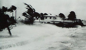
Here's a pic from Hurricane Hattie in 1961. Hattie was a Category 5 at landfall on Belize with sustained winds of 160 mph and a barometric pressure of 920 mb.
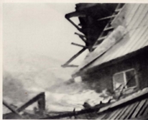
Here's some photos from Hurricane Cleo in 1964. Prior to Charley, Hurricane Cleo was the only "C" storm to ever hit Florida. Considering how often Florida is hit by hurricanes and tropical storms, I found that interesting.
Visit the Caribbean-Central America Weather Thread where you can find at first post web cams,radars and observations from Caribbean basin members Click Here
I know this next one isn't a pic of Camille in action, but it is a ground radar pic of Camille. This is the only radar pic of Camille I have ever come across.
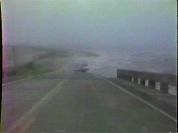
Here's a chilling photo during Hurricane Eloise in 1975. Although I think it's the angle the photo was taken in that makes the waves look like they're gonna engulf all those buildings. However, Eloise did bring in a 16 ft storm surge.
Now Allen is a fascinating storm to examine. The only other storm I know of that reached CAT 5 status three times is Ivan last year. Allen occured pretty early in the season for such a powerful storm as well.