Warm April Pattern Likely to Begin Just Before Mid-Month

U.S. & Caribbean Weather Discussions and Severe Weather Events

Moderator: S2k Moderators

Forum rules

The posts in this forum are NOT official forecast and should not be used as such. They are just the opinion of the poster and may or may not be backed by sound meteorological data. They are NOT endorsed by any professional institution or STORM2K.

Help Support Storm2K
Message
Author
donsutherland1
S2K Analyst
S2K Analyst
Posts: 2718
Joined: Mon Sep 15, 2003 8:49 pm
Location: New York

Warm April Pattern Likely to Begin Just Before Mid-Month

#1 Postby donsutherland1 » Mon Apr 04, 2005 4:17 pm

Currently, although the 4/4/2005 12z run of the GFS argues for caution, it is likely that the evolution of the current pattern should lead to readings generally averaging above normal in the East for much of the second half of April (probably at least April 13 through April 25).

ENSO Analogs:
As a general rule, in times of changing patterns where uncertainty is highest, analogs can provide invaluable guidance. Based on late February data (which has continued to be supported by weekly ENSO data through March 23), odds favor a warm April in the East:
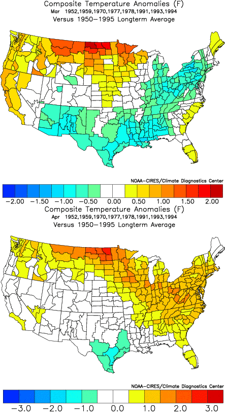
Closest 15 Matches:
• Northeast: 11/15 (73%) normal to above normal temperatures
• Mid-Atlantic: 12/15 (80%) normal to above normal temperatures
• Southeast: 13/15 (87%) normal to above normal temperatures

Closest 10 Matches:
• Northeast: 8/10 (80%) normal to above normal temperatures
• Mid-Atlantic: 8/10 (80%) normal to above normal temperatures
• Southeast: 8/10 (80%) normal to above normal temperatures

Image

Major Teleconnection Indices:
There is now strong support on the GFS ensembles for the NAO to go positive just prior to April 10. This development is supported by the GFS ensemble forecast for the Arctic Oscillation (AO). Since 1950, 77% of cases that saw the AO average positive in April also saw the NAO average positive. This timing is also consistent with the breakdown of past extreme blocks.

Positive NAO-Positive PNA:
• Very warm, on average in the East
• Cool anomalies are very unlikely in the Mid-Atlantic and Northeast
• New England is often wet

Positive NAO-Negative PNA:
• Chance for an outbreak of extreme warmth in the East
• Near normal in the Southeast and often somewhat below normal to near normal in the New England; Mid-Atlantic is typically warm
• Dry in the East

“Fire” in April:
15 of 20 (75%) of some of the most prominent outbreaks of heat in April were preceded by a positive NAO at least 5 days prior to the start of the event. 14 of those 15 (93%) cases had a positive NAO at the start of the event. 12 of 15 (80%) of those cases had a negative PNA at the start of the event. Outbreaks of heat that met all the above criteria (positive NAO 5 days before the start of the event, positive NAO at the start of the event, and a negative PNA at the start of the event) included the April 1976, April 1990, April 1991, and April 2002 outbreaks of heat. Needless to say, not every such situation with the global teleconnection indices led to an impressive outbreak of heat.

Madden-Julian Oscillation (MJO):
The Madden-Julian Oscillation (MJO) has just moved into Phase 4. Phases 4-6 are typically associated with the development of a positive NAO and ridging in the East. Phase 7, which is often associated with the start of a transition that leads to the return of a negative NAO, is probably 15-21 days away.

ECMWF Model:
The 8-10-day average for the 4/4 2005 0z run of the ECMWF tended to support a ridge in the East/trough in the West alignment. It also lent some support to the idea of a positive NAO.

CPC’s Ensemble Composite Analog for 500 mb Height Anomalies:
The 8-14-day forecast centered on April 15 produces analogs that overwhelmingly had warmer than normal readings in part or all of the East for the 3 days prior to and after the date cited. Analogs were: May 1, 1955, April 24, 1960, May 2, 1964, April 19, 1977, and April 4, 1999. The 6-10-day pool was cooler. This trend among the ensemble composite analogs adds to confidence in the idea that a transition to a warmer pattern will be occurring just before mid-month.

Consistency of Signals:
• Pattern Change: ENSO analogs, GFS Ensembles, MJO, ensemble composite analogs
• Positive NAO: Evolution of Extreme Blocks, NAO climatology, MJO, GFS Ensembles (both NAO and AO), ECMWF
• Above Normal Temperatures: ENSO analogs, GFS Ensembles (NAO signal), NAO-PNA profiles

Overall, I have average confidence that a warm pattern will likely commence in the East in the April 13-15 timeframe. After that, it should persist with at least 10-14 days seeing readings generally averaging above normal. Overall, the April 13-25 period will likely see readings in Boston, New York City, Philadelphia, and Washington, DC average above normal. The Mid-Atlantic region could see the largest warm anomalies and April 2005 could see a monthly mean temperature at or above 58° for Washington, DC.

Unlike with the pattern change idea for mid-February, there is greater uncertainty this time around. The seasonal transition also increases the uncertainty. The above idea will be verified at the end of April.
0 likes   

User avatar
Stephanie
S2K Supporter
S2K Supporter
Posts: 23843
Age: 63
Joined: Thu Feb 06, 2003 9:53 am
Location: Glassboro, NJ

#2 Postby Stephanie » Mon Apr 04, 2005 7:55 pm

Looking forward to it! :D
0 likes   

donsutherland1
S2K Analyst
S2K Analyst
Posts: 2718
Joined: Mon Sep 15, 2003 8:49 pm
Location: New York

#3 Postby donsutherland1 » Tue Apr 05, 2005 6:42 am

Enjoy it. So far, there remains growing support on the models. Today and tomorrow should be quite springlike, too.
0 likes   

donsutherland1
S2K Analyst
S2K Analyst
Posts: 2718
Joined: Mon Sep 15, 2003 8:49 pm
Location: New York

Re: Warm April Pattern Likely to Begin Just Before Mid-Month

#4 Postby donsutherland1 » Wed Apr 13, 2005 6:19 pm

Update...

At the opening of this thread, I noted that "a warm pattern will likely commence in the East in the April 13-15 timeframe. After that, it should persist with at least 10-14 days seeing readings generally averaging above normal. Overall, the April 13-25 period will likely see readings in Boston, New York City, Philadelphia, and Washington, DC average above normal."

From the latest computer guidance, with the 4/13 12z run of the ECMWF being used as the main output for purposes of this discussion, it appears that the warm pattern will begin on 4/16 +/- 1 day, which would fall close to or just outside the 4/13-15 timeframe alluded to on April 4.

There is now a pronounced warming trend being shown on the ECMWF. Select forecasts for 850 mb temperatures follow:

Boston:
4/15 12z: -2.4°C
4/16 12z: +2.1°C
4/20 12z: +9.9°C

New York City:
4/15 12z: -2.5°C
4/16 12z: +2.7°C
4/20 12z: +10.5°C

Philadelphia:
4/15 12z: -2.6°C
4/16 12z: +3.0°C
4/20 12z: +11.0°C

Washington, DC:
4/15 12z: -1.3°C
4/16 12z: +3.6°C
4/20 12z: +10.9°C

The idea of at least a burst of much above normal temperatures in the East is also borne out to some extent by the GFS ensembles. I would not be surprised if during next week one sees the mercury reach or exceed 75° in New York City at some point next week. Boston could also see its first 70° reading of the spring. At an extreme, the 80° isotherm could extend to New York City and perhaps across southernmost New England.

From midweek to late next week, a modestly cooler air mass could move across the region (4/21-22?). Afterward, a fresh warmup would likely commence in a few days.
0 likes   

snow_wizzard
Category 4
Category 4
Posts: 994
Joined: Mon Jan 17, 2005 12:15 am
Location: Covington, WA

#5 Postby snow_wizzard » Fri Apr 15, 2005 1:38 am

Fascinating stuff Don! So often the things you foretell end up being correct. I have been wondering what web site you get those composite maps from. It looks like those could be a great tool to add to my prediction formulas! :D

One interesting note is that the maps showed the Pacific NW would have a warm April, and it has been anything but warm. It just goes to show that meteorology is still a very imperfect science...
0 likes   

donsutherland1
S2K Analyst
S2K Analyst
Posts: 2718
Joined: Mon Sep 15, 2003 8:49 pm
Location: New York

#6 Postby donsutherland1 » Fri Apr 15, 2005 12:07 pm

Snow_Wizzard,

Thanks for the kind words. The link I use to create the composite maps is: http://www.cdc.noaa.gov/USclimate/USclimdivs.html

The maps at the beginning of this thread showed April temperature anomalies following winters with weak El Niños. They represented a starting point. Additional data e.g., that following extreme blocks, provided a cooler outlook for the Pacific Northwest (i.e., 1978, 2001, etc.). Overall, the idea of temperatures was anything but decisive. There was strong agreement with regard to precipitation. Overall, as you noted, much remains to be learned when it comes to longer-range forecasts.
0 likes   

TT-SEA

#7 Postby TT-SEA » Fri Apr 15, 2005 12:23 pm

That site is AWESOME.

It will keep me busy for a long time!! A great tool indeed.
0 likes   

donsutherland1
S2K Analyst
S2K Analyst
Posts: 2718
Joined: Mon Sep 15, 2003 8:49 pm
Location: New York

Re: Warm April Pattern Likely to Begin Just Before Mid-Month

#8 Postby donsutherland1 » Sun Apr 17, 2005 11:18 am

With the warm weather now in place, the "dog days" of April are now upon parts of the Mid-Atlantic into southern New England region:

Image
New Rochelle, New York (April 17, 2005)
0 likes   

User avatar
vbhoutex
Storm2k Executive
Storm2k Executive
Posts: 29112
Age: 73
Joined: Wed Oct 09, 2002 11:31 pm
Location: Cypress, TX
Contact:

#9 Postby vbhoutex » Sun Apr 17, 2005 6:14 pm

Beautiful!!! Thanks Don!!!
0 likes   

donsutherland1
S2K Analyst
S2K Analyst
Posts: 2718
Joined: Mon Sep 15, 2003 8:49 pm
Location: New York

#10 Postby donsutherland1 » Mon Apr 18, 2005 9:36 am

Thanks Dave.
0 likes   

StormChasr

#11 Postby StormChasr » Mon Apr 18, 2005 1:46 pm

Wow, could use some warm weather here. It was 48 degrees this morning. Yesterday, it topped out at 69 degrees---very unseasonable for N CENT Florida. Ocean is 65 degrees......brrrrhhh. Need a wet suit to scuba or snorkel. Whooooooe!!!
0 likes   

donsutherland1
S2K Analyst
S2K Analyst
Posts: 2718
Joined: Mon Sep 15, 2003 8:49 pm
Location: New York

Re: Warm April Pattern Likely to Begin Just Before Mid-Month

#12 Postby donsutherland1 » Wed Apr 20, 2005 6:21 pm

April 20 saw the temperature rocket into the middle and upper 80s across much of the Mid-Atlantic and Northeast. Highs included:

Boston: 87°
New York City: 87°
Newark: 88°
Philadelphia: 86°
Washington, DC: 86°

More and more trees and flowers were in bloom as the symphony of colors continued to spread across the warm landscape:

Image
0 likes   

Brent
S2K Supporter
S2K Supporter
Posts: 38090
Age: 36
Joined: Sun May 16, 2004 10:30 pm
Location: Tulsa Oklahoma
Contact:

#13 Postby Brent » Wed Apr 20, 2005 10:17 pm

WOW... it's even warmer up there than it is here.

82 today. 8-)
0 likes   
#neversummer

donsutherland1
S2K Analyst
S2K Analyst
Posts: 2718
Joined: Mon Sep 15, 2003 8:49 pm
Location: New York

Re: Warm April Pattern Likely to Begin Just Before Mid-Month

#14 Postby donsutherland1 » Tue Apr 26, 2005 9:12 am

Verification of the Mid-April Warm Period...

From April 4: ...a warm pattern will likely commence in the East in the April 13-15 timeframe. After that, it should persist with at least 10-14 days seeing readings generally averaging above normal. Overall, the April 13-25 period will likely see readings in Boston, New York City, Philadelphia, and Washington, DC average above normal. The Mid-Atlantic region could see the largest warm anomalies...

Temperature Anomalies (April 13-25 timeframe):

Boston: +1.7°
New York City: +2.8°
Washington, DC: +0.4°

Highest Temperature:

Boston: 87°, April 20
New York City: 87°, April 20
Washington, DC: 86°, April 20

First Warm Anomaly:

Boston: +4°, April 17
New York City: +3°, April 14
Washington, DC: +8°, April 18 (Normal on April 17)

Last Warm Anomaly:

Boston: +1°, April 24 (MOS suggests April 26 could be above normal)
New York City: +7°, April 21 (MOS suggests April 26 could be above normal)
Washington, DC: +1°, April 23

Overall, the warm spell did materialize but it was somewhat shorter than I had anticipated. Moreover, the warmest anomalies were located somewhat farther to the north than I had expected.

Finally, where we go from here is handled in my post on the current April block. The NAO has now fallen to -2.036. The East has already seen one impressive shot of cold air with the morning of 4/25 seeing readings in the low 40s in Boston, New York City, and Washington, DC. During the current 10 days or so (particularly the 4/25-5/5 timeframe), I believe that there will likely be at least one additional day where the temperature falls to 47° or below in Washington, DC, 45° or below in New York City, and 43° or below in Boston. Certainly, the signal on the latest run of the GFS ensembles is still there.

Afterward, some ridging should develop but it could be transient. More meaningful and sustained ridging is probably not likely until mid-May or somewhat beyond. So far, the MJO continues to progress steadily (now Phase 8) and that lends some support to the above-noted idea concerning more meaningful ridging to commence around mid-May or somewhat later.
0 likes   

donsutherland1
S2K Analyst
S2K Analyst
Posts: 2718
Joined: Mon Sep 15, 2003 8:49 pm
Location: New York

Re: Warm April Pattern Likely to Begin Just Before Mid-Month

#15 Postby donsutherland1 » Sun May 01, 2005 10:56 am

Final set of April verifications:

• From the opening of this thread:

The Mid-Atlantic region could see the largest warm anomalies and April 2005 could see a monthly mean temperature at or above 58° for Washington, DC.

The greatest warm anomalies among the East Coast's major cities were in the northern part of the Mid-Atlantic region. Washington, DC had a monthly mean temperature of 57.3°.

Final Monthly Mean Temperatures and Anomalies for April 2005:

Boston: 49.7° +1.4°
New York City: 55.1° +2.6°
Philadelphia: 55.3° +2.2°
Washington, DC: 57.3° +1.2°
0 likes   


Return to “USA & Caribbean Weather”

Who is online

Users browsing this forum: No registered users and 21 guests