

Courtesy of the DMSP satellite... an image of an ash plume from the Anathan volcano to the northeast of Typhoon Nesat. (I've kinda circled the ash plume for easy identification)
http://www.geocities.com/route71/False-1.jpg
Typhoon Nesat and Anathan volcano
Moderator: S2k Moderators
Forum rules

The posts in this forum are NOT official forecasts and should not be used as such. They are just the opinion of the poster and may or may not be backed by sound meteorological data. They are NOT endorsed by any professional institution or STORM2K. For official information, please refer to products from the National Hurricane Center and National Weather Service.

-
HurricaneBill
- Category 5

- Posts: 3420
- Joined: Sun Apr 11, 2004 5:51 pm
- Location: East Longmeadow, MA, USA
Here's a pic of Typhoon Yunya in 1991. Category 3 Typhoon Yunya happened to be heading towards the Philippines just as Mt. Pinatubo was erupting.
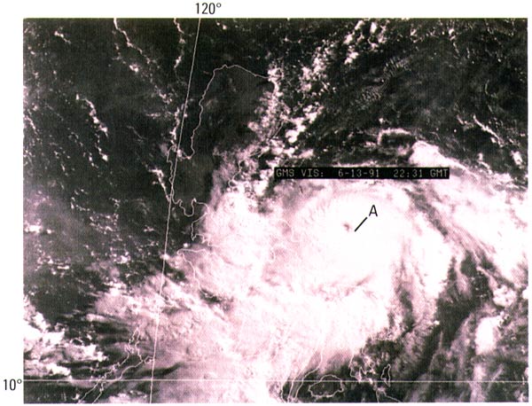
Ash from Pinatubo became incorporated into the circulation of Yunya. This resulted in the ash being spread over a large area and mixing with the rain to form a thick mud.
Talk about bad timing.
Ash from Pinatubo became incorporated into the circulation of Yunya. This resulted in the ash being spread over a large area and mixing with the rain to form a thick mud.
Talk about bad timing.
0 likes
Who is online
Users browsing this forum: No registered users and 61 guests