Useful Maps For This Season

This is the general tropical discussion area. Anyone can take their shot at predicting a storms path.

Moderator: S2k Moderators

Forum rules

The posts in this forum are NOT official forecasts and should not be used as such. They are just the opinion of the poster and may or may not be backed by sound meteorological data. They are NOT endorsed by any professional institution or STORM2K. For official information, please refer to products from the National Hurricane Center and National Weather Service.

Help Support Storm2K
Message
Author
User avatar
Skywatch_NC
Category 5
Category 5
Posts: 10949
Joined: Wed Feb 05, 2003 9:31 pm
Location: Raleigh, NC
Contact:

#21 Postby Skywatch_NC » Mon May 30, 2005 1:26 pm

cycloneye wrote:
Skywatch_NC wrote:
cycloneye wrote:Dont worrie because this thread will not be buried. :)


Luis, how can one guarantee that it won't be...if not stickied before things really start picking up here? :)


It will be up there as soon some of the stickys there now go. :)
Last edited by Skywatch_NC on Tue May 31, 2005 11:09 pm, edited 2 times in total.
0 likes   

cyclonaut

#22 Postby cyclonaut » Mon May 30, 2005 1:43 pm

Even if it cannot be stickied myself & others I'm sure will bring this back often.

OH & the quiz is Wednesday @ 3 Canelaw99..Be There!! :lol:
0 likes   

User avatar
Canelaw99
S2K Supporter
S2K Supporter
Posts: 2128
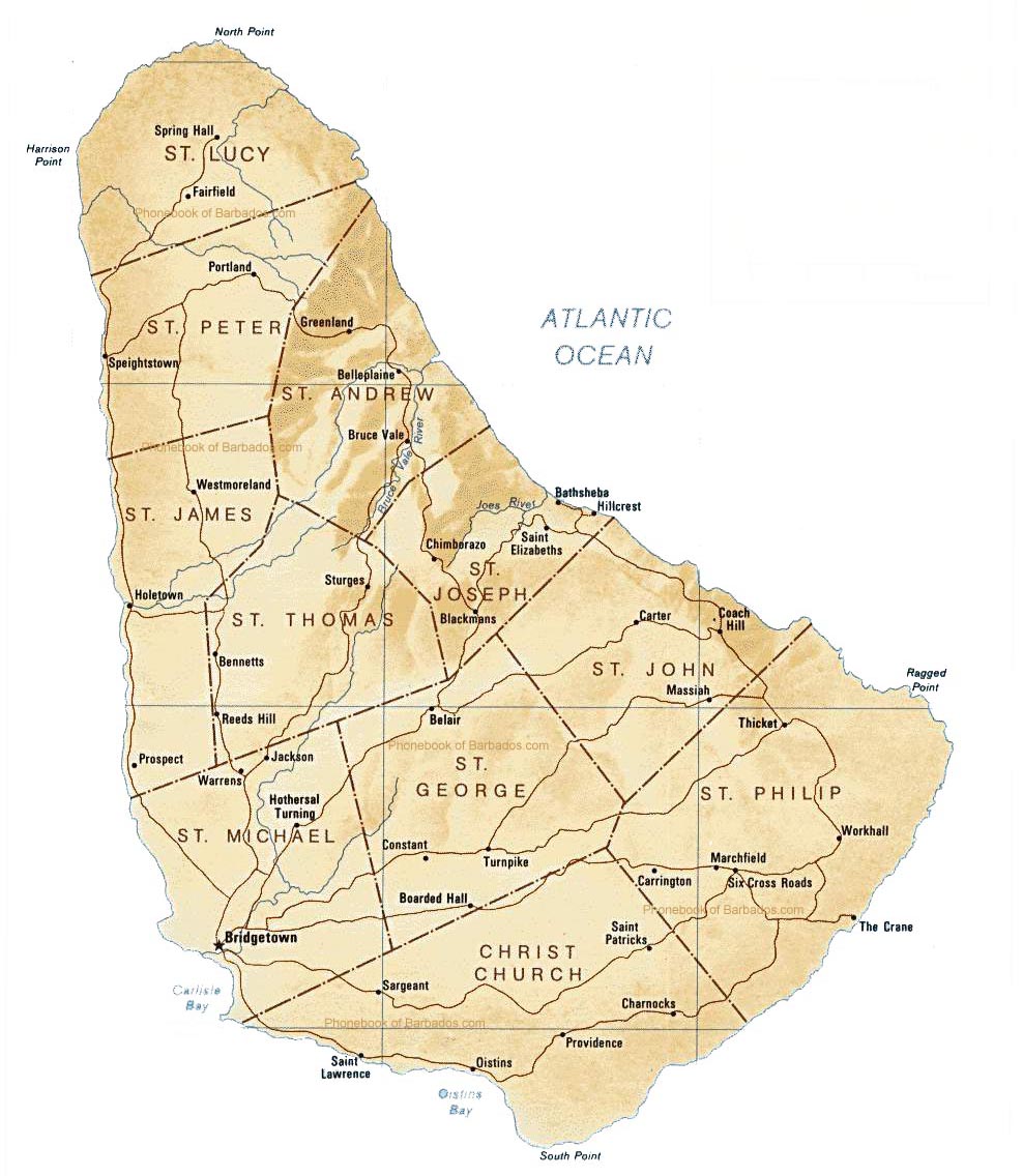
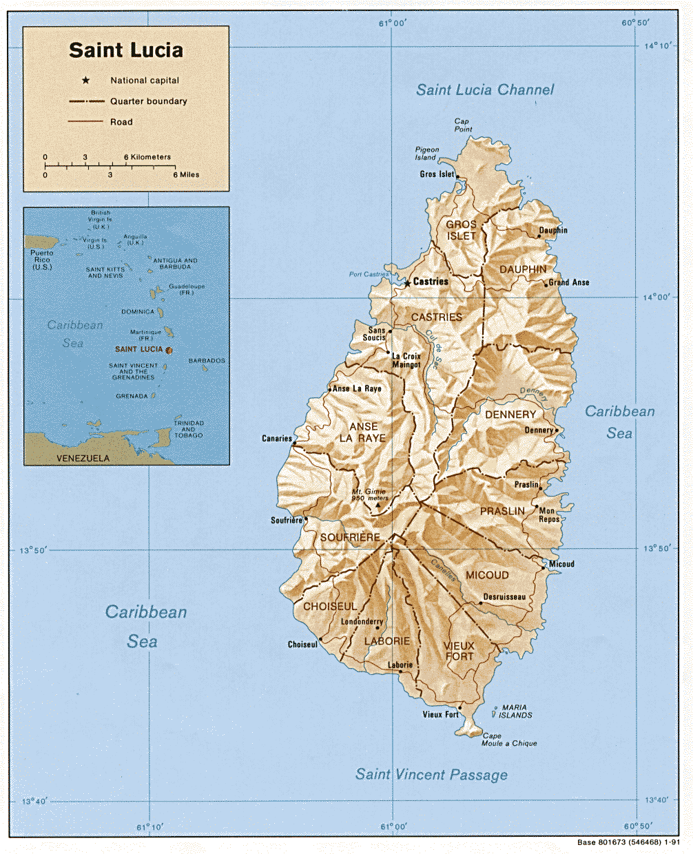
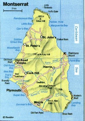
Age: 49
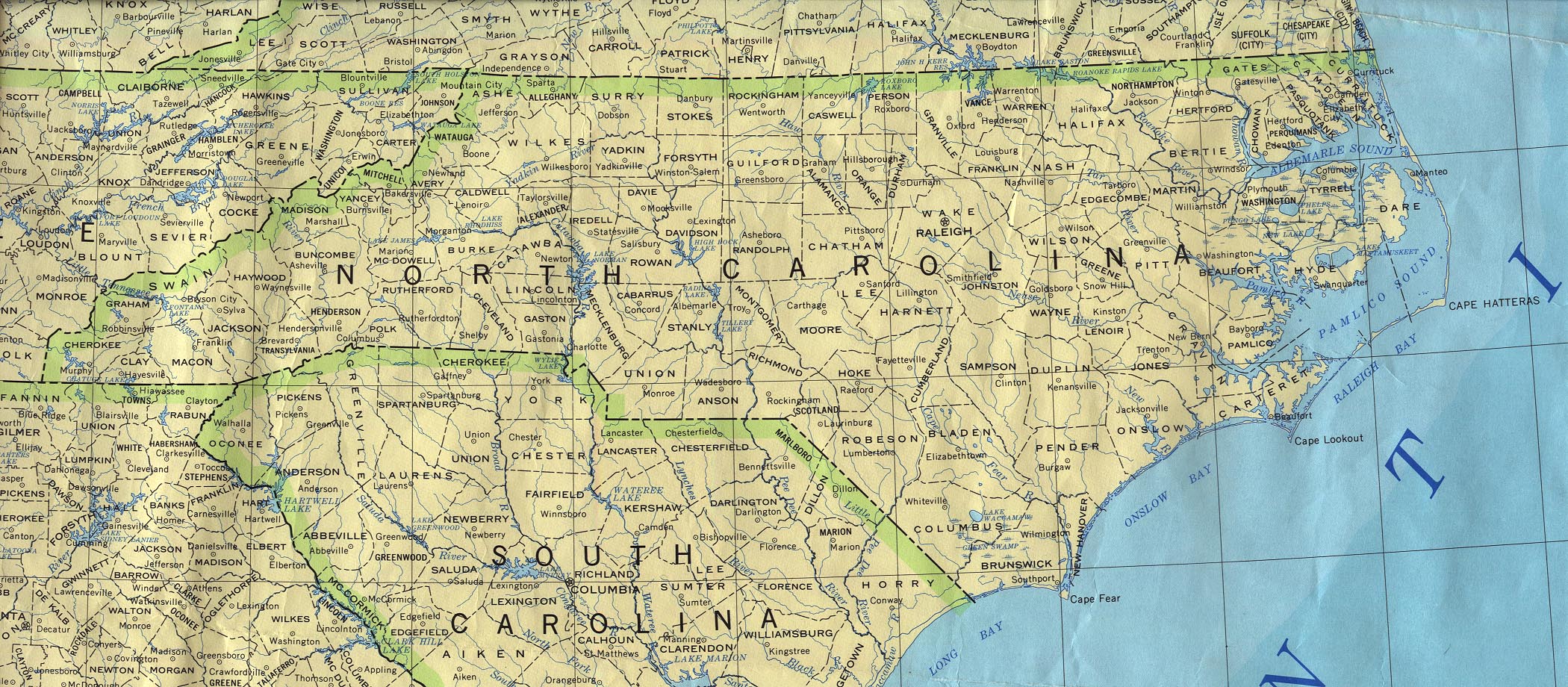
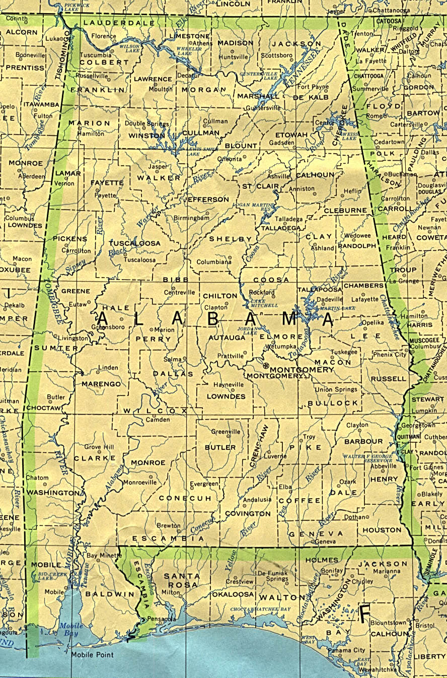
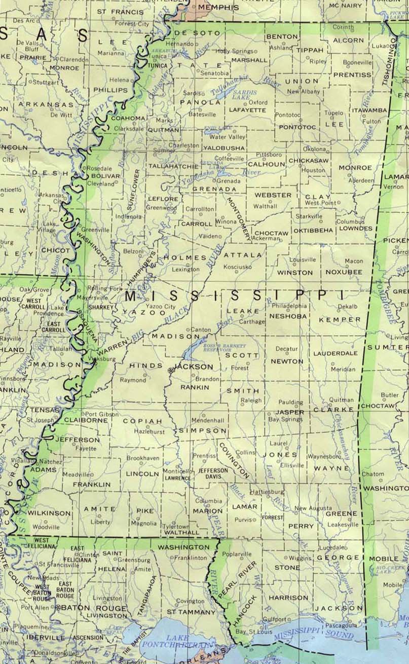
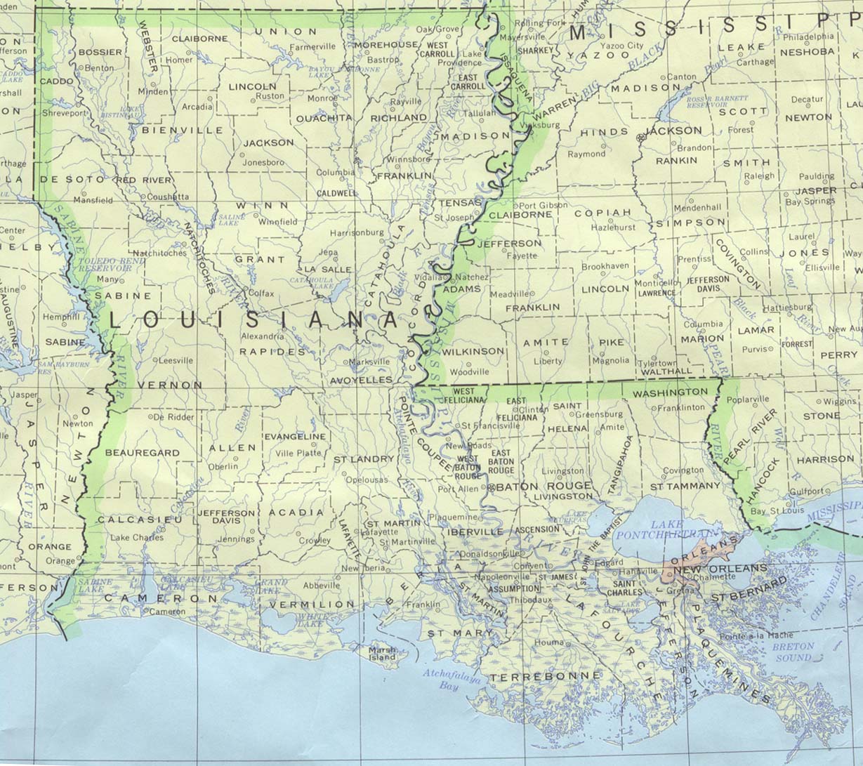
Joined: Tue Aug 31, 2004 8:27 am
Location: Homestead, FL

#23 Postby Canelaw99 » Mon May 30, 2005 8:51 pm

Cyclonaut -Can I be excused? LOL
0 likes   

User avatar
Skywatch_NC
Category 5
Category 5
Posts: 10949
Joined: Wed Feb 05, 2003 9:31 pm
Location: Raleigh, NC
Contact:

#24 Postby Skywatch_NC » Tue May 31, 2005 11:20 pm

cycloneye wrote:
cyclonaut wrote:Even if it cannot be stickied myself & others I'm sure will bring this back often.

OH & the quiz is Wednesday @ 3 Canelaw99..Be There!! :lol:


It is stickied now. :)


Everything looks GREAT here for the 2005 Season, Wxbuddy! :)
0 likes   

User avatar
mobilebay
Category 5
Category 5
Posts: 1853
Age: 51
Joined: Wed Aug 18, 2004 1:22 am
Location: Mobile, Alabama

#25 Postby mobilebay » Wed Jun 01, 2005 5:02 am

Those are very nice. Thanks. :D
0 likes   

User avatar
Skywatch_NC
Category 5
Category 5
Posts: 10949
Joined: Wed Feb 05, 2003 9:31 pm
Location: Raleigh, NC
Contact:

#26 Postby Skywatch_NC » Wed Jun 01, 2005 9:46 am

Thought this had been a sticky earlier today? :)
0 likes   

cyclonaut

#27 Postby cyclonaut » Wed Jun 01, 2005 1:48 pm

Broke the record for fastest sticky ever...Whatever I got the maps saved anyway!
0 likes   

GalvestonDuck
Category 5
Category 5
Posts: 15941
Age: 57
Joined: Fri Oct 11, 2002 8:11 am
Location: Galveston, oh Galveston (And yeah, it's a barrier island. Wanna make something of it?)

#28 Postby GalvestonDuck » Wed Jun 01, 2005 2:05 pm

cyclonaut wrote:Even if it cannot be stickied myself & others I'm sure will bring this back often.

OH & the quiz is Wednesday @ 3 Canelaw99..Be There!! :lol:


I need a pencil sharpener. My #2 broke. :lol:
0 likes   

User avatar
Canelaw99
S2K Supporter
S2K Supporter
Posts: 2128
Age: 49
Joined: Tue Aug 31, 2004 8:27 am
Location: Homestead, FL

#29 Postby Canelaw99 » Wed Jun 01, 2005 2:09 pm

GalvestonDuck wrote:
cyclonaut wrote:Even if it cannot be stickied myself & others I'm sure will bring this back often.

OH & the quiz is Wednesday @ 3 Canelaw99..Be There!! :lol:


I need a pencil sharpener. My #2 broke. :lol:


:eek: We need a #2? I only brought a pen...anyone got a pencil I can borrow?!
0 likes   

User avatar
Canelaw99
S2K Supporter
S2K Supporter
Posts: 2128
Age: 49
Joined: Tue Aug 31, 2004 8:27 am
Location: Homestead, FL

#30 Postby Canelaw99 » Thu Jun 02, 2005 10:50 am

: bumpity bump bump :

Sorry, but it was approaching the bottom of page 1 LOL
0 likes   

User avatar
Agua
Category 5
Category 5
Posts: 1138
Joined: Thu Jul 31, 2003 4:54 pm
Location: Biloxi, Mississippi

#31 Postby Agua » Thu Jun 02, 2005 10:54 am

What's the deal? Running low on stickies or something?
0 likes   

User avatar
Canelaw99
S2K Supporter
S2K Supporter
Posts: 2128
Age: 49
Joined: Tue Aug 31, 2004 8:27 am
Location: Homestead, FL

#32 Postby Canelaw99 » Thu Jun 02, 2005 10:55 am

Agua wrote:What's the deal? Running low on stickies or something?


I have some extra Post-Its :lol:
0 likes   

GalvestonDuck
Category 5
Category 5
Posts: 15941
Age: 57
Joined: Fri Oct 11, 2002 8:11 am
Location: Galveston, oh Galveston (And yeah, it's a barrier island. Wanna make something of it?)

#33 Postby GalvestonDuck » Thu Jun 02, 2005 10:57 am

No need to bump it. Those who have read it...have read it. Those who haven't will still have it marked as unread and the next one to respond will send it back up to the top for the rest of us.
0 likes   

cyclonaut

#34 Postby cyclonaut » Mon Jun 06, 2005 2:34 pm

Guess what?

MORE MAPS! :)

Trinidad & Tobago
Image
Barbados
Image
St.Vincent & The Grenadines+Grenada
Image
St.Lucia
Image
Guadeloupe,Dominica & Martinique
Image
Montserrat
Image
Antigua & Barbuda
Image

More to come soon!
0 likes   

cyclonaut

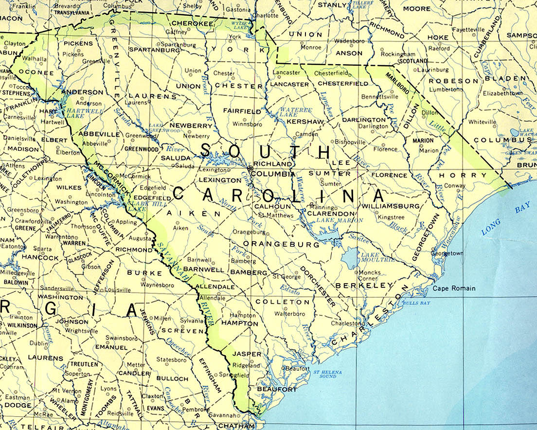
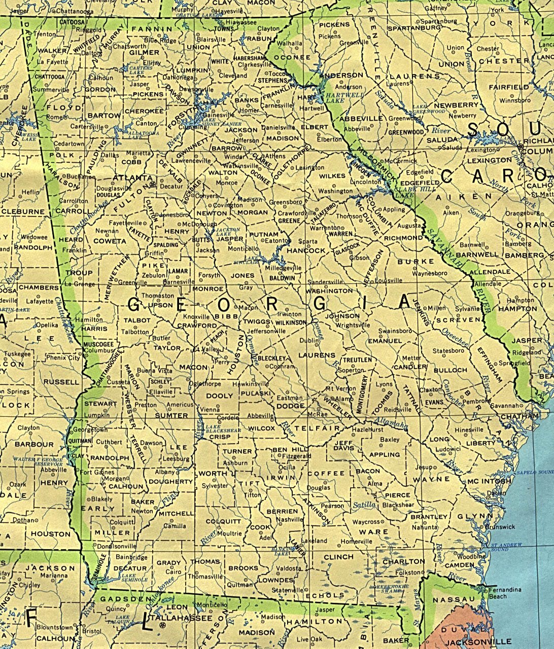
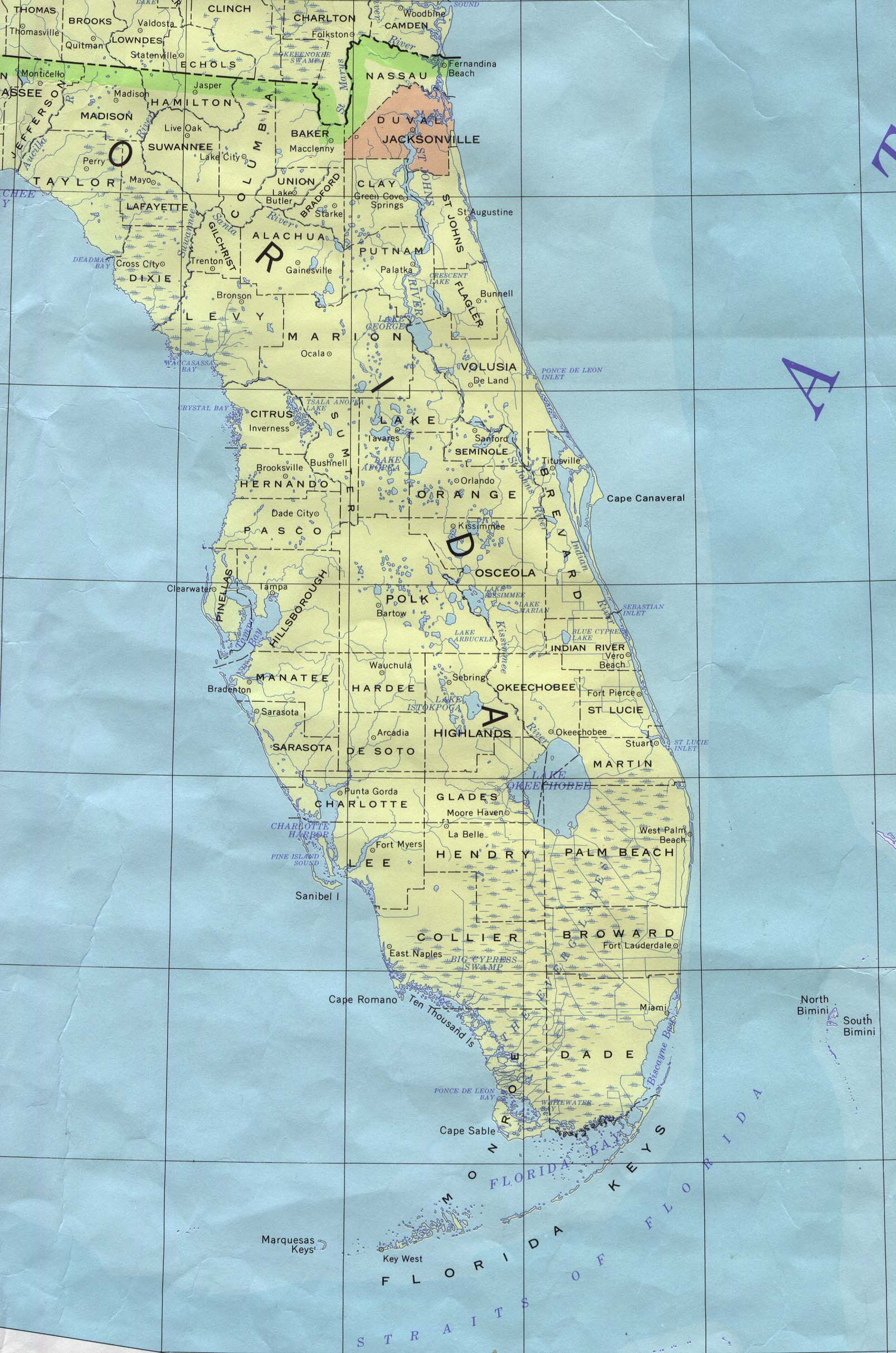
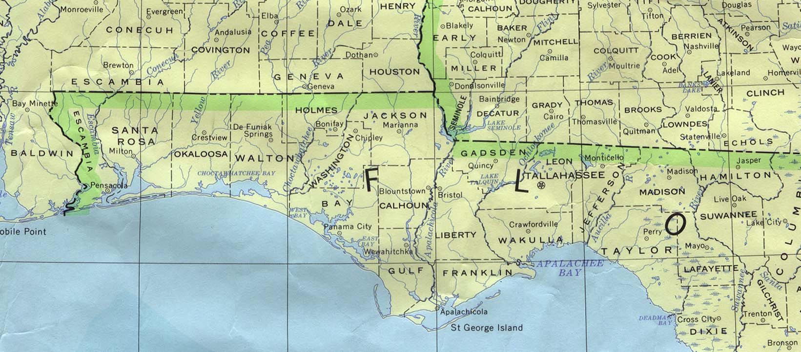
#35 Postby cyclonaut » Wed Jun 08, 2005 11:25 am

Maps for United States hurricane prone areas;
North Carolina
Image
South Carolina
Image
Georgia
Image
Florida Peninsula
Image
Florida Panhandle
Image
Alabama
Image
Mississippi
Image
Louisianna
Image
Texas (EAST)
Image
Last edited by cyclonaut on Wed Jun 15, 2005 11:51 am, edited 1 time in total.
0 likes   

User avatar
HurryKane
Category 5
Category 5
Posts: 1941
Joined: Sun Sep 12, 2004 8:08 pm
Location: Diamondhead, Mississippi

#36 Postby HurryKane » Wed Jun 08, 2005 12:14 pm

The Mississippi map didn't come up; looks like it's an image tag problem and not a problem with the URL itself.
0 likes   

User avatar
Agua
Category 5
Category 5
Posts: 1138
Joined: Thu Jul 31, 2003 4:54 pm
Location: Biloxi, Mississippi

#37 Postby Agua » Wed Jun 08, 2005 12:20 pm

Beat me to it. Was feeling left out. :D
0 likes   

User avatar
HurryKane
Category 5
Category 5
Posts: 1941
Joined: Sun Sep 12, 2004 8:08 pm
Location: Diamondhead, Mississippi

#38 Postby HurryKane » Wed Jun 08, 2005 12:22 pm

Agua wrote:Beat me to it. Was feeling left out. :D


We are always last in everything! :P
0 likes   

cyclonaut

#39 Postby cyclonaut » Wed Jun 15, 2005 11:46 am

MEXICO
Image
0 likes   

User avatar
BayouVenteux
S2K Supporter
S2K Supporter
Posts: 775
Age: 64
Joined: Thu Sep 04, 2003 3:26 pm
Location: Ascension Parish, Louisiana (30.3 N 91.0 W)

#40 Postby BayouVenteux » Wed Jun 15, 2005 12:20 pm

2 additional geography resources that someone may, at one time or another this season, find useful are http://maps.google.com/ , particularly the "Satellite" feature in the upper right-hand corner, which allows the user to move the map orientation to, in essence, "flyover" any area in North America, Central America, and the Caribbean (although the "marked" version map areas are limited to the U.S. and Canada). A nice way to get familiar with a region beyond conventional maps.

Another good resource is Zenith Aircraft's "Virtual GPS", at http://www.zenithair.com/misc/distance.html , which allows the user to measure the direct "as the crow flies" distance between 2 points anywhere in the world, using either lat/lon coordinates or city (even many small towns!) names. Very handy when you want to estimate EXACTLY how far the storm is from you.8-)
0 likes   


Return to “Talkin' Tropics”

Who is online

Users browsing this forum: No registered users and 563 guests