Tropical Storm Dora,Update=Downgraded to Depression

This is the general tropical discussion area. Anyone can take their shot at predicting a storms path.

Moderator: S2k Moderators

Forum rules

The posts in this forum are NOT official forecasts and should not be used as such. They are just the opinion of the poster and may or may not be backed by sound meteorological data. They are NOT endorsed by any professional institution or STORM2K. For official information, please refer to products from the National Hurricane Center and National Weather Service.

Help Support Storm2K
Message
Author
User avatar
cycloneye
Admin
Admin
Posts: 148503
Age: 69
Joined: Thu Oct 10, 2002 10:54 am
Location: San Juan, Puerto Rico

Tropical Storm Dora,Update=Downgraded to Depression

#1 Postby cycloneye » Fri Jul 01, 2005 2:50 pm

Image

Looks like the EPAC will see another Cyclone in the next few days.

A NEW AREA OF DISTURBED WEATHER HAS DEVELOPED ABOUT 225 MILES
SOUTH-SOUTHWEST OF THE GULF OF TEHUANTEPEC. THIS SYSTEM HAS THE
POTENTIAL FOR SOME DEVELOPMENT DURING THE NEXT DAY OR TWO AS IT
MOVES TOWARD THE WEST OR WEST-NORTHWEST.
Last edited by cycloneye on Tue Jul 05, 2005 4:00 pm, edited 9 times in total.
0 likes   

Matt-hurricanewatcher

#2 Postby Matt-hurricanewatcher » Fri Jul 01, 2005 2:51 pm

Hopefully it will form soon. Just got to watch it.
0 likes   

User avatar
skysummit
S2K Supporter
S2K Supporter
Posts: 5305
Age: 49
Joined: Tue Aug 31, 2004 11:09 pm
Location: Ponchatoula, LA
Contact:

#3 Postby skysummit » Fri Jul 01, 2005 2:52 pm

Geez....we're falling behind rapidly!
0 likes   

User avatar
dhweather
S2K Supporter
S2K Supporter
Posts: 6199
Joined: Sat Aug 14, 2004 9:29 pm
Location: Heath, TX
Contact:

#4 Postby dhweather » Fri Jul 01, 2005 2:54 pm

skysummit wrote:Geez....we're falling behind rapidly!


I know, the tropics look more promising on the other side of Panama.
0 likes   

User avatar
HURAKAN
Professional-Met
Professional-Met
Posts: 46086
Age: 38
Joined: Thu May 20, 2004 4:34 pm
Location: Key West, FL
Contact:

#5 Postby HURAKAN » Fri Jul 01, 2005 2:55 pm

Image
0 likes   

User avatar
cycloneye
Admin
Admin
Posts: 148503
Age: 69
Joined: Thu Oct 10, 2002 10:54 am
Location: San Juan, Puerto Rico

#6 Postby cycloneye » Fri Jul 01, 2005 2:57 pm

Let's remember that the EPAC always is ahead of the atlantic as it starts more earlier and because of that the peak for that basin is in august while the atlantic is in september.For sure the atlantic will catch up with the EPAC in terms of the numbers.
0 likes   
Visit the Caribbean-Central America Weather Thread where you can find at first post web cams,radars
and observations from Caribbean basin members Click Here

wxcrazytwo

#7 Postby wxcrazytwo » Fri Jul 01, 2005 2:59 pm

I feel like I am in romper room here. :wink:
0 likes   

User avatar
jdray
Category 3
Category 3
Posts: 853
Joined: Tue Aug 31, 2004 10:07 pm
Location: NE Florida

#8 Postby jdray » Fri Jul 01, 2005 3:19 pm

Northeast Floridians dont like the name Dora....


Grrr.....
0 likes   

User avatar
vacanechaser
Category 5
Category 5
Posts: 1461
Joined: Wed Dec 03, 2003 9:34 pm
Location: Portsmouth, Va
Contact:

#9 Postby vacanechaser » Fri Jul 01, 2005 3:29 pm

Lets just get Dora to be on her way... I believe she is hampering the system in the Caribbean.. Looks like the energy is being stolen, for lack of a better word, by Dora to be... Plus it should be creating some shear... Lets get it on westward and see what happens to the Caribbean system.. They are just too close right now

Jesse V. Bass III
http://www.vastormphoto.com
Hurricane Intercept Research Team
0 likes   
Jesse V. Bass III
http://www.vastormphoto.com
Hurricane Intercept Research Team

User avatar
HURAKAN
Professional-Met
Professional-Met
Posts: 46086
Age: 38
Joined: Thu May 20, 2004 4:34 pm
Location: Key West, FL
Contact:

#10 Postby HURAKAN » Fri Jul 01, 2005 3:30 pm

Image
0 likes   

User avatar
Hurricaneman
Category 5
Category 5
Posts: 7404
Age: 45
Joined: Tue Aug 31, 2004 3:24 pm
Location: central florida

#11 Postby Hurricaneman » Fri Jul 01, 2005 4:12 pm

This might just become Dora in a day or 2
0 likes   

User avatar
jdray
Category 3
Category 3
Posts: 853
Joined: Tue Aug 31, 2004 10:07 pm
Location: NE Florida

#12 Postby jdray » Fri Jul 01, 2005 4:19 pm

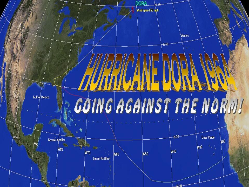
Hurricane Dora 1964
965mb recorded @ St. Augustine Beach.
Winds 125mph.
ftp://ftp.nhc.noaa.gov/pub/storm_archiv ... elim01.gif
ftp://ftp.nhc.noaa.gov/pub/storm_archiv ... elim03.gif

Was a Cat2/3 when it hit land.


Great Photo Library
http://djmabry.org/beaches/dora.html

My favorite?
http://djmabry.org/contributed/dora6.jpg
where is the St Johns River and Where is the sidewalk?
0 likes   

User avatar
LCfromFL
Category 1
Category 1
Posts: 257
Joined: Wed Aug 11, 2004 11:17 pm
Location: NE FL

#13 Postby LCfromFL » Fri Jul 01, 2005 4:37 pm

jdray wrote:Hurricane Dora 1964

My favorite?
http://djmabry.org/contributed/dora6.jpg
where is the St Johns River and Where is the sidewalk?


Wow! Great pic of the St John's. That looks like it was taken from about where The Landing is today. Hard to tell how deep that is, but the riverbank is waaaay back from the camera - where those street lights are by that far fence.

Great pics! Thanks for sharing!
0 likes   

User avatar
cycloneye
Admin
Admin
Posts: 148503
Age: 69
Joined: Thu Oct 10, 2002 10:54 am
Location: San Juan, Puerto Rico

#14 Postby cycloneye » Fri Jul 01, 2005 5:32 pm

ABPZ20 KNHC 012218
TWOEP
TROPICAL WEATHER OUTLOOK
NWS TPC/NATIONAL HURRICANE CENTER MIAMI FL
4 PM PDT FRI JUL 1 2005

FOR THE EASTERN NORTH PACIFIC...EAST OF 140 DEGREES WEST LONGITUDE.

A LARGE AREA OF DISTURBED WEATHER HAS BECOME A LITTLE BETTER
ORGANIZED ABOUT 375 MILES SOUTH-SOUTHEAST OF ACAPULCO MEXICO. SOME
ADDITIONAL DEVELOPMENT IS POSSIBLE DURING THE NEXT DAY OR TWO AS
THE SYSTEM MOVES WESTWARD AT AROUND 10 MPH.


ELSEWHERE...TROPICAL STORM FORMATION IS NOT EXPECTED THROUGH
SATURDAY.

FORECASTER STEWART
0 likes   
Visit the Caribbean-Central America Weather Thread where you can find at first post web cams,radars
and observations from Caribbean basin members Click Here

User avatar
cycloneye
Admin
Admin
Posts: 148503
Age: 69
Joined: Thu Oct 10, 2002 10:54 am
Location: San Juan, Puerto Rico

#15 Postby cycloneye » Fri Jul 01, 2005 5:53 pm

Last edited by cycloneye on Fri Jul 01, 2005 6:05 pm, edited 2 times in total.
0 likes   

User avatar
cycloneye
Admin
Admin
Posts: 148503
Age: 69
Joined: Thu Oct 10, 2002 10:54 am
Location: San Juan, Puerto Rico

#16 Postby cycloneye » Fri Jul 01, 2005 5:59 pm

TROPICAL DEPRESSION INVEST (EP932005) ON 20050701 1800 UTC

...00 HRS... ...12 HRS... ...24 HRS... ...36 HRS...
050701 1800 050702 0600 050702 1800 050703 0600

LAT LON LAT LON LAT LON LAT LON
BAMD 12.5N 96.5W 12.7N 98.2W 13.0N 99.5W 13.4N 100.8W
BAMM 12.5N 96.5W 12.8N 98.1W 13.1N 99.5W 13.5N 100.8W
LBAR 12.5N 96.5W 12.7N 98.3W 13.0N 100.1W 13.5N 102.1W
SHIP 20KTS 28KTS 37KTS 46KTS
DSHP 20KTS 28KTS 37KTS 46KTS

...48 HRS... ...72 HRS... ...96 HRS... ..120 HRS...
050703 1800 050704 1800 050705 1800 050706 1800

LAT LON LAT LON LAT LON LAT LON
BAMD 14.0N 102.1W 15.5N 105.2W 17.4N 109.0W 19.3N 113.2W
BAMM 14.0N 102.1W 15.4N 105.2W 17.3N 108.9W 19.0N 113.4W
LBAR 13.9N 104.3W 15.9N 109.7W 18.6N 115.2W 20.9N 119.8W
SHIP 56KTS 64KTS 60KTS 52KTS
DSHP 56KTS 64KTS 60KTS 52KTS

...INITIAL CONDITIONS...
LATCUR = 12.5N LONCUR = 96.5W DIRCUR = 280DEG SPDCUR = 8KT
LATM12 = 12.3N LONM12 = 94.9W DIRM12 = 277DEG SPDM12 = 8KT
LATM24 = 12.1N LONM24 = 93.3W
WNDCUR = 20KT RMAXWD = 60NM WNDM12 = 15KT
CENPRS = 1009MB OUTPRS = 1011MB OUTRAD = 150NM SDEPTH = D
RD34NE = 0NM RD34SE = 0NM RD34SW = 0NM RD34NW = 0NM


It looks like yes Dora will be forming in the next couple of days as conditions are favorable and the models at this first run reconize that.I am going out on a limb to say that this system with the more south latitud has more warm waters to travel has a real chance to be the second hurricane of the EPAC season.

Image
0 likes   
Visit the Caribbean-Central America Weather Thread where you can find at first post web cams,radars
and observations from Caribbean basin members Click Here

User avatar
cycloneye
Admin
Admin
Posts: 148503
Age: 69
Joined: Thu Oct 10, 2002 10:54 am
Location: San Juan, Puerto Rico

#17 Postby cycloneye » Fri Jul 01, 2005 8:24 pm

TROPICAL DEPRESSION INVEST (EP932005) ON 20050702 0000 UTC

...00 HRS... ...12 HRS... ...24 HRS... ...36 HRS...
050702 0000 050702 1200 050703 0000 050703 1200

LAT LON LAT LON LAT LON LAT LON
BAMD 12.6N 97.3W 12.9N 98.7W 13.2N 99.8W 13.7N 100.9W
BAMM 12.6N 97.3W 12.9N 98.6W 13.2N 99.6W 13.7N 100.6W
LBAR 12.6N 97.3W 12.8N 99.0W 13.1N 100.8W 13.6N 102.8W
SHIP 20KTS 26KTS 35KTS 44KTS
DSHP 20KTS 26KTS 35KTS 44KTS

...48 HRS... ...72 HRS... ...96 HRS... ..120 HRS...
050704 0000 050705 0000 050706 0000 050707 0000

LAT LON LAT LON LAT LON LAT LON
BAMD 14.4N 102.1W 16.1N 105.0W 18.0N 108.6W 19.9N 112.7W
BAMM 14.3N 101.7W 16.1N 104.4W 18.2N 107.9W 20.1N 112.6W
LBAR 14.2N 105.0W 16.5N 110.5W 19.3N 116.1W 21.3N 120.6W
SHIP 54KTS 65KTS 63KTS 52KTS
DSHP 54KTS 65KTS 63KTS 52KTS

...INITIAL CONDITIONS...
LATCUR = 12.6N LONCUR = 97.3W DIRCUR = 280DEG SPDCUR = 8KT
LATM12 = 12.4N LONM12 = 95.7W DIRM12 = 277DEG SPDM12 = 8KT
LATM24 = 12.2N LONM24 = 94.1W
WNDCUR = 20KT RMAXWD = 60NM WNDM12 = 20KT
CENPRS = 1009MB OUTPRS = 1011MB OUTRAD = 150NM SDEPTH = D
RD34NE = 0NM RD34SE = 0NM RD34SW = 0NM RD34NW = 0NM


00:00 UTC run of the models.
0 likes   
Visit the Caribbean-Central America Weather Thread where you can find at first post web cams,radars
and observations from Caribbean basin members Click Here

Scorpion

#18 Postby Scorpion » Fri Jul 01, 2005 8:27 pm

Ahh stupid EPAC.
0 likes   

User avatar
cycloneye
Admin
Admin
Posts: 148503
Age: 69
Joined: Thu Oct 10, 2002 10:54 am
Location: San Juan, Puerto Rico

#19 Postby cycloneye » Fri Jul 01, 2005 9:54 pm

Scorpion wrote:Ahh stupid EPAC.


You are keeping score right? :)
0 likes   
Visit the Caribbean-Central America Weather Thread where you can find at first post web cams,radars
and observations from Caribbean basin members Click Here

User avatar
gatorcane
S2K Supporter
S2K Supporter
Posts: 23703
Age: 47
Joined: Sun Mar 13, 2005 3:54 pm
Location: Boca Raton, FL

#20 Postby gatorcane » Fri Jul 01, 2005 9:57 pm

the EPAC is active as usual...what is the official score now?
0 likes   


Return to “Talkin' Tropics”

Who is online

Users browsing this forum: KirbyDude25, Team Ghost and 584 guests