Center now over the GOM..
Moderator: S2k Moderators
Forum rules

The posts in this forum are NOT official forecasts and should not be used as such. They are just the opinion of the poster and may or may not be backed by sound meteorological data. They are NOT endorsed by any professional institution or STORM2K. For official information, please refer to products from the National Hurricane Center and National Weather Service.


Re: Center now over the GOM..
Big EZ wrote:in latest visible imagery.
Ok, I'll bite....where is it ? I'm not saying there's not one, but I would like to find it. I think if there is one it's just of the northern coast between Merida and Cancun.
0 likes


-
EyeOfTheStorm

- Tropical Low

- Posts: 26
- Joined: Mon Aug 09, 2004 2:20 pm
- Location: Texas
-
EyeOfTheStorm
- Tropical Low
- Posts: 26
- Joined: Mon Aug 09, 2004 2:20 pm
- Location: Texas
[quote="Janice"]Here is a nice view of the system...
http://www.ssd.noaa.gov/PS/TROP/DATA/RT ... -loop.html[/
quote]
Here is a better view
http://weather.cod.edu/analysis/loops/s ... n&type=vis
http://www.ssd.noaa.gov/PS/TROP/DATA/RT ... -loop.html[/
quote]
Here is a better view
http://weather.cod.edu/analysis/loops/s ... n&type=vis
0 likes
-
EyeOfTheStorm
- Tropical Low
- Posts: 26
- Joined: Mon Aug 09, 2004 2:20 pm
- Location: Texas
-
Guest
EyeOfTheStorm wrote:Janice wrote:Here is a nice view of the system...
http://www.ssd.noaa.gov/PS/TROP/DATA/RT ... -loop.html[/
quote]
Here is a better view
http://weather.cod.edu/analysis/loops/s ... n&type=vis
Great sat. u can clearly see the circulation, with good inflow and outflow reestablishing itself in all quads
0 likes
-
dolebot_Broward_NW
- Category 2

- Posts: 529
- Joined: Fri Sep 10, 2004 6:38 am
Cancun Radar
I don't speak Spanish, but I understood enough to find the cancun radar. There doesn't seem to be another nearer to the storm, and this one seems to fizzle out halfway across the yucatan.
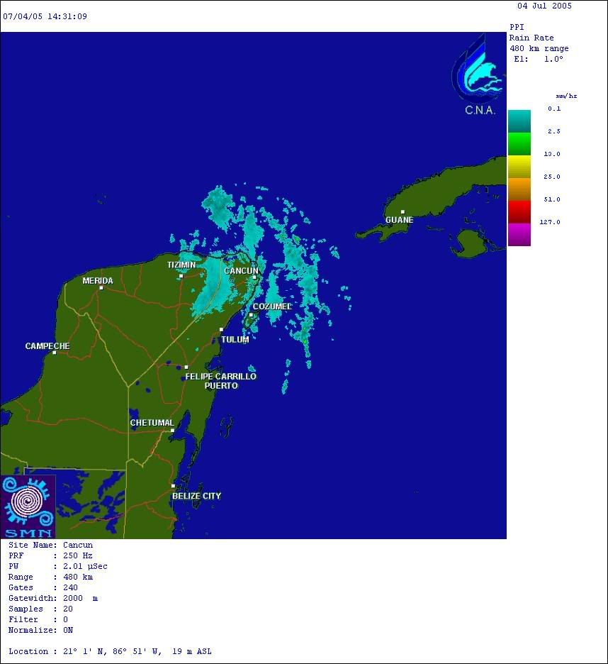
Unless either the storm is that weak, or the radar sux.
Unless either the storm is that weak, or the radar sux.
0 likes
casper wrote:What do you see Hiflyer?
Whelp all radars have a tendacy to make things circular...mostly referring to the outer edges of the returns. Secondly this thing is not animating right now...did last year....which does not help. Third...as someone pointed out I think it is blinded a bit by near return and not picking up far stuff on the west side. I don't think that was a center near Tizimin..think it is off the beach now on the north side of the coast.....imho. Think the Tizimin circular was just another chunk of energy moving north...been watching the water vapor loops overnight and the flow of energy north was interesting.
0 likes
-
Dean4Storms
- S2K Supporter

- Posts: 6358
- Age: 62
- Joined: Sun Aug 31, 2003 1:01 pm
- Location: Miramar Bch. FL
So you're thinking NW of Cancun then that sounds reasonable this pic someone thru out earlier I think verifies that some.
http://www.rap.ucar.edu/weather/satelli ... duration=6
http://www.rap.ucar.edu/weather/satelli ... duration=6
Last edited by Javlin on Mon Jul 04, 2005 10:17 am, edited 1 time in total.
0 likes


EyeOfTheStorm wrote:Janice wrote:Here is a nice view of the system...
http://www.ssd.noaa.gov/PS/TROP/DATA/RT ... -loop.html[/
quote]
Here is a better view
http://weather.cod.edu/analysis/loops/s ... n&type=vis
Hey, thanks for that link - that's a good focus for the GOM !
And you can see the trough digging east across Oklahoma in the frames,
which will also contribute to an eastward shift in later guidance.
THIS IS NOT AN OFFICIAL FORECAST IN ANY WAY !!!!!
I suspect that Texas' odds of seeing a landfall of any type (TD/TS/H)
from this are getting much closer to zero.
0 likes
Who is online
Users browsing this forum: hcane27 and 93 guests