Cindy looks serious on satellite
Moderator: S2k Moderators
Forum rules

The posts in this forum are NOT official forecasts and should not be used as such. They are just the opinion of the poster and may or may not be backed by sound meteorological data. They are NOT endorsed by any professional institution or STORM2K. For official information, please refer to products from the National Hurricane Center and National Weather Service.


-
Matt-hurricanewatcher
I agree.
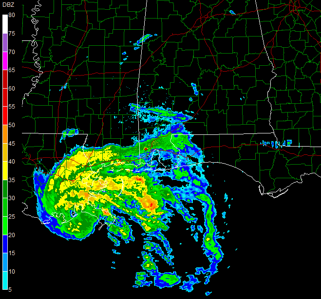
To all the people in this storms path. This system is not a Arlene do not treat it like it. Arlene only had 45 mph winds with 50 mph gust over land. Most of its winds stayed off shore. This storm has in fact has a large area of 60 to 70 mph surface winds. In there is some unoffical reports of those 70 to 75 mph winds making it onshore(Said by Sean In New orleans) Please take this system seriously people.!!!
To all the people in this storms path. This system is not a Arlene do not treat it like it. Arlene only had 45 mph winds with 50 mph gust over land. Most of its winds stayed off shore. This storm has in fact has a large area of 60 to 70 mph surface winds. In there is some unoffical reports of those 70 to 75 mph winds making it onshore(Said by Sean In New orleans) Please take this system seriously people.!!!
0 likes
Who is online
Users browsing this forum: No registered users and 48 guests