Invest 94E for EPAC

This is the general tropical discussion area. Anyone can take their shot at predicting a storms path.

Moderator: S2k Moderators

Forum rules

The posts in this forum are NOT official forecasts and should not be used as such. They are just the opinion of the poster and may or may not be backed by sound meteorological data. They are NOT endorsed by any professional institution or STORM2K. For official information, please refer to products from the National Hurricane Center and National Weather Service.

Help Support Storm2K
Message
Author
User avatar
cycloneye
Admin
Admin
Posts: 148501
Age: 69
Joined: Thu Oct 10, 2002 10:54 am
Location: San Juan, Puerto Rico

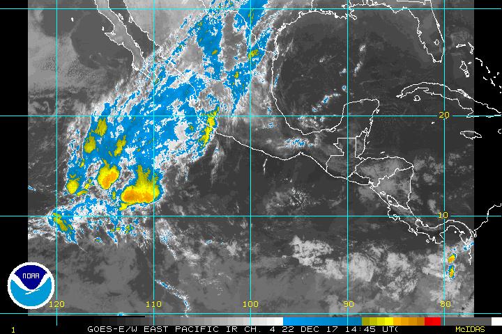
Invest 94E for EPAC

#1 Postby cycloneye » Sun Jul 17, 2005 8:09 pm

Image

New Invest for EPAC.
0 likes   

User avatar
deltadog03
Professional-Met
Professional-Met
Posts: 3580
Joined: Tue Jul 05, 2005 6:16 pm
Location: Macon, GA

Re: Invest 94E for EPAC

#2 Postby deltadog03 » Sun Jul 17, 2005 8:10 pm

cycloneye wrote:Image

New Invest for EPAC.


hey clcloneye....great work BTW...guess what model showed this thing the other day??? mmmmm MM5
0 likes   

Matt-hurricanewatcher

#3 Postby Matt-hurricanewatcher » Sun Jul 17, 2005 8:10 pm

Looks very good...Nice banding already forming with a LLC showing up on quickscats.

http://manati.orbit.nesdis.noaa.gov/dat ... MBas14.png
0 likes   

Matt-hurricanewatcher

#4 Postby Matt-hurricanewatcher » Sun Jul 17, 2005 8:10 pm

Guest what model forecasted Cindy...You got it MM5.


Also this storm could also be a factor with Emily.
0 likes   

User avatar
deltadog03
Professional-Met
Professional-Met
Posts: 3580
Joined: Tue Jul 05, 2005 6:16 pm
Location: Macon, GA

#5 Postby deltadog03 » Sun Jul 17, 2005 8:11 pm

Matt-hurricanewatcher wrote:Guest what model forecasted Cindy...You got it MM5.


LOL....
0 likes   

User avatar
cycloneye
Admin
Admin
Posts: 148501
Age: 69
Joined: Thu Oct 10, 2002 10:54 am
Location: San Juan, Puerto Rico

#6 Postby cycloneye » Sun Jul 17, 2005 8:45 pm

17/2345 UTC 14.8N 103.3W T1.0/1.0 94E -- East Pacific Ocean


First T numbers for invest 94E.

Image
0 likes   
Visit the Caribbean-Central America Weather Thread where you can find at first post web cams,radars
and observations from Caribbean basin members Click Here

User avatar
EDR1222
S2K Supporter
S2K Supporter
Posts: 1253
Joined: Mon Nov 10, 2003 12:58 pm
Location: Melbourne, FL

#7 Postby EDR1222 » Sun Jul 17, 2005 10:39 pm

Looks like 94E is well on its way. It will be interesting to see if it has any effect on Emily.
0 likes   

User avatar
Wnghs2007
Category 5
Category 5
Posts: 6836
Age: 36
Joined: Wed Mar 24, 2004 11:14 pm
Location: Gwinnett-Barrow Line; Georgia
Contact:

#8 Postby Wnghs2007 » Sun Jul 17, 2005 10:44 pm

What is going to be the Next Name for a Pacific Storm? Anyone know?
0 likes   

Matt-hurricanewatcher

#9 Postby Matt-hurricanewatcher » Sun Jul 17, 2005 10:45 pm

Eugene to tie the Atlatnic.
0 likes   

User avatar
Wnghs2007
Category 5
Category 5
Posts: 6836
Age: 36
Joined: Wed Mar 24, 2004 11:14 pm
Location: Gwinnett-Barrow Line; Georgia
Contact:

#10 Postby Wnghs2007 » Sun Jul 17, 2005 10:49 pm

Matt-hurricanewatcher wrote:Eugene to tie the Atlatnic.


Thanks Matt! I feel kind of silly because I didnt know that but I guess I have only been concentrating on the Atlantic for the past few weeks and months.
0 likes   

Derek Ortt

#11 Postby Derek Ortt » Sun Jul 17, 2005 10:55 pm

um, Matt


It was the UM MM5 that forecasted Cindy the best. The FSU model is NOT the same as our model
0 likes   

User avatar
HURAKAN
Professional-Met
Professional-Met
Posts: 46086
Age: 38
Joined: Thu May 20, 2004 4:34 pm
Location: Key West, FL
Contact:

Possible Tropical Cyclone Development in 36 hours = EUGENE

#12 Postby HURAKAN » Sun Jul 17, 2005 11:29 pm

Image
0 likes   

User avatar
P.K.
Professional-Met
Professional-Met
Posts: 5149
Joined: Thu Sep 23, 2004 5:57 pm
Location: Watford, England
Contact:

#13 Postby P.K. » Mon Jul 18, 2005 4:37 am

18/0545 UTC 14.8N 103.5W T1.0/1.0 94E -- East Pacific Ocean
0 likes   

User avatar
cycloneye
Admin
Admin
Posts: 148501
Age: 69
Joined: Thu Oct 10, 2002 10:54 am
Location: San Juan, Puerto Rico

#14 Postby cycloneye » Mon Jul 18, 2005 6:11 am

TWOEP
TROPICAL WEATHER OUTLOOK
NWS TPC/NATIONAL HURRICANE CENTER MIAMI FL
4 AM PDT MON JUL 18 2005

FOR THE EASTERN NORTH PACIFIC...EAST OF 140 DEGREES WEST LONGITUDE.

SATELLITE IMAGES SUGGEST THAT THE TROPICAL DISTURBANCE LOCATED ABOUT
330 MILES WEST-SOUTHWEST OF ACAPULCO CONTINUES TO BECOME BETTER
ORGANIZED. THIS SYSTEM IS MOVING SLOWLY WEST-NORTHWESTWARD...AND
IF THE CURRENT DEVELOPMENT TREND CONTINUES...ADVISORIES WILL BE
INITIATED ON THIS SYSTEM LATER THIS MORNING.

ELSEWHERE...TROPICAL STORM FORMATION IS NOT EXPECTED THROUGH
TUESDAY.

FORECASTER FRANKLIN


Depression later this morning.

Image
0 likes   
Visit the Caribbean-Central America Weather Thread where you can find at first post web cams,radars
and observations from Caribbean basin members Click Here

User avatar
wx247
S2K Supporter
S2K Supporter
Posts: 14279
Age: 42
Joined: Wed Feb 05, 2003 10:35 pm
Location: Monett, Missouri
Contact:

#15 Postby wx247 » Mon Jul 18, 2005 6:31 am

I'd say so. Very nice already!
0 likes   
Personal Forecast Disclaimer:
The posts in this forum are NOT official forecast and should not be used as such. They are just the opinion of the poster and may or may not be backed by sound meteorological data. They are NOT endorsed by any professional institution or storm2k.org. For official information, please refer to the NHC and NWS products.

User avatar
cycloneye
Admin
Admin
Posts: 148501
Age: 69
Joined: Thu Oct 10, 2002 10:54 am
Location: San Juan, Puerto Rico

#16 Postby cycloneye » Mon Jul 18, 2005 7:28 am

18/1145 UTC 14.6N 104.4W T2.0/2.0 94E -- East Pacific Ocean


TD5-E.
0 likes   
Visit the Caribbean-Central America Weather Thread where you can find at first post web cams,radars
and observations from Caribbean basin members Click Here

Matt-hurricanewatcher

#17 Postby Matt-hurricanewatcher » Mon Jul 18, 2005 7:31 am

In the Eastern Pacific hits one out of the park... :P
0 likes   

User avatar
Hurricanehink
S2K Supporter
S2K Supporter
Posts: 2044
Joined: Sun Nov 16, 2003 2:05 pm
Location: New Jersey

#18 Postby Hurricanehink » Mon Jul 18, 2005 8:47 am

Yep, official on NRL. 5E
0 likes   

User avatar
P.K.
Professional-Met
Professional-Met
Posts: 5149
Joined: Thu Sep 23, 2004 5:57 pm
Location: Watford, England
Contact:

#19 Postby P.K. » Mon Jul 18, 2005 10:09 am

000
WTPZ25 KNHC 181441
TCMEP5
TROPICAL STORM EUGENE FORECAST/ADVISORY NUMBER 1
NWS TPC/NATIONAL HURRICANE CENTER MIAMI FL EP052005
1500Z MON JUL 18 2005

TROPICAL STORM CENTER LOCATED NEAR 15.1N 105.6W AT 18/1500Z
POSITION ACCURATE WITHIN 30 NM

PRESENT MOVEMENT TOWARD THE WEST-NORTHWEST OR 285 DEGREES AT 12 KT

ESTIMATED MINIMUM CENTRAL PRESSURE 1000 MB

MAX SUSTAINED WINDS 35 KT WITH GUSTS TO 45 KT.
34 KT....... 30NE 20SE 15SW 15NW.
12 FT SEAS.. 30NE 30SE 30SW 30NW.
WINDS AND SEAS VARY GREATLY IN EACH QUADRANT. RADII IN NAUTICAL
MILES ARE THE LARGEST RADII EXPECTED ANYWHERE IN THAT QUADRANT.

REPEAT...CENTER LOCATED NEAR 15.1N 105.6W AT 18/1500Z
AT 18/1200Z CENTER WAS LOCATED NEAR 14.9N 105.1W

FORECAST VALID 19/0000Z 15.6N 107.2W
MAX WIND 40 KT...GUSTS 50 KT.
34 KT... 40NE 20SE 20SW 30NW.

FORECAST VALID 19/1200Z 16.5N 109.2W
MAX WIND 45 KT...GUSTS 55 KT.
34 KT... 60NE 40SE 30SW 60NW.

FORECAST VALID 20/0000Z 17.7N 111.2W
MAX WIND 50 KT...GUSTS 60 KT.
50 KT... 25NE 0SE 0SW 0NW.
34 KT... 75NE 40SE 40SW 75NW.

FORECAST VALID 20/1200Z 18.7N 113.3W
MAX WIND 40 KT...GUSTS 50 KT.
34 KT... 75NE 40SE 40SW 75NW.

FORECAST VALID 21/1200Z 20.0N 117.5W
MAX WIND 30 KT...GUSTS 40 KT.

EXTENDED OUTLOOK. NOTE...ERRORS FOR TRACK HAVE AVERAGED NEAR 200 NM
ON DAY 4 AND 250 NM ON DAY 5...AND FOR INTENSITY NEAR 20 KT EACH DAY

OUTLOOK VALID 22/1200Z 20.5N 120.5W...DISSIPATING
MAX WIND 25 KT...GUSTS 35 KT.

OUTLOOK VALID 23/1200Z 20.5N 123.5W...REMNANT LOW
MAX WIND 20 KT...GUSTS 25 KT.

REQUEST FOR 3 HOURLY SHIP REPORTS WITHIN 300 MILES OF 15.1N 105.6W

NEXT ADVISORY AT 18/2100Z

FORECASTER KNABB
0 likes   


Return to “Talkin' Tropics”

Who is online

Users browsing this forum: No registered users and 209 guests