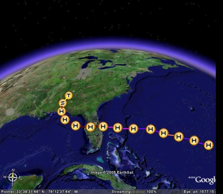
Well I might as well do one,used Google earth to get this,so here's the images,each little letter is 12hrs into the future,T stands for Tropical depression,S for tropical storm and H for hurricane:
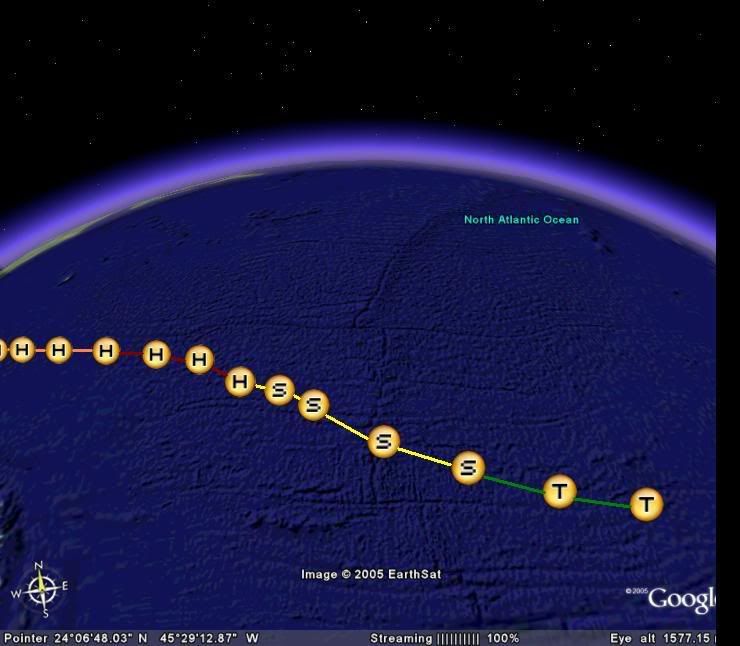
strength forecast:
12hrs:25kts
24hrs:35kts
36hrs:40kts
48hrs:50kts
60hrs:60kts
72hrs:65kts
84hrs:70kts
96hrs:75kts
108hrs:80kts
120hrs:90kts
132hrs:95kt
144hrs:100kts
156hrs:105kts
168hrs:100kts
180hrs:90kts(eyewall replacement)
192hrs:100kts
204hrs:110kts
216hrs:115kts
228hrs:120kts(starting eyewall replacement)
240hrs:80kts
252hrs:65kts
264hrs:75kts
276hrs:85kts
288hrs:65kts
300hrs:40kts
312hrs:25kts
Of course this is only my best guess and the later half will probably as badly forecast as GFS normal FI rubbish.I suppose the best way to describe this is abit like Frances last year.I suspect that the first 48hrs may be a bit optimistic and also it reaching category-2 in the GOM would largely depend on wether it comes out of Florida with a good structure or not.
As for the track,I belive that Harvey is now weakening quite quickly and if this continues to occur then the ridge may not be quite so badly affected by Harvey,which means that the storm may only take a WNW/NW track in the main before the ridge starts to build back somewhat sending it back on a W/WNW track,however although I veiw a Florida landfall as possible,certainly a east coast landfall is more then possible if it picks up more latitude then I expect and the ridge is indeed affected worse then I expected by Harvey.This is my ideas and as such this is required:
The following post is NOT an official forecast and should not be used as such. It is just the opinion of the poster and may or may not be backed by sound meteorological data. It is NOT endorsed by any professional institution including storm2k.org For Official Information please refer to the NHC and NWS products. 


