MJO
Moderator: S2k Moderators
Forum rules

The posts in this forum are NOT official forecasts and should not be used as such. They are just the opinion of the poster and may or may not be backed by sound meteorological data. They are NOT endorsed by any professional institution or STORM2K. For official information, please refer to products from the National Hurricane Center and National Weather Service.
-
AussieMark

- Category 5

- Posts: 5857
- Joined: Tue Sep 02, 2003 6:36 pm
- Location: near Sydney, Australia
I'm not an expert on MJO, but, I believe it means that if the theory is correct, there would be weaker tropical disturbances (or low pressure systems) exiting Africa.
If some here are correct, and "favorable" MJO conditions do not return to the Atlantic until at least mid-August, then, other issues would need to be considered as well - like the possibility of an early Fall season. In the past week, there have been two relatively strong cold fronts sweeping eastward across the U.S. - still a bit early, but, perhaps this is a sign of an early Fall season, which would impact the outcome of the Atlantic hurricane season.
In the end, the negative MJO might have a well-timed outcome, and is why I'm not convinced that NOAA's forecasted totals will become fact.
Frank
0 likes


The MJO goes in 30-day cycles, therefore it is going in that cycle at the right time. The positive phase should be with us through the heart of the season, give a week or two of a negative phase.
The NAO has been positive until the last week when it has gone negative which results in more of a trough across the Eastern Seaboard. It is beginning to go more positive again.
The NAO has been positive until the last week when it has gone negative which results in more of a trough across the Eastern Seaboard. It is beginning to go more positive again.
0 likes
-
wxcrazytwo
Frank2 wrote:I'm not an expert on MJO, but, I believe it means that if the theory is correct, there would be weaker tropical disturbances (or low pressure systems) exiting Africa.
If some here are correct, and "favorable" MJO conditions do not return to the Atlantic until at least mid-August, then, other issues would need to be considered as well - like the possibility of an early Fall season. In the past week, there have been two relatively strong cold fronts sweeping eastward across the U.S. - still a bit early, but, perhaps this is a sign of an early Fall season, which would impact the outcome of the Atlantic hurricane season.
In the end, the negative MJO might have a well-timed outcome, and is why I'm not convinced that NOAA's forecasted totals will become fact.
Frank
Okay, keep telling yourself that...
0 likes
-
WeatherEmperor
- S2K Supporter

- Posts: 4806
- Age: 42
- Joined: Thu Sep 04, 2003 2:54 pm
- Location: South Florida
wxcrazytwo wrote:Frank2 wrote:I'm not an expert on MJO, but, I believe it means that if the theory is correct, there would be weaker tropical disturbances (or low pressure systems) exiting Africa.
If some here are correct, and "favorable" MJO conditions do not return to the Atlantic until at least mid-August, then, other issues would need to be considered as well - like the possibility of an early Fall season. In the past week, there have been two relatively strong cold fronts sweeping eastward across the U.S. - still a bit early, but, perhaps this is a sign of an early Fall season, which would impact the outcome of the Atlantic hurricane season.
In the end, the negative MJO might have a well-timed outcome, and is why I'm not convinced that NOAA's forecasted totals will become fact.
Frank
Okay, keep telling yourself that...
I know. Id rather put my money on Dr.Gray and his years and years of experience.
<RICKY>
0 likes
Say what you folks want to say or believe, but, the pattern IS different from last season, in several ways.
With all due respect to those currently in the business, I'd be interested to know what those who I worked for in the 1980's (Stan Rosenthal, John Hope, Bob Sheets, etc.) would say about the current trends - since they were all more practical-minded in their thinking, I'll guess and say that they wouldn't be quite so eager to jump at the current extreme forecast carrot.
In fact, my first employer in the business was very much against the "crystal ball" approach to very long-term weather forecasting, citing that it created more tabloid-type material than anything - some of the posts on this board give validation to his comment.
Frank
1 likes
-
wxcrazytwo
Frank2 wrote:Say what you folks want to say or believe, but, the pattern IS different from last season, in several ways.
With all due respect to those currently in the business, I'd be interested to know what those who I worked for in the 1980's (Stan Rosenthal, John Hope, Bob Sheets, etc.) would say about the current trends - since they were all more practical-minded in their thinking, I'll guess and say that they wouldn't be quite so eager to jump at the current extreme forecast carrot.
In fact, my first employer in the business was very much against the "crystal ball" approach to very long-term weather forecasting, citing that it created more tabloid-type material than anything - some of the posts on this board give validation to his comment.
Frank
Dude, this is year is different than last year and in other years as well. However, much science has been done for NOAA to issue this kind of report. And not only that, but Dr. Gray has come up with the same kind f numbers. You just cannot disregard these kind of predictions. It is people like you who enforce the complacency people have when canes do come their, and when they hit you wonder why and why you were not informed earlier. I hear it all the time. Too much science behind the numbers..
0 likes
-
Andrew92

- S2K Supporter
- Posts: 3247
- Age: 42
- Joined: Mon Jun 16, 2003 12:35 am
- Location: Phoenix, Arizona
Frank2 wrote:I'm not an expert on MJO, but, I believe it means that if the theory is correct, there would be weaker tropical disturbances (or low pressure systems) exiting Africa.
If some here are correct, and "favorable" MJO conditions do not return to the Atlantic until at least mid-August, then, other issues would need to be considered as well - like the possibility of an early Fall season. In the past week, there have been two relatively strong cold fronts sweeping eastward across the U.S. - still a bit early, but, perhaps this is a sign of an early Fall season, which would impact the outcome of the Atlantic hurricane season.
In the end, the negative MJO might have a well-timed outcome, and is why I'm not convinced that NOAA's forecasted totals will become fact.
Frank
You have some good points and are knowledgeable in most of your posts. However, I can't help but disagree with this post about potentially "an early Fall." Do you know what the correlation is between the favorable MJO and an early Fall. I don't personally, but I'll tell you why I disagree.
I'm seeing that we are gradually getting back into the favorable MJO (seeing more green lines in the Atlantic, fewer brown lines). That doesn't mean we actually are in the heart of the favorable, just that conditions will get more favorable. However, right now, where I am in Northern Michigan, it is in the 90s today with high humidity, which is over 10 degrees above average for this time of year. While it is supposed to cool down some over the next couple days, it is then forecast to warm back up for at least the early part of next week.
I know those long-range forecasts need to be taken with a grain of salt, but I am not really thinking we're going to have an early Fall this year.
-Andrew92
0 likes
-
LSU2001

- S2K Supporter
- Posts: 1711
- Age: 58
- Joined: Sat Sep 11, 2004 11:01 pm
- Location: Cut Off, Louisiana
Frank2 wrote:I'm not an expert on MJO, but, I believe it means that if the theory is correct, there would be weaker tropical disturbances (or low pressure systems) exiting Africa.
If some here are correct, and "favorable" MJO conditions do not return to the Atlantic until at least mid-August, then, other issues would need to be considered as well - like the possibility of an early Fall season. In the past week, there have been two relatively strong cold fronts sweeping eastward across the U.S. - still a bit early, but, perhaps this is a sign of an early Fall season, which would impact the outcome of the Atlantic hurricane season.
In the end, the negative MJO might have a well-timed outcome, and is why I'm not convinced that NOAA's forecasted totals will become fact.
Frank
Lets see relatively strong cold fronts hmmmmmm, didn't charley's change of direction come from an early or late (depends how you look at it) cold front. I seem to remember record lows during july and aug. last year. I personally do not see the correlation between a couple of strong fronts and an early end to the season. I am not disagreeing that the season may be overhyped but I cannot see an early end when we have not even reached the usual peak of the season.
Just my 2 cents
TIm
0 likes
Personal Forecast Disclaimer:
The posts in this forum are NOT official forecast and should not be used as such. They are NOT endorsed by any professional institution or storm2k.org. For official information, please refer to the NHC and NWS products.
The posts in this forum are NOT official forecast and should not be used as such. They are NOT endorsed by any professional institution or storm2k.org. For official information, please refer to the NHC and NWS products.
-
cycloneye

- Admin

- Posts: 149276
- Age: 69
- Joined: Thu Oct 10, 2002 10:54 am
- Location: San Juan, Puerto Rico

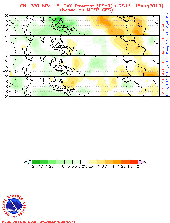
Still some dry MJO is in the atlantic but the green lines in the pacific are about to come into the basin shortly.But it will be a slow proccess towards favorable conditions in the atlantic as I haved been saying from mid to late august and foward.
0 likes
Visit the Caribbean-Central America Weather Thread where you can find at first post web cams,radars
and observations from Caribbean basin members Click Here
and observations from Caribbean basin members Click Here
-
Tampa Bay Hurricane

- Category 5
- Posts: 5597
- Age: 38
- Joined: Fri Jul 22, 2005 7:54 pm
- Location: St. Petersburg, FL

-
cycloneye
- Admin
- Posts: 149276
- Age: 69
- Joined: Thu Oct 10, 2002 10:54 am
- Location: San Juan, Puerto Rico
Still the Atlantic is not favorable for an active period of cyclones although there is now Irene but look at how much time it has taken for that system to become a storm and a minimal one as it's fighting for it's survival thanks to the unfavorable conditions that the MJO is creating combined with the negative NAO but that factor is for another thread.Late August is when now I see things starting to look very favorable.
0 likes
Visit the Caribbean-Central America Weather Thread where you can find at first post web cams,radars
and observations from Caribbean basin members Click Here
and observations from Caribbean basin members Click Here
-
Tampa Bay Hurricane
- Category 5
- Posts: 5597
- Age: 38
- Joined: Fri Jul 22, 2005 7:54 pm
- Location: St. Petersburg, FL
-
Tampa Bay Hurricane
- Category 5
- Posts: 5597
- Age: 38
- Joined: Fri Jul 22, 2005 7:54 pm
- Location: St. Petersburg, FL
-
Andrew92
- S2K Supporter
- Posts: 3247
- Age: 42
- Joined: Mon Jun 16, 2003 12:35 am
- Location: Phoenix, Arizona
cycloneye wrote:
Still the Atlantic is not favorable for an active period of cyclones although there is now Irene but look at how much time it has taken for that system to become a storm and a minimal one as it's fighting for it's survival thanks to the unfavorable conditions that the MJO is creating combined with the negative NAO but that factor is for another thread.Late August is when now I see things starting to look very favorable.
I mostly agree, but I still think something will develop in the next couple of weeks. However, we will have to be patient for anything big to develop. I still have a feeling that in September, we will be in the favorable MJO and we may get a blockbuster hurricane. *coughNatecough* or *coughRitacough*
-Andrew92
0 likes

-
Tampa Bay Hurricane
- Category 5
- Posts: 5597
- Age: 38
- Joined: Fri Jul 22, 2005 7:54 pm
- Location: St. Petersburg, FL
-
Tampa Bay Hurricane
- Category 5
- Posts: 5597
- Age: 38
- Joined: Fri Jul 22, 2005 7:54 pm
- Location: St. Petersburg, FL
Also check out this monster wave over central africa:
http://www.nrlmry.navy.mil/sat-bin/disp ... LATEST.jpg
http://www.nrlmry.navy.mil/sat-bin/disp ... LATEST.jpg
0 likes
Who is online
Users browsing this forum: dexterlabio and 203 guests