This has certainly been the storm that I will remember this season by. (I'm well aware this might look mad to a lot of you on here)
Edit - Hmm, the advisories thread is locked.
WTNT43 KNHC 102049
TCDAT3
TROPICAL STORM VINCE DISCUSSION NUMBER 6
NWS TPC/NATIONAL HURRICANE CENTER MIAMI FL
5 PM EDT MON OCT 10 2005
THE BURST OF CONVECTION THAT BEGAN ON THE EASTERN SIDE OF THE
CIRCULATION CENTER AT ABOUT THE TIME OF THE PREVIOUS ADVISORY DID
NOT LAST LONG... AND THE CONVECTION IS JUST ABOUT GONE. SSTS NEAR
22C AND PERSISTENT NORTHWESTERLY SHEAR CONTINUE TO PROMOTE A STEADY
DECLINE. THE ADVISORY INTENSITY IS SET TO 35 KT... WHICH LEANS
WEAKER THAN A BLEND OF THE 18Z DVORAK T AND CI NUMBERS...
2.5/3.0... DUE TO THE NEARLY COMPLETE ABSENCE OF DEEP CONVECTION.
EVEN WITHOUT THE CONVECTION... THE CENTRAL PRESSURE MIGHT STILL BE
JUST LOW ENOUGH TO SUPPORT 35 KT. VINCE PASSED DIRECTLY OVER BUOY
44743... OPERATED BY THE EUROPEAN GROUP ON OCEAN STATIONS... WHICH
MEASURED A PRESSURE NEAR 997 MB AT 14Z... WHICH IS A LITTLE LOWER
THAN HAD BEEN ESTIMATED AT THE TIME. HOWEVER... VINCE IS EXPECTED
TO WEAKEN TO A TROPICAL DEPRESSION SHORTLY AND NOT LONG AFTER THAT
DEGENERATE INTO A REMANT LOW LATER TONIGHT.
VINCE IS RACING EAST-NORTHEASTWARD AT ABOUT 22 KT AHEAD OF AN
APPROACHING FRONTAL SYSTEM. NO SIGNIFICANT CHANGE TO THE HEADING
AND SPEED ARE EXPECTED PRIOR TO THE LANDFALL OF THE REMNANT LOW.
IT APPEARS MORE LIKELY NOW THAT THE CIRCULATION WILL DISSIPATE OVER
LAND BEFORE THE FRONT CAN ABSORB IT.
FORECASTER KNABB
FORECAST POSITIONS AND MAX WINDS
INITIAL 10/2100Z 35.9N 11.6W 35 KT
12HR VT 11/0600Z 37.5N 8.0W 30 KT...REMNANT LOW
24HR VT 11/1800Z...DISSIPATED INLAND
Vince,Comments,Sat Pics,Models Thread
Moderator: S2k Moderators
Forum rules

The posts in this forum are NOT official forecasts and should not be used as such. They are just the opinion of the poster and may or may not be backed by sound meteorological data. They are NOT endorsed by any professional institution or STORM2K. For official information, please refer to products from the National Hurricane Center and National Weather Service.
-
senorpepr

- Military Met/Moderator

- Posts: 12542
- Age: 43
- Joined: Fri Aug 22, 2003 9:22 pm
- Location: Mackenbach, Germany
- Contact:
P.K. wrote:Did you not say the same about the chances of it becoming a hurricane though?
I can't see it doing that either though.
10/1800 UTC 35.2N 13.0W T2.5/3.0 VINCE -- Atlantic Ocean
LOL... well, I'll be honest: that scenario I came up with was from the surface progs out of the 21st OWS (USAF) of Sembach, Germany.
0 likes
-
P.K.

- Professional-Met

- Posts: 5149
- Joined: Thu Sep 23, 2004 5:57 pm
- Location: Watford, England
- Contact:
Can't be often you have used those for TCs!
The current Sembach chart for anyone else who is interested: http://www.wetter-zentrale.de/pics/semb0.png
The current Sembach chart for anyone else who is interested: http://www.wetter-zentrale.de/pics/semb0.png
0 likes

-
senorpepr
- Military Met/Moderator
- Posts: 12542
- Age: 43
- Joined: Fri Aug 22, 2003 9:22 pm
- Location: Mackenbach, Germany
- Contact:
P.K. wrote:Can't be often you have used those for TCs!
The current Sembach chart for anyone else who is interested: http://www.wetter-zentrale.de/pics/semb0.png
Shoot... back a few years ago I used to make this charts from Sembach. I would use a TC symbol once in a while only for Indian Ocean cyclones, but never an Atlantic storm.
Here are more Sembach charts: http://ows.public.sembach.af.mil/wxcharts/wxcharts.htm
0 likes
-
cycloneye

- Admin

- Posts: 148746
- Age: 69
- Joined: Thu Oct 10, 2002 10:54 am
- Location: San Juan, Puerto Rico
P.K I forgot to leave that advisorie thread open  as I was without power for over 4 hours until now.I locked it because there were replies and that is for advisories only.
0 likes
Visit the Caribbean-Central America Weather Thread where you can find at first post web cams,radars
and observations from Caribbean basin members Click Here
and observations from Caribbean basin members Click Here
-
WindRunner

- Category 5

- Posts: 5806
- Age: 35
- Joined: Fri Jul 29, 2005 8:07 pm
- Location: Warrenton, VA, but Albany, NY for school
- Contact:
00Z models have him back to 40kts and down to 998mb. Either restrengthening  or transitioning now.
DISCLAIMER...NUMERICAL MODELS ARE SUBJECT TO LARGE ERRORS.
PLEASE REFER TO TPC/NHC OFFICIAL FORECASTS FOR TROPICAL CYCLONES.
NATIONAL HURRICANE CENTER NORTH ATLANTIC OBJECTIVE AIDS FOR
TROPICAL STORM VINCE (AL232005) ON 20051011 0000 UTC
...00 HRS... ...12 HRS... ...24 HRS... ...36 HRS...
051011 0000 051011 1200 051012 0000 051012 1200
LAT LON LAT LON LAT LON LAT LON
BAMD 36.0N 10.6W 37.4N 5.0W 38.0N .5W 38.2N 3.0E
BAMM 36.0N 10.6W 38.3N 5.5W 40.1N 1.4W 41.7N 1.2E
A98E 36.0N 10.6W 37.0N 6.2W 37.9N 1.9W 38.3N 2.1E
LBAR 36.0N 10.6W 37.4N 5.4W 37.9N .7W 37.9N 2.7E
...48 HRS... ...72 HRS... ...96 HRS... ..120 HRS...
051013 0000 051014 0000 051015 0000 051016 0000
LAT LON LAT LON LAT LON LAT LON
BAMD 37.9N 7.1E 36.0N 16.1E 33.1N 25.4E 35.3N 39.0E
BAMM 43.7N 2.9E 46.1N 1.7E 48.2N 4.6W 54.4N 11.6W
A98E 38.8N 5.0E 40.4N 11.5E 39.1N 22.1E 37.9N 39.5E
LBAR 37.4N 5.5E 38.8N 1.3E 42.1N 1.2W 41.2N 1.7E
...INITIAL CONDITIONS...
LATCUR = 36.0N LONCUR = 10.6W DIRCUR = 75DEG SPDCUR = 19KT
LATM12 = 34.7N LONM12 = 15.3W DIRM12 = 75DEG SPDM12 = 19KT
LATM24 = 34.3N LONM24 = 18.3W
WNDCUR = 40KT RMAXWD = 60NM WNDM12 = 45KT
CENPRS = 998MB OUTPRS = 1012MB OUTRAD = 185NM SDEPTH = D
RD34NE = 60NM RD34SE = 100NM RD34SW = 100NM RD34NW = 0NM
0 likes
-
Matt-hurricanewatcher
-
fasterdisaster
- Category 5
- Posts: 1868
- Joined: Mon Sep 19, 2005 4:41 pm
- Location: Miami, Florida
-
Matt-hurricanewatcher
Latest satellite shows it moving due Eastward. If this keeps up its going to make the Med...Come on Vince Wahooo!!!
One quastion will the nhc be able to issue Advisories once in the Med? Is it still inside there area?
http://www.eumetsat.int/idcplg?IdcServi ... d=444&l=en
One quastion will the nhc be able to issue Advisories once in the Med? Is it still inside there area?
http://www.eumetsat.int/idcplg?IdcServi ... d=444&l=en
0 likes
-
fasterdisaster
- Category 5
- Posts: 1868
- Joined: Mon Sep 19, 2005 4:41 pm
- Location: Miami, Florida
-
Matt-hurricanewatcher
-
fasterdisaster
- Category 5
- Posts: 1868
- Joined: Mon Sep 19, 2005 4:41 pm
- Location: Miami, Florida
It appears that Vince is now just offshore the southern coast of Portugal. It should be making landfall between 0700Z and 0800Z, or within the next 75 minutes from the time I'm typing this. The picture below is from 0600Z.

Since the next NHC advisory won't be coming until 5 AM AST, it's likely that Vince will have made landfall on the Iberian Peninsula as a tropical storm.
Since the next NHC advisory won't be coming until 5 AM AST, it's likely that Vince will have made landfall on the Iberian Peninsula as a tropical storm.
0 likes

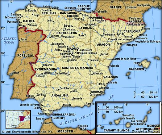
Matt-hurricanewatcher wrote:Wow its very close to the Med. First tropical storm to hit Spain!
The area of strongest convection is to the east of the center. On the satellite loop (click the Play button or "Animar" to show the loop) you can see the center of circulation currently located due south of the area between Faro and Santo Antonio in Portugal. It might have even made landfall - it looks very close.
0 likes

042
WHXX01 KWBC 110626
CHGHUR
DISCLAIMER...NUMERICAL MODELS ARE SUBJECT TO LARGE ERRORS.
PLEASE REFER TO TPC/NHC OFFICIAL FORECASTS FOR TROPICAL CYCLONES.
NATIONAL HURRICANE CENTER NORTH ATLANTIC OBJECTIVE AIDS FOR
TROPICAL DEPRESSION VINCE (AL232005) ON 20051011 0600 UTC
...00 HRS... ...12 HRS... ...24 HRS... ...36 HRS...
051011 0600 051011 1800 051012 0600 051012 1800
LAT LON LAT LON LAT LON LAT LON
LBAR 36.8N 8.4W 38.3N 3.5W 38.7N .5E 38.9N 4.0E
...48 HRS... ...72 HRS... ...96 HRS... ..120 HRS...
051013 0600 051014 0600 051015 0600 051016 0600
LAT LON LAT LON LAT LON LAT LON
LBAR 38.5N 7.0E .0N .0W .0N .0W .0N .0W
...INITIAL CONDITIONS...
LATCUR = 36.8N LONCUR = 8.4W DIRCUR = 65DEG SPDCUR = 20KT
LATM12 = 35.4N LONM12 = 12.8W DIRM12 = 70DEG SPDM12 = 20KT
LATM24 = 34.5N LONM24 = 17.2W
WNDCUR = 30KT RMAXWD = 60NM WNDM12 = 35KT
CENPRS = 1000MB OUTPRS = 1012MB OUTRAD = 120NM SDEPTH = D
RD34NE = 0NM RD34SE = 0NM RD34SW = 0NM RD34NW = 0NM
6z models have it now as a 30kt TD. So it looks like TPC is going to downgrade before it makes landfall.
0 likes
-
krysof
Thunder44 wrote:042
WHXX01 KWBC 110626
CHGHUR
DISCLAIMER...NUMERICAL MODELS ARE SUBJECT TO LARGE ERRORS.
PLEASE REFER TO TPC/NHC OFFICIAL FORECASTS FOR TROPICAL CYCLONES.
NATIONAL HURRICANE CENTER NORTH ATLANTIC OBJECTIVE AIDS FOR
TROPICAL DEPRESSION VINCE (AL232005) ON 20051011 0600 UTC
...00 HRS... ...12 HRS... ...24 HRS... ...36 HRS...
051011 0600 051011 1800 051012 0600 051012 1800
LAT LON LAT LON LAT LON LAT LON
LBAR 36.8N 8.4W 38.3N 3.5W 38.7N .5E 38.9N 4.0E
...48 HRS... ...72 HRS... ...96 HRS... ..120 HRS...
051013 0600 051014 0600 051015 0600 051016 0600
LAT LON LAT LON LAT LON LAT LON
LBAR 38.5N 7.0E .0N .0W .0N .0W .0N .0W
...INITIAL CONDITIONS...
LATCUR = 36.8N LONCUR = 8.4W DIRCUR = 65DEG SPDCUR = 20KT
LATM12 = 35.4N LONM12 = 12.8W DIRM12 = 70DEG SPDM12 = 20KT
LATM24 = 34.5N LONM24 = 17.2W
WNDCUR = 30KT RMAXWD = 60NM WNDM12 = 35KT
CENPRS = 1000MB OUTPRS = 1012MB OUTRAD = 120NM SDEPTH = D
RD34NE = 0NM RD34SE = 0NM RD34SW = 0NM RD34NW = 0NM
6z models have it now as a 30kt TD. So it looks like TPC is going to downgrade before it makes landfall.
I think it already made landfall before.
0 likes
Who is online
Users browsing this forum: Hurricanehink and 65 guests