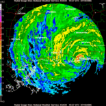
T.S. BETA Comments,Sat Pics,Models Thread
Moderator: S2k Moderators
- TheEuropean
- Professional-Met

- Posts: 1797
- Age: 60
- Joined: Tue Sep 20, 2005 3:17 pm
- Location: Voerde, Germany
- Contact:
T.S. BETA Comments,Sat Pics,Models Thread
Now it is BETA, first advisory at 5am
<IMG SRC="http://www.saevert.de/bilder/wzforum/051027twentysix1.jpg">
May become a CAT1 shortly before landfall?
<IMG SRC="http://www.saevert.de/bilder/wzforum/051027twentysix1.jpg">
May become a CAT1 shortly before landfall?
0 likes
- TheEuropean
- Professional-Met

- Posts: 1797
- Age: 60
- Joined: Tue Sep 20, 2005 3:17 pm
- Location: Voerde, Germany
- Contact:
- beachbum_al
- Category 5

- Posts: 2163
- Age: 56
- Joined: Thu Jul 14, 2005 9:23 pm
- Location: South Alabama Coast
- Contact:
See what happens when I go to bed. First it was a TD and this morning we have Beta. So where is Beta headed for?
Also does the UKMET see something different than the other models?

off of website http://www.crownweather.com/tropical
Also does the UKMET see something different than the other models?

off of website http://www.crownweather.com/tropical
0 likes
- johngaltfla
- Category 5

- Posts: 2074
- Joined: Sun Jul 10, 2005 9:17 pm
- Location: Sarasota County, FL
- Contact:
- cycloneye
- Admin

- Posts: 149844
- Age: 69
- Joined: Thu Oct 10, 2002 10:54 am
- Location: San Juan, Puerto Rico
27/1145 UTC 10.9N 81.4W T3.0/3.0 BETA
Beta a little more stronger 45kts according to SSD dvorak sat estimates.
Beta a little more stronger 45kts according to SSD dvorak sat estimates.
0 likes
Visit the Caribbean-Central America Weather Thread where you can find at first post web cams,radars
and observations from Caribbean basin members Click Here
and observations from Caribbean basin members Click Here
-
superfly
- Aquawind
- Category 5

- Posts: 6714
- Age: 62
- Joined: Mon Jun 16, 2003 10:41 pm
- Location: Salisbury, NC
- Contact:
Michael06 wrote:Is the LBAR a very reliable tropical model?
NO... Thank Goodness..
http://www.storm2k.org/phpbb2/viewtopic.php?t=77706
Paul
0 likes
- cycloneye
- Admin

- Posts: 149844
- Age: 69
- Joined: Thu Oct 10, 2002 10:54 am
- Location: San Juan, Puerto Rico
TROPICAL STORM BETA (AL262005) ON 20051027 1200 UTC
...00 HRS... ...12 HRS... ...24 HRS... ...36 HRS...
051027 1200 051028 0000 051028 1200 051029 0000
LAT LON LAT LON LAT LON LAT LON
BAMD 11.4N 81.3W 12.6N 82.0W 13.8N 82.8W 15.0N 83.6W
BAMM 11.4N 81.3W 12.4N 81.9W 13.4N 82.6W 14.3N 83.3W
A98E 11.4N 81.3W 12.0N 81.6W 12.6N 82.3W 13.3N 83.0W
LBAR 11.4N 81.3W 12.4N 81.7W 14.1N 82.4W 16.2N 83.4W
SHIP 35KTS 43KTS 50KTS 58KTS
DSHP 35KTS 43KTS 50KTS 58KTS
...48 HRS... ...72 HRS... ...96 HRS... ..120 HRS...
051029 1200 051030 1200 051031 1200 051101 1200
LAT LON LAT LON LAT LON LAT LON
BAMD 15.7N 84.3W 15.6N 86.3W 15.2N 89.5W 15.1N 92.6W
BAMM 14.8N 84.1W 14.4N 86.5W 13.4N 90.2W 13.1N 94.1W
A98E 14.4N 83.6W 17.1N 84.9W 18.7N 85.8W 19.7N 85.1W
LBAR 18.3N 84.1W 22.4N 83.2W 28.2N 79.3W 33.3N 67.2W
SHIP 64KTS 69KTS 66KTS 58KTS
DSHP 64KTS 33KTS 27KTS 30KTS
...INITIAL CONDITIONS...
LATCUR = 11.4N LONCUR = 81.3W DIRCUR = 350DEG SPDCUR = 3KT
LATM12 = 10.8N LONM12 = 81.2W DIRM12 = 334DEG SPDM12 = 2KT
LATM24 = 10.2N LONM24 = 80.5W
WNDCUR = 35KT RMAXWD = 15NM WNDM12 = 30KT
CENPRS = 1000MB OUTPRS = 1011MB OUTRAD = 150NM SDEPTH = D
RD34NE = 50NM RD34SE = 50NM RD34SW = 50NM RD34NW = 50NM
12:00z Models.
0 likes
Visit the Caribbean-Central America Weather Thread where you can find at first post web cams,radars
and observations from Caribbean basin members Click Here
and observations from Caribbean basin members Click Here
- Weatherfreak14
- Category 5

- Posts: 1381
- Joined: Sat Sep 24, 2005 3:40 pm
- Location: Beaufort, SC
- Contact:
-
EverythingIsEverything
- Tropical Storm

- Posts: 107
- Joined: Tue Aug 31, 2004 4:18 pm
- Location: Virginia Beach, Virginia
- Contact:
- HurricaneGirl
- Category 5

- Posts: 5838
- Age: 61
- Joined: Thu Feb 06, 2003 9:45 am
- Location: Clare, Michigan
- Contact:
-
no advance
- Category 1

- Posts: 413
- Joined: Wed Aug 24, 2005 1:50 pm
- Location: merritt is.
Who is online
Users browsing this forum: No registered users and 13 guests


