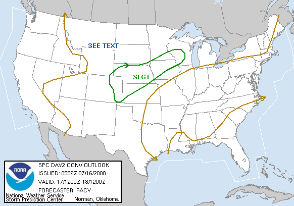
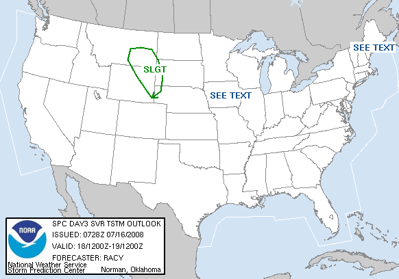
I'm going to throw this in here, I made this
Chase Forecast for some of the other boards, but I figured some of you here
might enjoy it. Tell me if you don't, haha.. But anyway here is my elongated chase forecast for Thursday:
NAM 00z model run: Low pressure system shown at 984 mb in southcentral Nebraska by 1 pm on Thursday, low moves pretty much nowhere as it becomes vertically stacked in the evening hours; still manages to fall to 982 mb by 7 pm. Starting at the surface, Td's are shown in the mid 50s Thursday morning and then quickly rise up into the lower 60s by afternoon hours, even some mid 60s in northern Missouri. LCL levels with that aren't terrible in western Iowa, but eastern NE is a little worse off. Either way LCL levels look to be anywhere from 500m to 1000m. Surface winds should back somewhat, but with the low not moving it isn't too impressive. Rising up, we show very good vorticity advection at 500 in eastern Nebraska and western Iowa for the most part. 0-3 km SRH in western Iowa should be anywhere from 200-300 m2/s2 which is pretty good. Using a finer grid with the NAM does show better SRH and cape values, which should be considered. SRH with that grid are shown to be above 300 in areas of western Iowa; cape values on the normal NAM grid are shown at >3000 j/kg in western Iowa and northwestern MO, the finer grid actually shows much the same. The cap! Looks to hold good through noon, with it finally breaking sometime around 3 pm most likely in eastern Nebraska... Earlier talk had storm motion very rapid, but looking at Bunkers formula for storm motion, its' shown at 30-40 kts which isn't too bad at all... So, looking at the NAM you would be looking at an eastern Nebraska target sometime around 3 pm.
GFS's 00z run: Surface low expected across central Nebraska at noon, but then shows it further east just north of Lincoln, NE for the rest of the afternoon. The pressure with the low also isnt' as strong, only shown at 986.. Despite this GFS is actually better with breaking out precip along the dryline, unlike the NAM. GFS is also very good in the vorticity advection coming in with the jet streak as is the NAM. Good Td's shown with the GFS as well, with low 60s throughout the warm sector just ahead of the dryline. Other severe weather parameters that are calculated won't be in until 2 am or 3 am so i won't have those in this forecast. But, looking at all of this information chase target would likely be further east along the NE/IA borders or just into NE and target would be around that 3 pm timeframe as well.
As I update I might not get them on here, but I will get them up on my website.


