Wave system at C.Carib.,Sat. Images,Comments,Discussion #1
Moderator: S2k Moderators
Forum rules

The posts in this forum are NOT official forecasts and should not be used as such. They are just the opinion of the poster and may or may not be backed by sound meteorological data. They are NOT endorsed by any professional institution or STORM2K. For official information, please refer to products from the National Hurricane Center and National Weather Service.
-
HurricaneHunter914
- Category 5

- Posts: 4439
- Age: 32
- Joined: Fri Mar 10, 2006 7:36 pm
- Location: College Station, TX
Give it a chance it might regenerate later and I think ExtrmeWeatherGuy is right, I got a little confused on the location of the wave I just saw a SAT pic and now I think this might just go straight through the Caribbean and possibly into the GOM.
0 likes
Personal Forecast Disclaimer:
The posts in this forum are NOT official forecast and should not be used as such. They are just the opinion of the poster and may or may not be backed by sound meteorological data. They are NOT endorsed by any professional institution or storm2k.org. For official information, please refer to the NHC and NWS products.
The posts in this forum are NOT official forecast and should not be used as such. They are just the opinion of the poster and may or may not be backed by sound meteorological data. They are NOT endorsed by any professional institution or storm2k.org. For official information, please refer to the NHC and NWS products.

CHRISTY wrote:our caribbean wave has gone....

Yes the thunderstorms have, but the wave axis is still there. You can see a MLC just south of Hati moving WNW towards Jamaica this morning on IR-2 satellite imagery. It will have a chance to develop it moves into the Western Carribean this weekend.
0 likes


Looks like subsidence is entering the NW Carribean this morning. That would prohibit development there anytime soon.
http://www.ssd.noaa.gov/goes/east/watl/loop-wv.html
http://www.ssd.noaa.gov/goes/east/watl/loop-wv.html
0 likes
-
cycloneye

- Admin

- Posts: 148763
- Age: 69
- Joined: Thu Oct 10, 2002 10:54 am
- Location: San Juan, Puerto Rico
drezee wrote:3 mb 24-hr pressure falls in the buoys in front of the islands.
Which Islands you are talking about?
0 likes
Visit the Caribbean-Central America Weather Thread where you can find at first post web cams,radars
and observations from Caribbean basin members Click Here
and observations from Caribbean basin members Click Here
-
jusforsean

- Category 1

- Posts: 395
- Joined: Wed Nov 09, 2005 8:22 am
- Location: South Florida
Thunder44 wrote:Looks like subsidence is entering the NW Carribean this morning. That would prohibit development there anytime soon.
http://www.ssd.noaa.gov/goes/east/watl/loop-wv.html
subsidence: is this like as in a calming effect?
0 likes
jusforsean wrote:Thunder44 wrote:Looks like subsidence is entering the NW Carribean this morning. That would prohibit development there anytime soon.
http://www.ssd.noaa.gov/goes/east/watl/loop-wv.html
subsidence: is this like as in a calming effect?
It's dry or sinking air behind a middle to upper level trough dropping down into the Carribean this morning. The 8:05am discussion from NHC sums it up better:
THE REST OF THE CARIBBEAN SEA AND THE ATLANTIC OCEAN
SOUTH OF 25N WEST OF 50W...
A MIDDLE TO UPPER LEVEL LOW CENTER IS NEAR 16N79W...ABOUT
120 NM SOUTHWEST OF JAMAICA. THIS LOW CENTER IS PART OF
A BROADER AREA OF LOW PRESSURE WHICH HAS BEEN WORKING ITS WAY
WESTWARD DURING THE LAST 48 HOURS OR SO. A LOW CENTER HAD BEEN
SEEN IN WATER VAPOR IMAGERY A FEW DAYS AGO...AND A TROUGH WAS
IN THE CENTRAL CARIBBEAN SEA YESTERDAY STRETCHING FROM SOUTHERN
HISPANIOLA SOUTHWESTWARD. ISOLATED MODERATE TO STRONG SHOWERS
AND THUNDERSTORMS HAVE BEEN DEVELOPING IN THIS AREA AS THE
16N79W LOW CENTER HAS BEEN MOVING WESTWARD. SHOWERS AND
THUNDERSTORMS NOW ARE FOUND NORTH OF 16N WEST OF 79W. A MIDDLE
TO UPPER LEVEL TROUGH STRETCHES FROM A 22N57W LOW CENTER TO
19N60W TO 18N68W TO THE 16N79W LOW CENTER. MIDDLE TO UPPER LEVEL
CLOUDS ARE WITHIN 200 NM TO THE EAST AND SOUTHEAST OF THIS
TROUGH. MOSTLY HIGH CLOUDS ARE NEAR THE 22N57W ATLANTIC OCEAN
LOW CENTER...FROM 20N TO 26N BETWEEN 45W AND 58W. MIDDLE TO
UPPER LEVEL CLOUDS COVER THE CARIBBEAN SEA FROM 15N TO 20N
BETWEEN 64W AND 76W. THE STRONG SHOWERS AND THUNDERSTORMS EAST
OF NICARAGUA SIX HOURS AGO HAVE BEEN DISSIPATING. ISOLATED
MODERATE SHOWERS ARE SOUTH OF 13N WEST OF 75W.
0 likes

-
cycloneye
- Admin
- Posts: 148763
- Age: 69
- Joined: Thu Oct 10, 2002 10:54 am
- Location: San Juan, Puerto Rico
Christy,only look at the upper right part of pic you posted.That is an Upper Low from where the TUTT trough starts as you can see it easily.From where I am I dont mind that that TUTT remains there all season long as it's a shield to the islands from the CV systems.
0 likes
Visit the Caribbean-Central America Weather Thread where you can find at first post web cams,radars
and observations from Caribbean basin members Click Here
and observations from Caribbean basin members Click Here

-
CHRISTY
cycloneye wrote:Christy,only look at the upper right part of pic you posted.That is an Upper Low from where the TUTT trough starts as you can see it easily.From where I am I dont mind that that TUTT remains there all season long as it's a shield to the islands from the CV systems.
yea i see the the upper low hopefullly lots of fish this season.PS!i will say this these have been very impressive tropical waves coming of africa the last couple of days it almost seems like there a little bit a head of schdule but to me conditions out there are not favorable for the development of these waves just yet.
0 likes
-
HouTXmetro

- Category 5
- Posts: 3949
- Joined: Sun Jun 13, 2004 6:00 pm
- Location: District of Columbia, USA
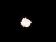
Nice swirl, I don't think this wave is dead yet. IMO things will get real interesting if this Wave starts to interact with the convection firing in the BOC. I'm very impressed that it has maintained a finite circulation.
0 likes
[Disclaimer: My Amateur Opinion, please defer to your local authorities or the NHC for Guidance.]
-
Extremeweatherguy

- Category 5
- Posts: 11095
- Joined: Mon Oct 10, 2005 8:13 pm
- Location: Florida


Interestingly, if one looks at the GFS model today, (http://moe.met.fsu.edu/cgi-bin/gfstc2.c ... =Animation)
one sees that the Bermuda High will be stretching deep into the Gulf and possibly preventing this tropical wave/whatever from hitting points east of the Mississippi.
one sees that the Bermuda High will be stretching deep into the Gulf and possibly preventing this tropical wave/whatever from hitting points east of the Mississippi.
0 likes
-
CHRISTY

Who is online
Users browsing this forum: No registered users and 71 guests