latest IR image shows an EXPLOSION in convection:
http://www.ssd.noaa.gov/goes/east/carb/avn-l.jpg
ALSO: JB is still "fearing" that this will end up in the western Gulf by the middle part of next week.
Wave in Central Caribbean
Moderator: S2k Moderators
Forum rules

The posts in this forum are NOT official forecasts and should not be used as such. They are just the opinion of the poster and may or may not be backed by sound meteorological data. They are NOT endorsed by any professional institution or STORM2K. For official information, please refer to products from the National Hurricane Center and National Weather Service.
-
Extremeweatherguy

- Category 5

- Posts: 11095
- Joined: Mon Oct 10, 2005 8:13 pm
- Location: Florida
-
HurricaneHunter914
- Category 5
- Posts: 4439
- Age: 32
- Joined: Fri Mar 10, 2006 7:36 pm
- Location: College Station, TX
http://www.ssd.noaa.gov/goes/east/watl/avn-l.jpg
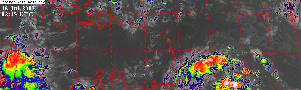
The wave is starting to roar. The Lesser Antilles seems to have little affect on our growing wave.
The wave is starting to roar. The Lesser Antilles seems to have little affect on our growing wave.
0 likes
Personal Forecast Disclaimer:
The posts in this forum are NOT official forecast and should not be used as such. They are just the opinion of the poster and may or may not be backed by sound meteorological data. They are NOT endorsed by any professional institution or storm2k.org. For official information, please refer to the NHC and NWS products.
The posts in this forum are NOT official forecast and should not be used as such. They are just the opinion of the poster and may or may not be backed by sound meteorological data. They are NOT endorsed by any professional institution or storm2k.org. For official information, please refer to the NHC and NWS products.
-
bvigal

- S2K Supporter

- Posts: 2276
- Joined: Sun Jul 24, 2005 8:49 am
- Location: British Virgin Islands
- Contact:
Ship report:
Code: Select all
ID   TIME   LAT   LON   PRES   PTDY   ATMP
   (GMT)         in   in   °F
SHIP   2100   13.6   -62.4   29.82   -0.06   82
0 likes

-
HurricaneHunter914
- Category 5
- Posts: 4439
- Age: 32
- Joined: Fri Mar 10, 2006 7:36 pm
- Location: College Station, TX
What would that mean for this wave if the lightning stopped? (Sorry if the question is dumb).
0 likes
Personal Forecast Disclaimer:
The posts in this forum are NOT official forecast and should not be used as such. They are just the opinion of the poster and may or may not be backed by sound meteorological data. They are NOT endorsed by any professional institution or storm2k.org. For official information, please refer to the NHC and NWS products.
The posts in this forum are NOT official forecast and should not be used as such. They are just the opinion of the poster and may or may not be backed by sound meteorological data. They are NOT endorsed by any professional institution or storm2k.org. For official information, please refer to the NHC and NWS products.
-
Extremeweatherguy
- Category 5
- Posts: 11095
- Joined: Mon Oct 10, 2005 8:13 pm
- Location: Florida
-
HurricaneHunter914
- Category 5
- Posts: 4439
- Age: 32
- Joined: Fri Mar 10, 2006 7:36 pm
- Location: College Station, TX
Looking at SAT it seems like it did the opposite of weakening IMO.
0 likes
Personal Forecast Disclaimer:
The posts in this forum are NOT official forecast and should not be used as such. They are just the opinion of the poster and may or may not be backed by sound meteorological data. They are NOT endorsed by any professional institution or storm2k.org. For official information, please refer to the NHC and NWS products.
The posts in this forum are NOT official forecast and should not be used as such. They are just the opinion of the poster and may or may not be backed by sound meteorological data. They are NOT endorsed by any professional institution or storm2k.org. For official information, please refer to the NHC and NWS products.
-
Furious George
- Tropical Storm

- Posts: 126
- Joined: Tue Sep 07, 2004 9:03 pm
Both accuweather and Jeff Masters suggesting Florida will have to watch out, and it might not be a Gulf threat.
Accuweather:
This wave will bring showers into the southern Bahamas and Hispaniola tomorrow and tomorrow night then might enhance shower and thunderstorm devleopment over the northern Bahamas and perhaps into southeast Florida Friday night into Saturday morning.
Jeff Master's Blog:
A tropical wave a few hundred miles east of the northernmost Lesser Antilles Islands is moving west to west-northwest at 15-20 mph. The amount of thunderstorm activity associated with this wave has increased over the past day, as the dry Saharan air surrounding the wave has gradually diluted. However, the wave is now under 30 knots of vertical wind shear. This wind shear is being created by the counter-clockwise flow of air around an upper-level low pressure system to the north of Puerto Rico. This low is not expected to move much the next five days, and should continue to create hostile wind shear over the wave. The wave will spread showers and gusty winds to Puerto Rico on Thursday, and the Bahama Islands on Friday and Saturday. By Saturday, as the wave approaches Florida, it will not be as close to the upper-level low, and the shear may lessen, potentially allowing some development. The wave is expected to turn north towards the Carolinas and not enter the Gulf of Mexico.
0 likes
-
Extremeweatherguy
- Category 5
- Posts: 11095
- Joined: Mon Oct 10, 2005 8:13 pm
- Location: Florida
I see too strong of a ridge and too fast of a movement for this to not enter the Gulf. I'm not saying FL won't be affected, but I think at some point this will be in the Gulf. Also, another thing to consider is that both discussions you posted are hours old, whereas JB's latest discussion was just recently posted.Furious George wrote:Both accuweather and Jeff Masters suggesting Florida will have to watch out, and it might not be a Gulf threat.
Accuweather:
This wave will bring showers into the southern Bahamas and Hispaniola tomorrow and tomorrow night then might enhance shower and thunderstorm devleopment over the northern Bahamas and perhaps into southeast Florida Friday night into Saturday morning.
Jeff Master's Blog:
A tropical wave a few hundred miles east of the northernmost Lesser Antilles Islands is moving west to west-northwest at 15-20 mph. The amount of thunderstorm activity associated with this wave has increased over the past day, as the dry Saharan air surrounding the wave has gradually diluted. However, the wave is now under 30 knots of vertical wind shear. This wind shear is being created by the counter-clockwise flow of air around an upper-level low pressure system to the north of Puerto Rico. This low is not expected to move much the next five days, and should continue to create hostile wind shear over the wave. The wave will spread showers and gusty winds to Puerto Rico on Thursday, and the Bahama Islands on Friday and Saturday. By Saturday, as the wave approaches Florida, it will not be as close to the upper-level low, and the shear may lessen, potentially allowing some development. The wave is expected to turn north towards the Carolinas and not enter the Gulf of Mexico.
0 likes
-
HurricaneHunter914
- Category 5
- Posts: 4439
- Age: 32
- Joined: Fri Mar 10, 2006 7:36 pm
- Location: College Station, TX
Shear might win the battle this time though, this thing won't survive if the shear doesn't decrease.
0 likes
Personal Forecast Disclaimer:
The posts in this forum are NOT official forecast and should not be used as such. They are just the opinion of the poster and may or may not be backed by sound meteorological data. They are NOT endorsed by any professional institution or storm2k.org. For official information, please refer to the NHC and NWS products.
The posts in this forum are NOT official forecast and should not be used as such. They are just the opinion of the poster and may or may not be backed by sound meteorological data. They are NOT endorsed by any professional institution or storm2k.org. For official information, please refer to the NHC and NWS products.
-
Extremeweatherguy
- Category 5
- Posts: 11095
- Joined: Mon Oct 10, 2005 8:13 pm
- Location: Florida
0Z NAM has this system in the NW Caribbean by July 30th (this sunday):
http://www.nco.ncep.noaa.gov/pmb/nwprod ... _084.shtml
If this verifies, then the system may be into the Central Gulf by the 31st/1st, and the western Gulf by the 2nd/3rd. Considering I will be driving along the northern Gulf on the 31st and 1st, I will have to watch this one closely!
http://www.nco.ncep.noaa.gov/pmb/nwprod ... _084.shtml
If this verifies, then the system may be into the Central Gulf by the 31st/1st, and the western Gulf by the 2nd/3rd. Considering I will be driving along the northern Gulf on the 31st and 1st, I will have to watch this one closely!
0 likes
-
HurricaneHunter914
- Category 5
- Posts: 4439
- Age: 32
- Joined: Fri Mar 10, 2006 7:36 pm
- Location: College Station, TX
0 likes
Personal Forecast Disclaimer:
The posts in this forum are NOT official forecast and should not be used as such. They are just the opinion of the poster and may or may not be backed by sound meteorological data. They are NOT endorsed by any professional institution or storm2k.org. For official information, please refer to the NHC and NWS products.
The posts in this forum are NOT official forecast and should not be used as such. They are just the opinion of the poster and may or may not be backed by sound meteorological data. They are NOT endorsed by any professional institution or storm2k.org. For official information, please refer to the NHC and NWS products.
-
cheezyWXguy

- Category 5
- Posts: 6242
- Joined: Mon Feb 13, 2006 12:29 am
- Location: Dallas, TX
-
Grease Monkey

- Category 2

- Posts: 727
- Joined: Fri Jun 09, 2006 9:25 pm
-
Extremeweatherguy
- Category 5
- Posts: 11095
- Joined: Mon Oct 10, 2005 8:13 pm
- Location: Florida
-
ts_kakolina

- Tropical Depression

- Posts: 58
- Joined: Wed Jul 13, 2005 8:27 am
- Location: Carolina, Puerto Rico
Very impressive, at least for us in Puerto Rico. Looks like we have a stormy night ahead of us.
Last edited by ts_kakolina on Thu Jul 27, 2006 5:44 am, edited 1 time in total.
0 likes

-
Matt-hurricanewatcher
-
HURAKAN

- Professional-Met

- Posts: 46086
- Age: 38
- Joined: Thu May 20, 2004 4:34 pm
- Location: Key West, FL
- Contact:
TROPICAL WEATHER OUTLOOK
NWS TPC/NATIONAL HURRICANE CENTER MIAMI FL
530 AM EDT THU JUL 27 2006
FOR THE NORTH ATLANTIC...CARIBBEAN SEA AND THE GULF OF MEXICO...
CLOUDINESS AND SHOWERS...OCCASIONALLY HEAVY...FROM PUERTO
RICO...MUCH OF THE LESSER ANTILLES AND ADJACENT WATERS ARE
ASSOCIATED WITH A TROPICAL WAVE. THIS SYSTEM IS EXPECTED TO MOVE
WESTWARD ACROSS THE CARIBBEAN SEA WHERE UPPER-LEVEL WINDS ARE
HIGHLY UNFAVORABLE FOR TROPICAL CYCLONE FORMATION.
TROPICAL STORM FORMATION IS NOT EXPECTED THROUGH FRIDAY.
$$
FORECASTER AVILA
0 likes

AREA FORECAST DISCUSSION
NATIONAL WEATHER SERVICE MELBOURNE FL
310 AM EDT THU JUL 27 2006
Excerpt:
SUN-MON...GFS HAS BACKED OFF PREVIOUS SCENARIO OF TROPICAL WAVE
REACHING CWA SUNDAY AND NOW IS MORE CONSISTENT WITH ECMWF/UKMET IN
KEEPING RIDGE INTACT AND MOISTURE REMAINING SOUTH OF REGION.
NATIONAL WEATHER SERVICE MELBOURNE FL
310 AM EDT THU JUL 27 2006
Excerpt:
SUN-MON...GFS HAS BACKED OFF PREVIOUS SCENARIO OF TROPICAL WAVE
REACHING CWA SUNDAY AND NOW IS MORE CONSISTENT WITH ECMWF/UKMET IN
KEEPING RIDGE INTACT AND MOISTURE REMAINING SOUTH OF REGION.
0 likes
The following post is NOT an official forecast and should not be used as such. It is just the opinion of the poster and may or may not be backed by sound meteorological data. It is NOT endorsed by any professional institution including storm2k.org For Official Information please refer to the NHC and NWS products.
Who is online
Users browsing this forum: No registered users and 63 guests