Invest 99L East of Windwards #3
Moderator: S2k Moderators
Forum rules

The posts in this forum are NOT official forecasts and should not be used as such. They are just the opinion of the poster and may or may not be backed by sound meteorological data. They are NOT endorsed by any professional institution or STORM2K. For official information, please refer to products from the National Hurricane Center and National Weather Service.
-
windstorm99

- S2K Supporter

- Posts: 1578
- Age: 48
- Joined: Sat May 26, 2007 8:10 am
- Location: Miami, Florida
- Contact:

Re: Invest 99L East of Windwards #3
I don't know about 99. If I had to say one way or the other, I don't think it's going to come together. I'm significantly more interested in the wave behind it.
0 likes
-
Brent
- S2K Supporter
- Posts: 38755
- Age: 37
- Joined: Sun May 16, 2004 10:30 pm
- Location: Tulsa Oklahoma
- Contact:
Re: Invest 99L East of Windwards #3
10:30pm TWO:
THE AREA OF LOW PRESSURE ASSOCIATED WITH A TROPICAL WAVE HAS
CONTINUED TO MOVE WESTWARD AND IS CENTERED ABOUT 425 MILES EAST OF
THE SOUTHERN WINDWARD ISLANDS. THE SHOWER ACTIVITY REMAINS
DISORGANIZED BUT ENVIRONMENTAL CONDITIONS APPEAR TO BE FAVORABLE
FOR A TROPICAL DEPRESSION TO FORM DURING THE NEXT COUPLE OF
DAYS...AS THE SYSTEM MOVES WESTWARD AT 10 TO 15 MPH. EVEN IF
DEVELOPMENT DOES NOT OCCUR...THIS SYSTEM WILL LIKELY BRING A FEW
SQUALLS TO THE WINDWARD ISLANDS DURING THE NEXT DAY OR SO. AN AIR
FORCE PLANE IS SCHEDULED TO INVESTIGATE THE SYSTEM ON WEDNESDAY
AFTERNOON...IF NECESSARY.
0 likes
-
Weatherfreak14

- Category 5

- Posts: 1381
- Joined: Sat Sep 24, 2005 3:40 pm
- Location: Beaufort, SC
- Contact:
Re: Invest 99L East of Windwards #3
Well, it still looks that they are still going to fly out in the system.
0 likes
-
Derek Ortt

-
Weatherfreak14
- Category 5
- Posts: 1381
- Joined: Sat Sep 24, 2005 3:40 pm
- Location: Beaufort, SC
- Contact:
Re: Invest 99L East of Windwards #3
Well i think overall the system is better organized in structure, it just needs lots and lots of convection and needs to maintain that. 
0 likes
-
philnyc
- S2K Supporter
- Posts: 313
- Joined: Thu Jun 07, 2007 1:14 am
- Location: Brooklyn, New York City, New York
- Contact:
Re:
Derek Ortt wrote:I'm counting the low levels as between 850 and 7-600. Mid levels is closer to the 500mb level, at least in the way I think of them
Thanks, Derek. That makes sense to me. Thanks for the insight. These disturbances bob up and down in various sectors as they try to develop, so where the shear levels are is critical to understanding them.
0 likes
-
fox13weather
- Professional-Met

- Posts: 161
- Joined: Tue Sep 20, 2005 7:49 pm
Re:
Normandy wrote:I really don't see why people suddenly thing the chances of this developing are lower today than yesterday, especially considering the fact it is much better organized at this point that it has ever been.
much better organized?? It is at best, a disorganized tropical wave. If it is better organized tonight, what was it last night?? A 1030mb high?
0 likes
-
hurricanefloyd5

- Category 5
- Posts: 1659
- Age: 45
- Joined: Sun May 02, 2004 10:53 am
- Location: Spartanburg
- Contact:
Re: Invest 99L East of Windwards #3
THE AREA OF LOW PRESSURE ASSOCIATED WITH A TROPICAL WAVE HAS
CONTINUED TO MOVE WESTWARD AND IS CENTERED ABOUT 425 MILES EAST OF
THE SOUTHERN WINDWARD ISLANDS. THE SHOWER ACTIVITY REMAINS
DISORGANIZED BUT ENVIRONMENTAL CONDITIONS APPEAR TO BE FAVORABLE
FOR A TROPICAL DEPRESSION TO FORM DURING THE NEXT COUPLE OF
DAYS...AS THE SYSTEM MOVES WESTWARD AT 10 TO 15 MPH. EVEN IF
DEVELOPMENT DOES NOT OCCUR...THIS SYSTEM WILL LIKELY BRING A FEW
SQUALLS TO THE WINDWARD ISLANDS DURING THE NEXT DAY OR SO. AN AIR
FORCE PLANE IS SCHEDULED TO INVESTIGATE THE SYSTEM ON WEDNESDAY
AFTERNOON...IF NECESSARY.
0 likes
Re: Re:
fox13weather wrote:Normandy wrote:I really don't see why people suddenly thing the chances of this developing are lower today than yesterday, especially considering the fact it is much better organized at this point that it has ever been.
much better organized?? It is at best, a disorganized tropical wave. If it is better organized tonight, what was it last night?? A 1030mb high?
Yes it is better organized.
Day 1: It was imbedded in the ITCZ
Day 2: Thunderstorms began consolidating
Day 3: It produced a vigourous MLC
Day 4 (Today): it has a Low Level Circulation.
Thats improved organization.
So, to answer your question, no it wasn't a 1030 mb high. It was a 1012 mb high....or is that called low pressure? Wait.
Last edited by Normandy on Tue Jul 31, 2007 9:48 pm, edited 2 times in total.
0 likes
-
Ed Mahmoud
Re: Invest 99L East of Windwards #3
Just refreshed the IR2 floater, and there is some kind of circulation now under/just East of the new convective blob.
Of course, is there a model anyway that carries either a closed low or even the low or mid level vort max with this anywhere North of the Yucatan/extreme Southern BOC?
At this point, in my opinion as a dedicated amateur, this looks almost as good as Invest 96 did a couple of weeks back, when it probably was close to being a TD, before it ingested the SAL and died.
0 likes

-
Stormcenter
- S2K Supporter
- Posts: 6689
- Joined: Wed Sep 03, 2003 11:27 am
- Location: Houston, TX
Re: Re:
Normandy wrote:fox13weather wrote:Normandy wrote:I really don't see why people suddenly thing the chances of this developing are lower today than yesterday, especially considering the fact it is much better organized at this point that it has ever been.
much better organized?? It is at best, a disorganized tropical wave. If it is better organized tonight, what was it last night?? A 1030mb high?
Yes. Were you not paying attention?
Day 1: It was imbedded in the ITCZ
Day 2: Thunderstorms began consolidating
Day 3: It produced a vigourous MLC
Day 4 (Today): it has a Low Level Circulation.
Thats improved organization.
I'm sorry but it does not look impressive at the moment.
It actually looked better last night.
Anyway that is not to say that it won't develop sometime in the future in the Carribean.
0 likes
Well looks really aren't what im discussing.
Last night it didn't have a LLC, and tonight it appears it might have something close to one. However last night it had more convection.
Again im not saying this looks like a TD, im just making a case that its probably the best organized its been (even though its not that well organized now).
Last night it didn't have a LLC, and tonight it appears it might have something close to one. However last night it had more convection.
Again im not saying this looks like a TD, im just making a case that its probably the best organized its been (even though its not that well organized now).
Last edited by Normandy on Tue Jul 31, 2007 9:43 pm, edited 1 time in total.
0 likes
-
NONAME

- Category 1

- Posts: 373
- Age: 36
- Joined: Sat Mar 18, 2006 8:15 am
- Location: Where the Wind Blows
Re: Re:
Normandy wrote:fox13weather wrote:Normandy wrote:I really don't see why people suddenly thing the chances of this developing are lower today than yesterday, especially considering the fact it is much better organized at this point that it has ever been.
much better organized?? It is at best, a disorganized tropical wave. If it is better organized tonight, what was it last night?? A 1030mb high?
Yes it is better organized. Were you not paying attention?
Day 1: It was imbedded in the ITCZ
Day 2: Thunderstorms began consolidating
Day 3: It produced a vigourous MLC
Day 4 (Today): it has a Low Level Circulation.
Thats improved organization.
I Don't get this why do people keep arguing with the pro-Mets, I used to thing they were wrong when they say the thing they do but then I realize that they were right now I trust what they say and they do know more then we do so we should thing more highly of there opinion.
0 likes
Re: Invest 99L East of Windwards #3
^I was just matching his sarcasm.
Although I still do believe its better organized tonight then last night, despite it having more convection last night. Your entitled to disagree with pro mets all you want....yet i do value their opinions (including fox13weathers).
Although I still do believe its better organized tonight then last night, despite it having more convection last night. Your entitled to disagree with pro mets all you want....yet i do value their opinions (including fox13weathers).
0 likes
-
SouthFloridawx

- S2K Supporter
- Posts: 8346
- Age: 47
- Joined: Tue Jul 26, 2005 1:16 am
- Location: Sarasota, FL
- Contact:
Re: Invest 99L East of Windwards #3
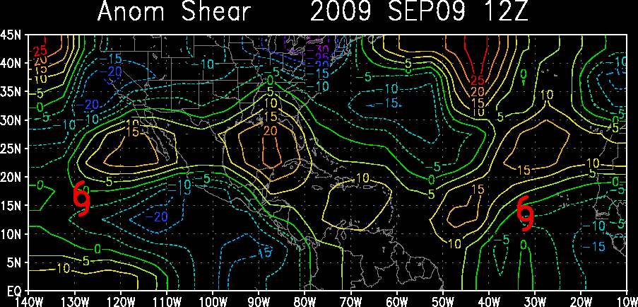
Ahh.. should definitely lower shear in the next couple of days in the Caribbean.
0 likes
-
skysummit

- S2K Supporter
- Posts: 5305
- Age: 50
- Joined: Tue Aug 31, 2004 11:09 pm
- Location: Ponchatoula, LA
- Contact:
There's a little something different tonight than last night. Last night at this time, the convection was rapidly intensifying....almost sucking up all the moisture it could all at once. It was almost certain that impressive blob would not last through the day today. However, tonight, convection seems to slowly be increasing near what looks to be a circulation at one layer or another. This may be better for it to develop.....SLOWLY. It's not an "over kill" like it was last night.
0 likes
Who is online
Users browsing this forum: No registered users and 269 guests