CAT 5 Hurricane Dean - Archived threads
Moderator: S2k Moderators

Re: Tropical Storm DEAN: Discussions,Analysis and Imagery
Dean is already at the latitude of Barbados, the next advisory will be shifted to the north
0 likes

-
Brent
- S2K Supporter

- Posts: 38249
- Age: 37
- Joined: Sun May 16, 2004 10:30 pm
- Location: Tulsa Oklahoma
- Contact:
Re: Tropical Storm DEAN: Discussions,Analysis and Imagery
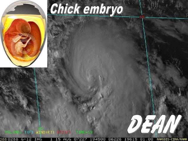
HAHA... I thought it looked like a baby before it was born too! I think this is going to grow up to be a big bad one though.
0 likes


Re: Tropical Storm DEAN: Discussions,Analysis and Imagery
Dean on the last 6 hours.

Maybe a jog, a wooble or a new track? How much time we will need to have an answer?
Maybe a jog, a wooble or a new track? How much time we will need to have an answer?
0 likes


Re: Re:
SouthFloridawx wrote:http://tinyurl.com/38su3eNormandy wrote:Folks why are you using WV and IR imagery to determine motion when we have good ole visibles?
http://www.ssd.noaa.gov/goes/flt/t1/loop-vis.html
Dean has not gained as much lattitude as some are claiming here. Looking at that loop Dean moved from 45.5W to 47.5W, and moved from 12.3N to 13N. Thats 2 degrees west, .7 degrees north. Thats not even close to a NW motion.
Thats another good shot, and shows a CLEAR wnw motion and nothing more. It didn't even take a NW wobble at all.
If this were moving NW, it would cross 50W at 15N....and that is absolutely NOT going to happen.
0 likes
-
Derek Ortt
-
MSRobi911

- S2K Supporter
- Posts: 1259
- Age: 70
- Joined: Sun Sep 14, 2003 1:55 pm
- Location: Pascagoula, Misssissippi
Re: Tropical Storm DEAN: Discussions,Analysis and Imagery
Thanks SouthFL
I couldn't get the other link to work at all.
Mary
I couldn't get the other link to work at all.
Mary
0 likes

-
tolakram
- Admin

- Posts: 20165
- Age: 62
- Joined: Sun Aug 27, 2006 8:23 pm
- Location: Florence, KY (name is Mark)
Re: Tropical Storm DEAN: Discussions,Analysis and Imagery
I have to say, with my untrained eye, it looks to be moving almost due NW. 
0 likes
-
windstorm99

- S2K Supporter
- Posts: 1578
- Age: 48
- Joined: Sat May 26, 2007 8:10 am
- Location: Miami, Florida
- Contact:
Re: Tropical Storm DEAN: Discussions,Analysis and Imagery
Looks clearly WNW to me...
Will the NHC say WNW at 5pm probably not and will wait till 11pm to see if its not a wobble.Its being doing this for a while though.
Will the NHC say WNW at 5pm probably not and will wait till 11pm to see if its not a wobble.Its being doing this for a while though.
Last edited by windstorm99 on Wed Aug 15, 2007 3:15 pm, edited 1 time in total.
0 likes
-
Brent
- S2K Supporter
- Posts: 38249
- Age: 37
- Joined: Sun May 16, 2004 10:30 pm
- Location: Tulsa Oklahoma
- Contact:
Re: Tropical Storm DEAN: Discussions,Analysis and Imagery
tolakram wrote:I have to say, with my untrained eye, it looks to be moving almost due NW.
It's definitely WNW it appears, I think it will pass 50 W near 14 N though on that track.
0 likes
-
SouthFloridawx

- S2K Supporter
- Posts: 8346
- Age: 47
- Joined: Tue Jul 26, 2005 1:16 am
- Location: Sarasota, FL
- Contact:
Re: Tropical Storm DEAN: Discussions,Analysis and Imagery
Ok first of all... GFS 12zinitialized the system @ 1008 mb.
http://www.nco.ncep.noaa.gov/pmb/nwprod/analysis/carib/gfs/12/images/gfs_ten_000l.gif
The navy site has Dean @ 994mb. I don't see how in any way shape or form, that it was initilized properly. This is going to affect the model and the track.
http://www.nco.ncep.noaa.gov/pmb/nwprod/analysis/carib/gfs/12/images/gfs_ten_000l.gif
The navy site has Dean @ 994mb. I don't see how in any way shape or form, that it was initilized properly. This is going to affect the model and the track.
0 likes
-
Aquawind

- Category 5

- Posts: 6714
- Age: 62
- Joined: Mon Jun 16, 2003 10:41 pm
- Location: Salisbury, NC
- Contact:
Re: Tropical Storm DEAN: Discussions,Analysis and Imagery
Maybe a jog, a wooble or a new track? How much time we will need to have an answer?
Ohh my friend this will be the battle of the ages.. Is it a weeble or not? I have seen wobbles last more than a few hours before..at least everyone else said it was a wobble..lmao. Many a young hobbiest have broken down into the Dean fetal position over this exact issue.
0 likes
-
JonathanBelles
- Professional-Met

- Posts: 11430
- Age: 35
- Joined: Sat Dec 24, 2005 9:00 pm
- Location: School: Florida State University (Tallahassee, FL) Home: St. Petersburg, Florida
- Contact:
-
ALhurricane

- Professional-Met
- Posts: 452
- Joined: Wed Jan 08, 2003 12:46 pm
- Location: Daphne, AL
Re: Tropical Storm DEAN: Discussions,Analysis and Imagery
One thing that may be leading to more of an appearance of a WNW motion than what there really is is the fact the convective envelope and associated outflow is expanding north. This is the first time we have seen the outflow become established to the north of the cyclone.
I would not get too excited on this perceived WNW motion yet. The mean steering flow over the next several days indicates primarily a west track.
I would not get too excited on this perceived WNW motion yet. The mean steering flow over the next several days indicates primarily a west track.
0 likes
-
LeeJet
Re: Re:
Normandy wrote:SouthFloridawx wrote:http://tinyurl.com/38su3eNormandy wrote:Folks why are you using WV and IR imagery to determine motion when we have good ole visibles?
http://www.ssd.noaa.gov/goes/flt/t1/loop-vis.html
Dean has not gained as much lattitude as some are claiming here. Looking at that loop Dean moved from 45.5W to 47.5W, and moved from 12.3N to 13N. Thats 2 degrees west, .7 degrees north. Thats not even close to a NW motion.
Thats another good shot, and shows a CLEAR wnw motion and nothing more. It didn't even take a NW wobble at all.
If this were moving NW, it would cross 50W at 15N....and that is absolutely NOT going to happen.
Just admit that you want it to go to Texas, and stop this implicit -removed-. Everybody is doing it, and it's annoying!
0 likes
Who is online
Users browsing this forum: Google Adsense [Bot] and 32 guests