Tampa Bay Hurricane wrote:http://www.srh.noaa.gov/productview.php?pil=AFDMLB&max=10
OUT OF MELBOURNE-
VERY STRONG RIDGE with Atlantic ridge merging with a contental
ridge. TD 8 will likely NOT recurve.
Mon-thu this thing goes WNW for 7 days..that would
bring it to the Bahamas...
gatorcane mentioned this earlier.MON-THU...THE CONTINENTAL RIDGE RIDING BEHIND THE DEVELOPING
STORM SYSTEM WILL PUSH INTO NEW ENGLAND EARLY NEXT WEEK WHERE IT
WILL MERGE WITH THE ATLC RIDGE. WITH THE RIDGE AXIS LOCATED SO FAR
TO THE N...ANY STORM SYSTEMS THAT DEVELOP OVER THE CONUS WILL BE
FORCED UP THE BACKSIDE OF THE RIDGE WHERE THEIR ABILITY TO PUSH
THE RIDGE AXIS BACK TO THE S WILL BE GREATLY LIMITED. THE RESULT
WILL BE A DOMINANT ERLY FLOW REGIME THROUGH MOST OF NEXT WEEK.
THESE ERLIES COULD PUSH A T-WAVE ACROSS FL BY MID WEEK.
Hmmm....storm under a potentially strong ridge heading in the general direction of Florida
Punkyg,
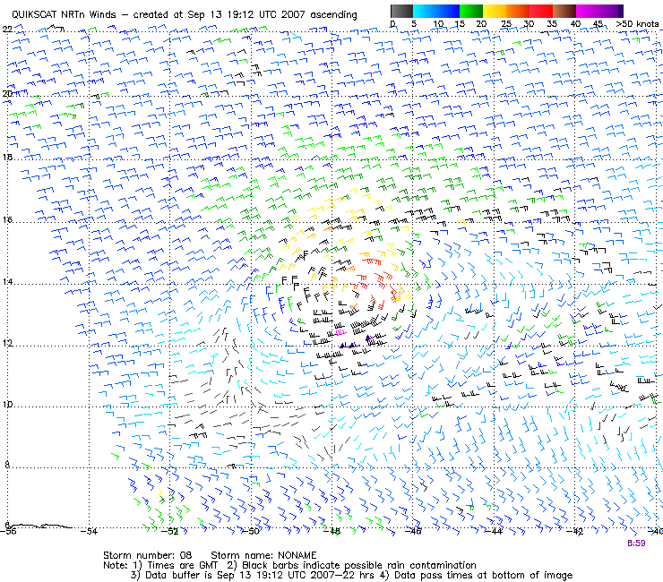
that JPEG that you posted shows TD #8 to be looking rather healthy at the moment. Looking very good indeed. I think recon finds a definite tropical storm.