Well Organized Low Pressure SSW of Cape Verde Islands

This is the general tropical discussion area. Anyone can take their shot at predicting a storms path.

Moderator: S2k Moderators

Forum rules

The posts in this forum are NOT official forecasts and should not be used as such. They are just the opinion of the poster and may or may not be backed by sound meteorological data. They are NOT endorsed by any professional institution or STORM2K. For official information, please refer to products from the National Hurricane Center and National Weather Service.

Help Support Storm2K
Message
Author
User avatar
GeneratorPower
S2K Supporter
S2K Supporter
Posts: 1648
Age: 45
Joined: Sun Dec 18, 2005 11:48 pm
Location: Huntsville, AL

Re: Low Pressure South of Cape Verde Islands

#41 Postby GeneratorPower » Sat Sep 22, 2007 3:10 pm

MiamiensisWx wrote:I see some hints of a LLC in the most recent ascending QuikSCAT pass. Look at the region between 26W-16W and 10N-5N. Note the winds E and W of the void. It may be partially closed, but the system was largely missed.

Click here


That's an understatement. It couldn't have missed it better if it were intentionally trying to miss it.
0 likes   

RL3AO
Moderator-Pro Met
Moderator-Pro Met
Posts: 16308
Joined: Thu Jun 14, 2007 10:03 pm
Location: NC

#42 Postby RL3AO » Sat Sep 22, 2007 3:11 pm

That QS pass is 14 hours old.
0 likes   

User avatar
cycloneye
Admin
Admin
Posts: 145867
Age: 69
Joined: Thu Oct 10, 2002 10:54 am
Location: San Juan, Puerto Rico

Re: Low Pressure South of Cape Verde Islands

#43 Postby cycloneye » Sat Sep 22, 2007 3:12 pm

Hopefully,later tonight we can have a complete quickscat of the area.
0 likes   

User avatar
cycloneye
Admin
Admin
Posts: 145867
Age: 69
Joined: Thu Oct 10, 2002 10:54 am
Location: San Juan, Puerto Rico

Re: Low Pressure South of Cape Verde Islands

#44 Postby cycloneye » Sat Sep 22, 2007 3:27 pm

Image

You can see the rotation even in this loop that is not a closeup.
0 likes   

User avatar
Vortex
S2K Supporter
S2K Supporter
Posts: 4644
Age: 53
Joined: Fri Aug 01, 2003 9:34 pm
Location: Hilton Head, SC

#45 Postby Vortex » Sat Sep 22, 2007 3:27 pm

Here's your long-tracker folks...Get out the maps :lol:
0 likes   

User avatar
Gustywind
Category 5
Category 5
Posts: 12334
Joined: Mon Sep 03, 2007 7:29 am
Location: Baie-Mahault, GUADELOUPE

Re: Low Pressure South of Cape Verde Islands

#46 Postby Gustywind » Sat Sep 22, 2007 3:39 pm

HUC wrote:Really something to bears watching !!!When a wave after exiting Mama Africa is ganing convection over the water,and so more south...MMMMMMM...... :eek:


Hi Huc....absolutely seems that something is boiling very south...the last week of September will be very promising if this trend continues !
0 likes   

User avatar
Gustywind
Category 5
Category 5
Posts: 12334
Joined: Mon Sep 03, 2007 7:29 am
Location: Baie-Mahault, GUADELOUPE

#47 Postby Gustywind » Sat Sep 22, 2007 4:07 pm

000
FXCA62 TJSJ 222026
AFDSJU

AREA FORECAST DISCUSSION
NATIONAL WEATHER SERVICE SAN JUAN PR
426 PM AST SAT SEP 22 2007

THE NEXT WAVE/TROUGH PASSAGE IS EXPECTED ON WEDNESDAY...THEN THE
MODEL BEGINS SPINNING UP SEVERAL WAVES...ONE THAT JUST CAME OFF OF AFRICA
AND ONE THAT IS YET TO MOVE INTO THE ATLANTIC. THESE SPIN-UPS ARE
NOT CERTAIN...BUT THE MODEL HAS THEM CROSSING 20 NORTH BEFORE 60
WEST AND BEFORE REACHING 45 WEST RESPECTIVELY. WILL WATCH THESE
CLOSELY. THE FIRST ONE IS EXHIBITING SOME FAIRLY GOOD TURNING NEAR
8 NORTH 23 WEST.

Interresting something to watch carefully :double: :roll: :cheesy:
0 likes   

CrazyC83
Professional-Met
Professional-Met
Posts: 34005
Joined: Tue Mar 07, 2006 11:57 pm
Location: Deep South, for the first time!

#48 Postby CrazyC83 » Sat Sep 22, 2007 4:10 pm

This could be 96L soon at this rate...
0 likes   

jhamps10

Re:

#49 Postby jhamps10 » Sat Sep 22, 2007 4:18 pm

CrazyC83 wrote:This could be 96L soon at this rate...


actually to be honest it should be 96L right now. Looks like we've got a long tracker on our hands.

actually when I read the 95L, I thought that this was it, until I looked at the sat.
0 likes   

njweather
Tropical Storm
Tropical Storm
Posts: 169
Joined: Fri Aug 17, 2007 10:45 pm
Location: Washington, DC

Re: Low Pressure South of Cape Verde Islands

#50 Postby njweather » Sat Sep 22, 2007 4:23 pm

hmm, so basically, will this be make landfall in Houston or NOLA?

j/k, of course!

but given the community's desperation for a good storm, I expect this to be quite hyped....

Regardless, it does look good. Can anyone say anything on potential conditions in the Caribbean around when this is expected to reach the islands?
0 likes   

RL3AO
Moderator-Pro Met
Moderator-Pro Met
Posts: 16308
Joined: Thu Jun 14, 2007 10:03 pm
Location: NC

#51 Postby RL3AO » Sat Sep 22, 2007 4:23 pm

Patience young padawans. Lets see if it can hold convection for a while.
0 likes   

User avatar
Vortex
S2K Supporter
S2K Supporter
Posts: 4644
Age: 53
Joined: Fri Aug 01, 2003 9:34 pm
Location: Hilton Head, SC

#52 Postby Vortex » Sat Sep 22, 2007 4:25 pm

Should be designated Invest anytime...All global models agree on a general westard motion the next 5 days...
0 likes   

User avatar
HURAKAN
Professional-Met
Professional-Met
Posts: 46086
Age: 38
Joined: Thu May 20, 2004 4:34 pm
Location: Key West, FL
Contact:

#53 Postby HURAKAN » Sat Sep 22, 2007 4:28 pm

662
ABNT20 KNHC 222127
TWOAT
TROPICAL WEATHER OUTLOOK
NWS TPC/NATIONAL HURRICANE CENTER MIAMI FL
530 PM EDT SAT SEP 22 2007

FOR THE NORTH ATLANTIC...CARIBBEAN SEA AND THE GULF OF MEXICO...

THE TROPICS HAVE BECOME A LITTLE MORE ACTIVE THIS AFTERNOON WITH
SEVERAL AREAS OF DISTURBED WEATHER. SATELLITE IMAGES AND SURFACE
OBSERVATIONS INDICATE THAT A BROAD AREA OF LOW PRESSURE HAS FORMED
IN THE NORTHWESTERN CARIBBEAN SEA...AND IS ACCOMPANIED BY A LARGE
AREA OF CLOUDINESS AND THUNDERSTORMS. THE LOW IS EXPECTED TO MOVE
NORTHWESTWARD OVER THE YUCATAN PENINSULA TONIGHT. UPPER-LEVEL WINDS
ARE FAVORABLE FOR SLOW DEVELOPMENT OF THIS SYSTEM AFTER IT EMERGES
OVER THE GULF OF MEXICO ON SUNDAY.

SATELLITE IMAGES INDICATE THAT THE NON-TROPICAL LOW LOCATED ABOUT
825 MILES WEST-SOUTHWEST OF THE AZORES HAS BECOME A LITTLE BETTER
ORGANIZED. THIS SYSTEM COULD BECOME A TROPICAL OR A SUBTROPICAL
CYCLONE BEFORE IT MOVES NORTHEASTWARD OVER THE OPEN ATLANTIC IN A
COUPLE OF DAYS.

THE AREA OF DISTURBED WEATHER CENTERED ABOUT 900 MILES EAST OF THE
WINDWARD ISLANDS IS ASSOCIATED WITH A WESTWARD MOVING TROPICAL
WAVE. THERE ARE SOME INDICATIONS THAT THE SYSTEM HAS BECOME A
LITTLE BETTER ORGANIZED THIS AFTERNOON BUT ADDITIONAL
DEVELOPMENT...IF ANY...SHOULD BE SLOW TO OCCUR.

THE BROAD AREA OF LOW PRESSURE LOCATED ABOUT 550 MILES SOUTH OF THE
CAPE VERDE ISLANDS REMAINS WELL-ORGANIZED. THIS SYSTEM HAS THE
POTENTIAL TO BECOME A TROPICAL DEPRESSION AS IT MOVES WESTWARD AT
15 MPH DURING THE NEXT FEW DAYS.

AND YET ANOTHER AREA OF CLOUDINESS AND THUNDERSTORMS EXTENDS FROM
NORTHEAST OF THE LEEWARD ISLANDS NORTHEASTWARD ACROSS THE ATLANTIC
FOR SEVERAL HUNDRED MILES. UPPER-LEVEL WINDS ARE HIGHLY UNFAVORABLE
FOR DEVELOPMENT.

ELSEWHERE...TROPICAL CYCLONE FORMATION IS NOT EXPECTED DURING THE
NEXT 48 HOURS.

$$

FORECASTER AVILA/BLAKE
0 likes   

User avatar
Vortex
S2K Supporter
S2K Supporter
Posts: 4644
Age: 53
Joined: Fri Aug 01, 2003 9:34 pm
Location: Hilton Head, SC

#54 Postby Vortex » Sat Sep 22, 2007 4:29 pm

cycloneye, I rememeber you were getting ready to break out the tracking map before Ingrid formed as we thought that would be a long tracker..This one appears to be the REAL-DEAL!!
0 likes   

RL3AO
Moderator-Pro Met
Moderator-Pro Met
Posts: 16308
Joined: Thu Jun 14, 2007 10:03 pm
Location: NC

#55 Postby RL3AO » Sat Sep 22, 2007 4:30 pm

Image
0 likes   

njweather
Tropical Storm
Tropical Storm
Posts: 169
Joined: Fri Aug 17, 2007 10:45 pm
Location: Washington, DC

Re: Low Pressure South of Cape Verde Islands

#56 Postby njweather » Sat Sep 22, 2007 4:35 pm

wow, that was fast...

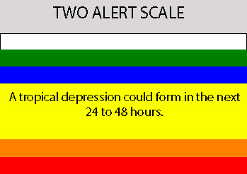
When was the last time something that far out was given a TWO TD warning?
0 likes   

RL3AO
Moderator-Pro Met
Moderator-Pro Met
Posts: 16308
Joined: Thu Jun 14, 2007 10:03 pm
Location: NC

Re: Low Pressure South of Cape Verde Islands

#57 Postby RL3AO » Sat Sep 22, 2007 4:36 pm

njweather wrote:wow, that was fast...

When was the last time something that far out was given a TWO TD warning?


Helene last year?
0 likes   

JTD
Category 5
Category 5
Posts: 1558
Joined: Sun Nov 02, 2003 6:35 pm

Re: Low Pressure South of Cape Verde Islands

#58 Postby JTD » Sat Sep 22, 2007 4:41 pm

RL3AO wrote:
njweather wrote:wow, that was fast...

When was the last time something that far out was given a TWO TD warning?


Helene last year?


Yes, actually was just reading the Helene thread yesterday! The NHC was already mentioning it well it was still over Africa (halfway on and halfway off)!

So, I read just above that the global models have this moving generally westward for 5 days? So this is not a fish?
0 likes   

User avatar
Vortex
S2K Supporter
S2K Supporter
Posts: 4644
Age: 53
Joined: Fri Aug 01, 2003 9:34 pm
Location: Hilton Head, SC

#59 Postby Vortex » Sat Sep 22, 2007 4:42 pm

very different pattern than Helene...Helene formed further north and moved wnw/nw into a weakness over the open Atlantic. The synoptics are just the opposite for this system...
0 likes   

HUC
Category 2
Category 2
Posts: 590
Joined: Fri Oct 03, 2003 3:48 pm
Location: Basse-Terre Guadeloupe

Re: Low Pressure South of Cape Verde Islands

#60 Postby HUC » Sat Sep 22, 2007 4:43 pm

What a two this evening!!!!!!!!!!!!!!!!! :double:
0 likes   


Return to “Talkin' Tropics”

Who is online

Users browsing this forum: Beef Stew, cajungal, floridasun, Killjoy12, LAF92, riapal, wileytheartist and 38 guests